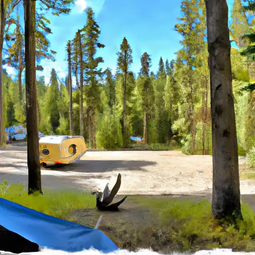
The Lost Johnny camping area in Montana offers stunning views of the surrounding mountains and forests. Nearby points of interest include the Kootenai National Forest, the Cabinet Mountains Wilderness, and the Bull River. The campground includes basic amenities such as picnic tables and fire rings, but no water or restroom facilities. It operates on a first-come, first-serve basis with 10 campsites available. The best time to visit is during the summer months with average temperatures ranging from 60-80 degrees Fahrenheit. However, visitors should be prepared for sudden changes in weather and bring appropriate gear. The Lost Johnny camping area provides a perfect getaway for those seeking a rustic camping experience in the midst of scenic beauty.
GOAT LICK INTERPRETIVE
The Goat Lick Interpretive point of interest is located in Montana and is a must-visit for wildlife enthusiasts and nature lovers. This point of interest is located in the Glacier ...
APGAR BRIDGE (LOWER MCDONALD CREEK)
Located in Montana's Glacier National Park, the Apgar Bridge over Lower McDonald Creek is a popular point of interest for visitors to the park. Here are some reasons why you ...
ESSEX
Located in the beautiful state of Montana, Essex is a must-visit point of interest for anyone planning a trip to Glacier National Park. This charming village is located near the ...
WEST GLACIER
West Glacier, located in Montana, is an incredible destination for those seeking beautiful natural scenery and outdoor activities. This point of interest is part of the Glacier National Park, which ...
KRUEGER HELICOPTER
Krueger Helicopter Point of Interest is a popular destination located in Montana's Glacier National Park. This area is known for its stunning natural beauty, with breathtaking views of the surrounding ...
APGAR VILLAGE
Apgar Village is a quaint and historic area located in Glacier National Park, Montana, and is a must-visit destination for nature enthusiasts and history buffs alike. One of the top ...
APGAR VISITOR CENTER
The Apgar Visitor Center is a must-see point of interest for anyone visiting Montana's Glacier National Park. Located near the park's west entrance, the center offers information, exhibits, and resources ...
MCGEE MEADOW
Welcome to McGee Meadow, a stunning point of interest in Montana's national park system. Here are some reasons to visit and unique things to see: 1. Magnificent Scenery - McGee ...
MINUTEMAN AVIATION (HELICOPTER)
The Minuteman Aviation (Helicopter) point of interest in Montana is a must-visit destination for anyone interested in experiencing the stunning natural beauty of the state from a unique perspective. Located ...