YUBA PASS

Amenities Weather Recreation


CAMPING CALIFORNIA

Yuba Pass


April 24, 2024

Yuba Pass Campground is nestled in the Sierra Nevada Mountains of California at an elevation of 6,700 feet. The campground offers breathtaking views of the surrounding mountains, including the Sierra Buttes, and the nearby Yuba River. The area is known for its abundant wildlife, including black bears, and is ideal for hiking, fishing, and mountain biking.

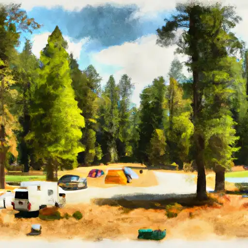
The campground has 24 first-come-first-serve campsites, each with a picnic table and fire ring. There are also vault toilets and potable water available for campers.

Nearby points of interest include the Lakes Basin Recreation Area, which offers numerous lakes and trails for fishing and hiking. The historic town of Downieville, with its Gold Rush history, is also a short drive away.

An interesting fact about the area is that it was once home to the Nisenan tribe, who hunted and fished in the surrounding mountains for thousands of years before the arrival of European settlers.

The best time of year to visit Yuba Pass Campground is during the summer months, with average temperatures ranging from 70-80 degrees Fahrenheit during the day and dropping to 40-50 degrees Fahrenheit at night. However, the area is also beautiful in the fall with the changing leaves of the aspen trees.


Weather Outlook


16 Day Long Term Forecast

Seasonal Comparison


Historical Data


Area Boat Ramps

SARDINE LAKE ROAD 990, SIERRA CITY
Upper Yuba Watershed, California
WOODCAMP ACCESS ROAD NEVADA COUNTY
Upper Yuba Watershed, California
SALMON LAKE ROAD 1500, SIERRA CITY
Upper Yuba Watershed, California
LOST COVE BOAT RAMP
East Branch North Fork Feather Watershed, California
SMOKEY LANE 44-50, ALLEGHANY
Upper Yuba Watershed, California
PENINSULA ROAD, STRAWBERRY VALLEY
Middle Fork Feather Watershed, California
SALMON LAKE -BOAT RAMP BOATING SITE
Upper Yuba Watershed, California
HENNESS PASS ROAD, SIERRAVILLE
Upper Yuba Watershed, California
PLUMAS COUNTY
Middle Fork Feather Watershed, California
MEADOW LAKE ROAD NEVADA COUNTY
Upper Yuba Watershed, California

Rafting & Kayaking

NF BOUNDARY TO CONFLUENCE WITH NORTH FORK FEATHER RIVER
North Fork Feather Watershed, California
STATE PARK TO CONFLUENCE WITH MIDDLE FORK FEATHER WSR
Middle Fork Feather Watershed, California
ROCK CREEK DAM TO CRESTA RESERVOIR
North Fork Feather Watershed, California
HEADWATERS TO MIDDLE FORK FEATHER WSR
Middle Fork Feather Watershed, California
HEADWATERS TO CONFLUENCE WITH NELSON CREEK
Middle Fork Feather Watershed, California
HEADWATERS TO BUCKS LAKE
North Fork Feather Watershed, California
SILVER LAKE TO MEADOW VALLEY
East Branch North Fork Feather Watershed, California
CONFLUENCE WITH EAST AND WEST BRANCHES OF NELSON CREEK TO CONFLUENCE WITH MIDDLE FORK FEATHER WSR
Middle Fork Feather Watershed, California
CARIBOU RESERVOIR TO BELDON
North Fork Feather Watershed, California
FRENCHMAN RESERVOIR TO NF BOUNDARY
Middle Fork Feather Watershed, Nevada

Parks & Recreation


Honey Lake Wildlife Area

Chester Park

Cedar Drive

Mogul Park

Wilderness Bucks Lake

Lundsford Park

Glendale Park

Wilderness Caribou

Portola City Park

Idlewild Park


WASHINGTON OVERLOOK OBSERVATION SITE
ALPHA OMEGA OBSERVATION SITE
KYBURZ MARSH WATCHABLE WILDLIFE SITE
RED ROCKS SCENIC AREA
The Red Rocks Scenic Area is located in the Honey-Eagle Lakes watershed of Nevada. It spans over 195,000 acres and offers breathtaking views of towering red-rock formations and sandstone cliffs. ...

Log Your Visit

When was your last visit to Yuba Pass?

Add a Photo

How was it? How were conditions?

Rate the camping


Submit

Leave A Review

Yuba Pass

Submit

Upload an Image

Yuba Pass

Favorite Limit Reached