
Forestry Commission Dam Reservoir Report
Last Updated: December 6, 2025
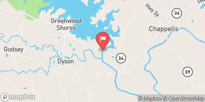
Located in Edgefield, South Carolina, the Forestry Commission Dam stands as a vital irrigation resource in the area, completed in 1959 with a height of 39 feet and a storage capacity of 155 acre-feet.
°F
°F
mph
Wind
%
Humidity
Summary
The dam, primarily designed for irrigation purposes, spans 460 feet in length and covers an area of 8 acres, serving as a crucial water management structure for the region. With state regulatory oversight and inspection, the dam boasts a low hazard potential and fair condition assessment, ensuring its continued safety and functionality for the community.
Situated along the TR-SHAW CREEK, the Forestry Commission Dam is owned and regulated by the state authorities, with South Carolina Department of Health and Environmental Control overseeing its permitting, inspection, and enforcement processes. The dam's buttress core design and earth construction type contribute to its stability and reliability in providing essential water resources for agricultural and irrigation needs in the region. Despite its modest hazard potential, the dam's infrastructure remains robust and well-maintained, reflecting the commitment to ensuring water resource sustainability and climate resilience in the area.
With Congressman Jeff Duncan representing the district, the Forestry Commission Dam serves as a testament to the collaborative efforts between state and federal agencies in managing water resources for the community. Its strategic location and purposeful design underscore the importance of effective dam management in supporting agricultural activities and water supply reliability, showcasing a harmonious balance between human development and environmental stewardship. As a key component of the local water infrastructure, the Forestry Commission Dam plays a crucial role in enhancing water security and climate adaptation for the region's residents and ecosystems.
Year Completed |
1959 |
Dam Length |
460 |
Dam Height |
39 |
River Or Stream |
TR-SHAW CREEK |
Primary Dam Type |
Earth |
Surface Area |
8 |
Nid Storage |
155 |
Hazard Potential |
Low |
Foundations |
Unlisted/Unknown |
Nid Height |
39 |
Seasonal Comparison
Weather Forecast
Nearby Streamflow Levels
 Mctier Creek (Rd 209) Near Monetta
|
22cfs |
 Augusta Canal Nr Augusta (Upper)
|
2020cfs |
 Stevens Creek Near Modoc
|
110cfs |
 Savannah River At Augusta
|
7950cfs |
 Butler Creek Below 7th Avenue
|
13cfs |
 Lake Greenwood Tailrace Nr Chappells
|
1240cfs |
Dam Data Reference
Condition Assessment
SatisfactoryNo existing or potential dam safety deficiencies are recognized. Acceptable performance is expected under all loading conditions (static, hydrologic, seismic) in accordance with the minimum applicable state or federal regulatory criteria or tolerable risk guidelines.
Fair
No existing dam safety deficiencies are recognized for normal operating conditions. Rare or extreme hydrologic and/or seismic events may result in a dam safety deficiency. Risk may be in the range to take further action. Note: Rare or extreme event is defined by the regulatory agency based on their minimum
Poor A dam safety deficiency is recognized for normal operating conditions which may realistically occur. Remedial action is necessary. POOR may also be used when uncertainties exist as to critical analysis parameters which identify a potential dam safety deficiency. Investigations and studies are necessary.
Unsatisfactory
A dam safety deficiency is recognized that requires immediate or emergency remedial action for problem resolution.
Not Rated
The dam has not been inspected, is not under state or federal jurisdiction, or has been inspected but, for whatever reason, has not been rated.
Not Available
Dams for which the condition assessment is restricted to approved government users.
Hazard Potential Classification
HighDams assigned the high hazard potential classification are those where failure or mis-operation will probably cause loss of human life.
Significant
Dams assigned the significant hazard potential classification are those dams where failure or mis-operation results in no probable loss of human life but can cause economic loss, environment damage, disruption of lifeline facilities, or impact other concerns. Significant hazard potential classification dams are often located in predominantly rural or agricultural areas but could be in areas with population and significant infrastructure.
Low
Dams assigned the low hazard potential classification are those where failure or mis-operation results in no probable loss of human life and low economic and/or environmental losses. Losses are principally limited to the owner's property.
Undetermined
Dams for which a downstream hazard potential has not been designated or is not provided.
Not Available
Dams for which the downstream hazard potential is restricted to approved government users.
 Forestry Commission Dam
 Courthouse Square
 Aiken Wayside Park
 Ernest Weaver Park
 Gregg Park Civic Center