

Tie Hack
Amenities • Weather • Recreation
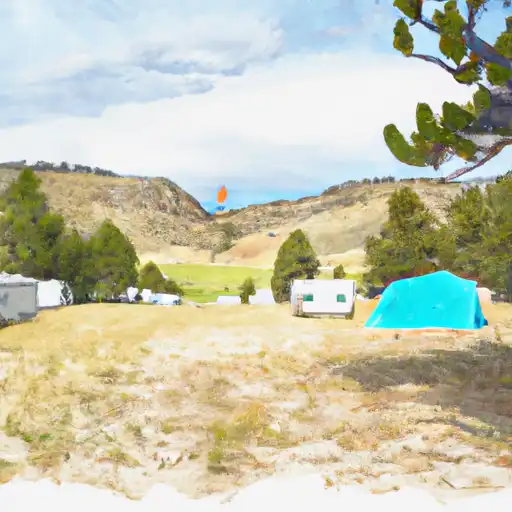
The Tie Hack Camping Area is nestled in the beautiful Shoshone National Forest in Wyoming, providing visitors with stunning views of the surrounding mountains and forests. The area is located near several points of interest, including the historic Tie Hack Reservoir, where visitors can fish or boat, and the nearby town of Dubois, which offers shopping, dining, and other recreational activities.
The campground includes several amenities, such as picnic tables, fire rings, and vault toilets. The area is first-come, first-serve, with 11 campsites available, each offering ample space for campers and RVs. An interesting fact about the camping area is that it was originally used by tie hacks, who cut and hauled railroad ties down the nearby river.
The best time of year to visit the Tie Hack Camping Area is during the summer months, when temperatures average around 70 degrees Fahrenheit during the day and 40 degrees Fahrenheit at night. Visitors can enjoy hiking, fishing, and other outdoor activities during this time, although the area is also popular for winter sports such as snowmobiling and cross-country skiing during the colder months. Overall, the Tie Hack Camping Area offers a unique and picturesque camping experience in the heart of Wyoming's natural beauty.
June 1, 2024
°F
°F
mph
Windspeed
%
Humidity
Explore the Interactive Map
View recreational hotspots like fishing, camping, and parks, alongside climate-related data such as river levels, snowpack, and weather forecasts. Enjoy 3D mapping for an immersive experience, and switch to satellite view for a detailed look at your favorite spots. Simply click, explore, and discover nature like never before!

Popular Camping Destinations
| Camping Area | Campsites | Reservations | Toilets | Showers | Elevation |
|---|---|---|---|---|---|
| Tongue River Reservoir State Park | 105 | 3,458 ft | |||
| Sibley Lake | 20 | 7,996 ft | |||
| Tie Flume | 27 | 8,350 ft | |||
| Red Shale | 14 | 3,203 ft | |||
| Two Leggins FAS | Numerous | 2,936 ft | |||
| Washington Park - Sheridan | 5 | 3,765 ft | |||
| Tongue River Camp - Amsden Creek WMA | Numerous | 4,088 ft | |||
| Owen Creek | 8 | 8,477 ft | |||
| North Tongue | 12 | 7,840 ft | |||
| Prune Creek | 21 | 7,687 ft |
Fishing Areas
Points of Interest
You Might Like
Explore Nearby Places

Green Meadow Park is a beautiful and scenic attraction located in the state of Wyoming in the United States. The park boasts a wide range of natural features and offers plenty of opportunities for visitors to explore and enjoy the great outdoors. Some of the most popular activities that can be enjoyed at Green Meadow Park include hiking, camping, fishing, and wildlife watching. One of the key reasons to visit Green Meadow Park is its stunning natural beauty. The park is home to a wide range of wildlife, including deer, elk, bison, and a variety of bird species. Visitors can ...