

California Whitewater
SNOW LAKE TO HOOVER WILDERNESS BOUNDARY
STREAMFLOW: 109 CFS
• Class IV-V River Run
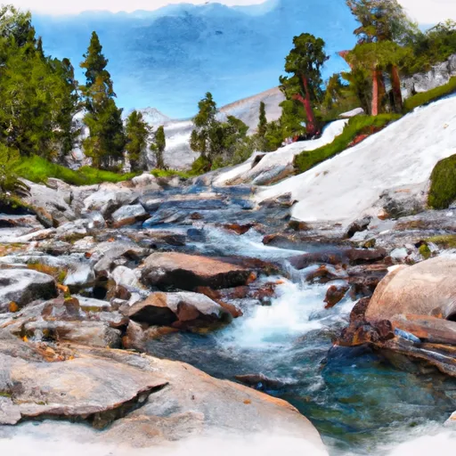
The Whitewater River Run from Snow Lake to Hoover Wilderness Boundary in California is an exciting and challenging adventure for experienced kayakers and rafters. This rugged, remote section of the river is characterized by steep drops, tight turns, and challenging rapids.
The ideal streamflow range for this section of the river is between 300 and 600 cubic feet per second (cfs), which typically occurs in the spring and early summer months. The class rating for this section of the river is a Class IV-V, indicating that it is only suitable for experienced paddlers with strong whitewater skills.
The total segment mileage for this river run is approximately 7 miles, with a variety of challenging rapids and obstacles. Some of the most notable features include the Snow Lake Falls, the Rattlesnake Rapid, and the Big Drop. These features require expert maneuvering and quick reflexes to navigate successfully.
In addition to the challenging rapids, there are specific regulations to consider when planning a trip on this section of the river. Permits are required for all overnight trips, and campfires are prohibited above 10,000 feet elevation. Visitors are also required to pack out all trash and follow Leave No Trace principles to minimize impact on the environment.
Overall, the Whitewater River Run from Snow Lake to Hoover Wilderness Boundary is a thrilling and challenging adventure for experienced paddlers. However, it is important to carefully consider the ideal streamflow range, class rating, specific river rapids and obstacles, and regulations before embarking on this journey. Get driving directions.
| Last Updated | 2024-04-25 |
| River Levels | 385 cfs (3.67 ft) |
| Percent of Normal | 227% |
| Reporting Streamgauge | Robinson C at Twin Lks Outlet nr Bridgeport, CA |
| Elevation | 7,082 ft. |
| River | |
| Watershed | Upper Tuolumne |
Nearby Camping
| Location | Campsites | Reservations | Toilets | Showers | Elevation |
|---|---|---|---|---|---|
| Obsidian | 18 | 7,682 ft | |||
| Tuolumne Meadows - Yosemite National Park | 304 | 8,626 ft | |||
| Chris Flat | 15 | 6,896 ft | |||
| Robinson Creek | 60 | 7,047 ft | |||
| Sonora Bridge | 23 | 6,788 ft | |||
| Leavitt Meadows | 18 | 7,124 ft | |||
| Lower Twin Lake | 17 | 7,102 ft | |||
| Yosemite Creek - Yosemite National Park | 75 | 7,251 ft | |||
| Paha | 26 | 7,073 ft | |||
| Porcupine Flat - Yosemite National Park | 52 | 8,110 ft |
Weather Forecast
