

California Whitewater
JUST BELOW HIGHWAY 36 CROSSING TO ONE-HALF MILE DOWNSTREAM FROM HOLE-IN-THE-GROUND
STREAMFLOW: 198 CFS
• Class III-IV River Run
The Whitewater River Run in California is an exciting adventure for experienced whitewater rafters. The ideal streamflow range for this section of the river is between 500 and 1,500 cubic feet per second (cfs), which typically occurs during the spring and early summer months. This section of the river is rated as Class III-IV, which means it has moderate to difficult rapids and requires good paddling skills.
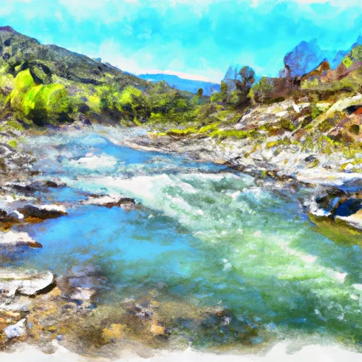
The segment mileage for this section of the Whitewater River run is about 4 miles, starting just below Highway 36 Crossing and ending one-half mile downstream from Hole-in-the-Ground. This section of the river features several challenging rapids, including "The Chute," "The Maze," and "The Squeeze." These rapids require careful maneuvering to avoid obstacles such as rocks and strainers.
There are specific regulations for this area that must be followed to ensure safety and preserve the natural environment. All participants must wear a personal flotation device (PFD) and helmets are strongly recommended. Camping and fires are not permitted in the area. Respect for wildlife and the environment is also required.
Overall, the Whitewater River Run Just Below Highway 36 Crossing To One-Half Mile Downstream From Hole-In-The-Ground in California is a thrilling whitewater experience that requires skill and caution. It is important to follow all regulations and safety precautions to ensure a successful and enjoyable trip. Get driving directions.
| Last Updated | 2024-04-25 |
| River Levels | 287 cfs (3.54 ft) |
| Percent of Normal | 115% |
| Reporting Streamgauge | HAT C NR HAT CREEK CA |
| Elevation | 4,327 ft. |
| River | |
| Watershed | Mill-Big Chico |
Nearby Camping
| Location | Campsites | Reservations | Toilets | Showers | Elevation |
|---|---|---|---|---|---|
| Manzanita Lake - Lassen Volcanic National Park | 179 | 5,901 ft | |||
| Crags - Lassen Volcanic National Park | 45 | 5,614 ft | |||
| Hole In The Ground | 13 | 4,276 ft | |||
| Summit Lake (north and south) - Lassen Volcanic National Park | 90 | 6,685 ft | |||
| Southwest - Lassen Volcanic National Park | Numerous | 6,716 ft | |||
| Gurnsey Creek | 30 | 4,735 ft | |||
| Cherry Hill | 26 | 4,730 ft | |||
| Battle Creek | 50 | 4,831 ft | |||
| Elam | 11 | 4,374 ft | |||
| West Branch | 15 | 4,890 ft | |||
| Butte Meadows | 13 | 4,303 ft |
Weather Forecast
