

California Whitewater
HEADWATERS TO FOREST ROAD 16S02
STREAMFLOW: 71 CFS
• Class IV-V River Run
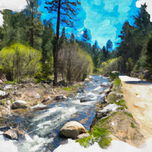
The Whitewater River run in California is a popular destination for kayakers and rafters. The Headwaters To Forest Road 16S02 segment of the river is approximately 10.5 miles long and is rated as Class IV-V. The ideal streamflow range for this segment is between 300-600 cfs.
The run begins at the headwaters of the Whitewater River and ends at Forest Road 16S02. Along the way, there are several challenging rapids and obstacles to navigate, including S-turn, Drop Zone, and Suck Rock. This segment is recommended for experienced paddlers only, as the rapids can be extremely technical and demanding.
There are several regulations that visitors to this area should be aware of. The use of personal flotation devices is mandatory, and all paddlers should be prepared for cold water temperatures. Camping is not allowed along the river, and visitors should be aware of private property boundaries. Additionally, visitors should follow Leave No Trace principles and pack out all trash and waste.
Get driving directions.
| Last Updated | 2024-04-25 |
| River Levels | 43 cfs (3.39 ft) |
| Percent of Normal | 220% |
| Reporting Streamgauge | SF TULE R NR CHOLOLLO CAMPGROUND NR PORTERVILLE CA |
| Elevation | 3,702 ft. |
| River | |
| Watershed | Owens Lake |
Nearby Camping
| Location | Campsites | Reservations | Toilets | Showers | Elevation |
|---|---|---|---|---|---|
| Diaz Lake | 200 | 3,683 ft | |||
| Lone Pine | 42 | 5,866 ft | |||
| Tuttle Creek | 85 | 5,124 ft | |||
| Whitney Portal | 43 | 7,928 ft | |||
| Symmes Creek | Numerous | 5,143 ft | |||
| Portagee Joe | 15 | 3,780 ft | |||
| Alabama Hills Dispersed | Numerous | 4,603 ft |
Weather Forecast
