

Idaho Whitewater
NORTHERN BOUNDARY OF HARRIMAN PARK TO PINEHAVEN SUBDIVISION
STREAMFLOW: 1,130 CFS
• Class IV River Run
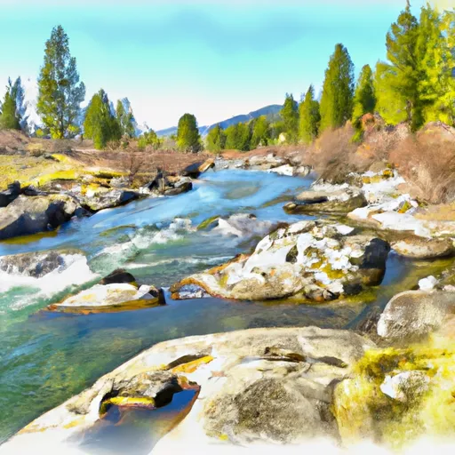
The Whitewater River Run from the northern boundary of Harriman Park to Pinehaven Subdivision in Idaho is a popular spot for white water enthusiasts. The ideal streamflow range for this river is between 500 and 2,000 cfs, with the optimal level being around 1,200 cfs. The Class rating for this river ranges from II to III, with some sections having Class IV rapids, making it a moderate to challenging river for kayaking and rafting.
The segment mileage of this river run is approximately 10 miles, with some notable rapids and obstacles such as the Big Kahuna, Shotgun, and Upper and Lower Mesa Falls. It is important to note that the rapids and obstacles on this river can be dangerous and should only be attempted by experienced and skilled paddlers.
Specific regulations for this area include the requirement of wearing a personal flotation device (PFD) at all times while on the river, as well as obeying all posted signs and regulations. Additionally, the use of alcohol and drugs is strictly prohibited on the river. It is also recommended to check with local authorities for any current restrictions or closures before heading out on the river.
Overall, the Whitewater River Run from the northern boundary of Harriman Park to Pinehaven Subdivision in Idaho offers a thrilling and challenging experience for experienced white water enthusiasts. However, it is important to be aware of the specific streamflow range, class rating, segment mileage, specific rapids and obstacles, and regulations in the area to ensure a safe and enjoyable experience. Get driving directions.
| Last Updated | 2024-04-25 |
| River Levels | 718 cfs (3.34 ft) |
| Percent of Normal | 178% |
| Reporting Streamgauge | HENRYS FORK NR ISLAND PARK ID |
| Elevation | 6,229 ft. |
| River | |
| Watershed | Upper Henrys |
Nearby Camping
| Location | Campsites | Reservations | Toilets | Showers | Elevation |
|---|---|---|---|---|---|
| Henrys Lake State Park | Numerous | 6,485 ft | |||
| Flat Rock | 38 | 6,425 ft | |||
| Grandview | 8 | 5,918 ft | |||
| Buttermilk | 53 | 6,335 ft | |||
| West End | 19 | 6,328 ft | |||
| McCrea Bridge | 23 | 6,335 ft | |||
| Warm River | 28 | 5,325 ft | |||
| Upper Coffee Pot | 14 | 6,375 ft | |||
| Box Canyon | 18 | 6,183 ft |
Weather Forecast
