

Idaho Whitewater
ELK MEADOWS TRAILHEAD TO CONFLUENCE WITH VALLEY CREEK
STREAMFLOW: 433 CFS
• Class III River Run
.
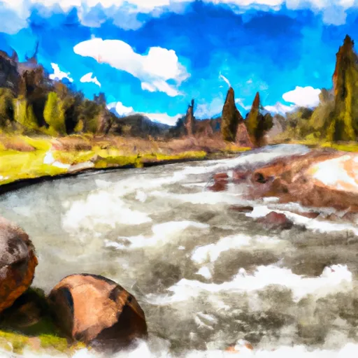
The Whitewater River run from the Elk Meadows Trailhead to the Confluence with Valley Creek in Idaho is a class III to IV run with an ideal streamflow range of 800 to 3000 cubic feet per second (cfs). The segment mileage is approximately 8.5 miles and includes specific rapids and obstacles such as the Fingers, the S-turn, and the Waterfall.
The Fingers is a narrow section of the river with several rocky outcroppings that require precise maneuvering to avoid. The S-turn is a sharp turn in the river that can create large waves and strong currents. The Waterfall is a steep drop that can be challenging to navigate, especially at higher flows.
There are specific regulations to the area, including a permit requirement for commercial outfitters and a limit on the number of daily launches. Additionally, all boaters must wear a personal flotation device and carry a whistle, and fires are not allowed along the river.
Get driving directions.
| Last Updated | 2024-04-25 |
| River Levels | 595 cfs (2.09 ft) |
| Percent of Normal | 100% |
| Reporting Streamgauge | VALLEY CREEK AT STANLEY ID |
| Elevation | 6,222 ft. |
| River | |
| Watershed | Upper Salmon |
Nearby Camping
| Location | Campsites | Reservations | Toilets | Showers | Elevation |
|---|---|---|---|---|---|
| Glacier View | 82 | 6,295 ft | |||
| Point | 19 | 6,570 ft | |||
| Mountain View | 9 | 6,496 ft | |||
| Stanley Lake | Numerous | 6,550 ft | |||
| Grandjean | 31 | 5,182 ft | |||
| Sunny Gulch | 59 | 6,442 ft | |||
| Thatcher C/G | 5 | 6,605 ft | |||
| Mount Heyburn | 23 | 6,580 ft | |||
| Redfish Outlet | Numerous | 6,566 ft | |||
| Chinook Bay | 18 | 6,495 ft | |||
| Sockeye | 24 | 6,608 ft | |||
| Josephus Lake | 14 | 7,039 ft | |||
| Sheep Trail | 8 | 6,582 ft |
Weather Forecast
