

Montana Whitewater
NO NAME CREEK HEADWATERS, SEC. 30, T10N, R22W TO MAINSTEM, SEC. 24, T10N, R22W
STREAMFLOW: 1,600 CFS
• Class III+ River Run
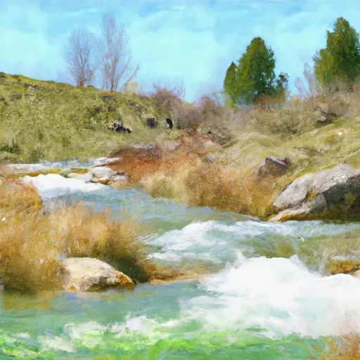
The No Name Creek Headwaters to Mainstem segment of the Whitewater River in Montana is a popular whitewater run for experienced paddlers. This 6-mile segment is rated as a class III+ run with some challenging rapids and obstacles along the way. The ideal streamflow range for this segment is between 500 and 1,500 cfs.
Some of the notable rapids and obstacles in this section of the river include the Punchbowl, a large hole that can be difficult to navigate, and the entrance to the Narrows, a tight and technical section of the river. Paddlers should be aware of strainers and sweepers along the way, which can be dangerous at high water levels.
In terms of regulations, paddlers should obtain a Montana fishing license if they plan to fish on the river. There are no specific regulations for whitewater paddling, but it is always important to practice Leave No Trace principles and respect private property along the riverbanks.
Get driving directions.
| Last Updated | 2024-04-25 |
| River Levels | 3870 cfs (7.82 ft) |
| Percent of Normal | 58% |
| Reporting Streamgauge | Bitterroot River at Bell Crossing nr Victor MT |
| Elevation | 3,328 ft. |
| River | Bitterroot-River |
| Watershed | Bitterroot |
Nearby Camping
| Location | Campsites | Reservations | Toilets | Showers | Elevation |
|---|---|---|---|---|---|
| Lolo Creek | 17 | 3,795 ft | |||
| Earl Tennant | 6 | 3,853 ft | |||
| Lewis and Clark | Numerous | 3,765 ft |
Weather Forecast
