

Montana Whitewater
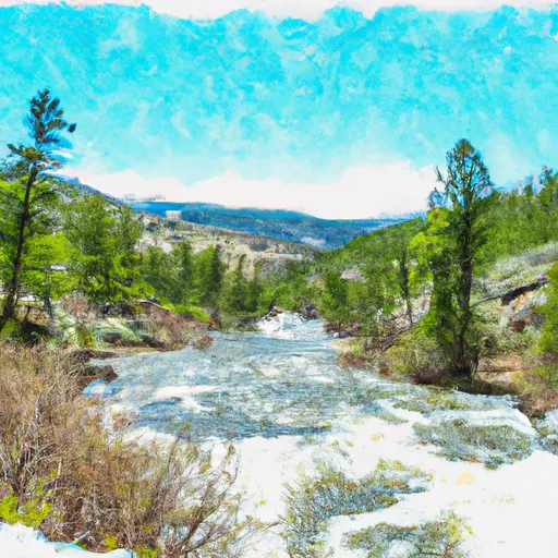
CUSTER FOREST BOUNDARY, SEC. 15, T5S, R15E TO ABSAROKA-BEARTOOTH WILDERNESS BOUNDARY
STREAMFLOW: 398 CFS
• Class III-IV River Run
The Whitewater River Run in Montana is a popular spot for kayakers and whitewater enthusiasts. The ideal streamflow range for kayaking is between 500 and 2000 cfs, although it can be possible to safely kayak at lower or higher flows depending on skill level. This section of the river is classified as a Class III-IV rapids, meaning that it is suitable for experienced kayakers.
The river run begins at the Custer Forest Boundary, Sec. 15, T5S, R15E and ends at the Absaroka-Beartooth Wilderness Boundary, covering a distance of approximately 7 miles. The section of the river includes several notable rapids, including "Picket Fence," "The Narrows," and "Jaws."
It is important to note that the Whitewater River Run is located within the Custer Gallatin National Forest and is subject to specific regulations. A permit is required for commercial use of the river, and camping is only allowed in designated sites. Additionally, all visitors must follow Leave No Trace principles and carry out all trash and waste.
Overall, the Whitewater River Run is a thrilling and challenging experience for experienced kayakers. However, it is important to always prioritize safety and follow all regulations and guidelines to protect the natural environment. Get driving directions.
| Last Updated | 2024-04-25 |
| River Levels | 4740 cfs (5.52 ft) |
| Percent of Normal | 64% |
| Reporting Streamgauge | Stillwater River near Absarokee MT |
| Elevation | 3,880 ft. |
| River | Stillwater-River |
| Watershed | Stillwater |
Nearby Camping
| Location | Campsites | Reservations | Toilets | Showers | Elevation |
|---|---|---|---|---|---|
| Pelican FAS | Numerous | 3,879 ft | |||
| Woodbine | 44 | 5,195 ft | |||
| Big Rock FAS | 5 | 4,215 ft | |||
| Initial Creek | 6 | 6,211 ft |
Weather Forecast
