

New-Mexico Whitewater
CONFLUENCE OF 2 HEADWATERS FOR SOUTH FORK (SEC 28, T10S, R11E) TO SOUTHERN BOUNDARY OF SOUTH FORK CAMPGROUND
STREAMFLOW: 9 CFS
• Class II-III River Run
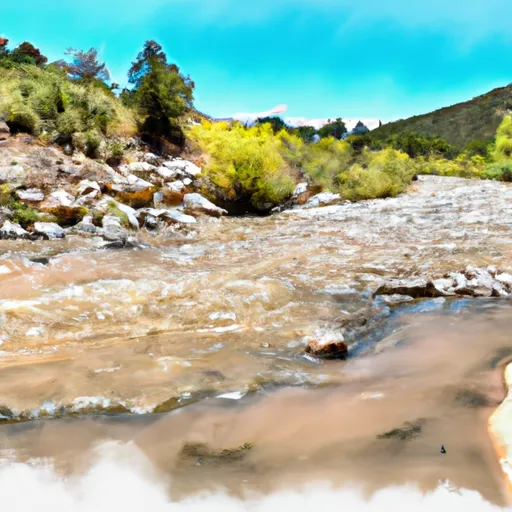
The Whitewater River Run at the Confluence of 2 Headwaters for South Fork in New Mexico is an exciting adventure for thrill-seeking kayakers and rafters. The ideal streamflow range for this segment is between 300 and 800 cubic feet per second (cfs). The run is rated Class II-III, which makes it appropriate for intermediate skill levels.
The segment runs for approximately 7.5 miles from the confluence of the two headwaters down to the southern boundary of the South Fork Campground. Along the way, there are numerous rapids and obstacles to navigate, including a Class III rapid called "Big Horn" and a Class II rapid called "Cottonwood Falls." The river also features some beautiful scenery, including red rock cliffs and ponderosa pine forests.
There are specific regulations in place for the area to ensure the safety of those participating in the whitewater river run. All boaters must wear personal flotation devices (PFDs) at all times, and it is recommended that they wear helmets as well. Additionally, all boats must be equipped with a whistle, and kayakers must have a spray skirt and a rescue throw bag.
Overall, the Whitewater River Run at the Confluence of 2 Headwaters for South Fork offers an exciting and challenging adventure for those looking to experience the thrill of whitewater rafting and kayaking in New Mexico. Get driving directions.
| Last Updated | 2024-04-25 |
| River Levels | 1 cfs (6.08 ft) |
| Percent of Normal | 204% |
| Reporting Streamgauge | EAGLE CREEK BELOW SOUTH FORK NEAR ALTO, NM |
| Elevation | 7,621 ft. |
| River | |
| Watershed | Rio Hondo |
Nearby Camping
| Location | Campsites | Reservations | Toilets | Showers | Elevation |
|---|---|---|---|---|---|
| Eagle Creek Lakes | Numerous | 8,268 ft | |||
| Deerhead | 20 | 8,776 ft | |||
| Silver | 29 | 8,997 ft | |||
| Skyline | 17 | 9,000 ft | |||
| Saddle | 16 | 8,948 ft | |||
| Silver Overflow | 52 | 9,006 ft | |||
| South Fork | 60 | 7,590 ft | |||
| Monjeau | 4 | 9,503 ft | |||
| Pines | 24 | 8,645 ft | |||
| Three Rivers | 12 | 6,418 ft | |||
| Sleepy Grass | 21 | 8,814 ft | |||
| Westlake | 75 | 7,410 ft | |||
| Lower Karr Canyon | 6 | 7,838 ft | |||
| Valley of Fires | 19 | 5,243 ft | |||
| Oak Grove | 30 | 8,355 ft | |||
| Apache | 24 | 8,889 ft |
Weather Forecast
