

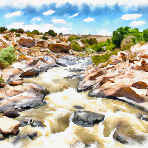
New-Mexico Whitewater
OJO SARCO
STREAMFLOW: 314 CFS
• Class II-III River Run
The Whitewater River Run at Ojo Sarco in New Mexico is a popular destination for whitewater enthusiasts. The ideal streamflow range for this segment of the river is between 300-800 cubic feet per second (cfs). The river is rated as a Class II-III, making it suitable for intermediate paddlers. The segment is approximately 5 miles long and features several rapids, including "S-Turn," "Rock Garden," and "The Slide." The river also has several obstacles such as trees and boulders.
It is important to note that the Whitewater River Run at Ojo Sarco is located on private property, and access is only permitted with permission. Additionally, all paddlers are required to wear proper safety gear, including a personal flotation device (PFD) and a helmet. It is also recommended that paddlers have previous whitewater experience before attempting this segment of the river.
Overall, the Whitewater River Run at Ojo Sarco offers a thrilling experience for intermediate paddlers. It is important to research current streamflow conditions and obtain permission before accessing the area. Get driving directions.
| Last Updated | 2024-04-25 |
| River Levels | 133 cfs (4.02 ft) |
| Percent of Normal | 267% |
| Reporting Streamgauge | RIO PUEBLO NR PENASCO, NM |
| Elevation | 7,800 ft. |
| River | |
| Watershed | Upper Rio Grande |
Nearby Camping
| Location | Campsites | Reservations | Toilets | Showers | Elevation |
|---|---|---|---|---|---|
| Field Tract | 15 | 7,408 ft | |||
| La Junta - Wild Rivers Rec Area | Numerous | 7,465 ft | |||
| North Lake - Santa Cruz Lake | 25 | 6,346 ft | |||
| Hyde Memorial State Park | 57 | 8,529 ft | |||
| Taos Junction | Numerous | 6,071 ft | |||
| Orilla Verde Rec Area | Numerous | 6,049 ft | |||
| Glorieta | 5 | 10,039 ft | |||
| Big Arsenic Springs - Wild Rivers Rec Area | Numerous | 7,516 ft | |||
| Montoso - Wild Rivers Rec Area | Numerous | 7,500 ft | |||
| Aspen Basin | 10 | 10,219 ft | |||
| Tererro - State Fish and Game | 10 | 7,714 ft | |||
| Borrego Mesa | 9 | 8,719 ft | |||
| Little Arsenic Springs | Numerous | 7,498 ft | |||
| Overlook - Santa Cruz Lake | 25 | 6,683 ft | |||
| Holy Ghost | 24 | 8,239 ft | |||
| Black Canyon | 36 | 8,389 ft | |||
| Cebolla Mesa | 5 | 7,372 ft | |||
| Big Tesuque | 10 | 9,723 ft | |||
| El Aguaje - Wild Rivers Rec Area | Numerous | 7,467 ft |
Weather Forecast
