

Utah
•
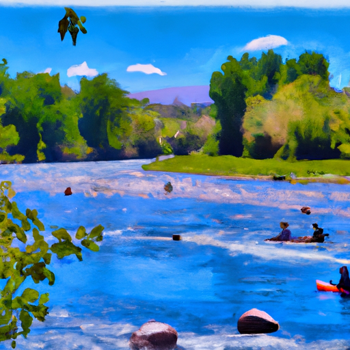
Uinta River
58°, Sunny
Uinta River (Uinta Valley Campground To Power Plant)
Class II- TO II+ Difficulty
STREAMFLOW: 89 CFS
Too Low58°, Sunny
The Uinta River run from Uinta Valley Campground to Power Plant is a Class II-III river run located in Utah. The river features several obstacles, including rapids and rocks, which require paddling skills and attention to detail. The best time to float this section of the river is in late spring to early summer when the water is high, usually around 300-500 CFS. Lower flows can make the trip more challenging, while higher flows can increase the difficulty level. Overall, this river run is suitable for intermediate paddlers with some experience.
Weather today, Sunny, with a high near 58. North wind 5 to 14 mph becoming south in the afternoon.
| Status | Too Low |
| Class Level | II- to II+ |
| Elevation | 7,324 ft |
| Run Length | 8.5 Mi |
| Streamflow Discharge | 88.9 cfs |
| Gauge Height | 5.3 ft |
| Reporting Streamgage |
Uinta River Blw Powerplant Diversion Nr Neola
USGS 09296800 |
