

Utah Whitewater
A SECTION River Run
A SECTION River Run
Whitewater Report
STREAMFLOW: 1,660 CFS
• Class III-IV River Run
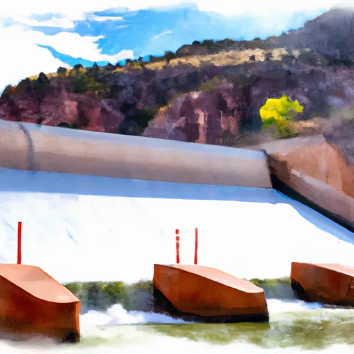
The Whitewater River Run from the Forest Service Spillway Boat Ramp below Flaming Gorge Dam to the Bureau of Land Management Boat Ramp at Indian Crossing in Utah is a popular route for experienced whitewater enthusiasts. The ideal streamflow range for this stretch of the Green River is 800-4000 cfs.
This segment of the river is rated as Class III-IV, with challenging rapids and obstacles, including Hell's Half Mile, an exhilarating Class IV rapid. The total distance of this river run is approximately 44 miles.
There are specific regulations for this area, including a required permit for all river trips, which can be obtained through the Bureau of Land Management. Additionally, all boats must have a fire pan and a portable toilet. Campfires are not allowed, and visitors must pack out all garbage.
Overall, the Whitewater River Run from the Forest Service Spillway Boat Ramp below Flaming Gorge Dam to the Bureau of Land Management Boat Ramp at Indian Crossing offers a thrilling and challenging whitewater experience for experienced kayakers and rafters. It is important to note that this is not a beginner-friendly section of the river and only experienced paddlers should attempt this route. Get driving directions.
| Last Updated | 2024-04-25 |
| River Levels | 6970 cfs (13.41 ft) |
| Percent of Normal | 93% |
| Reporting Streamgauge | GREEN RIVER NEAR GREENDALE, UT |
| Elevation | 5,606 ft. |
| River | Green-River |
| Watershed | Upper Green-Flaming Gorge Reservoir |
Nearby Camping
| Location | Campsites | Reservations | Toilets | Showers | Elevation |
|---|---|---|---|---|---|
| Red Fleet State Park | 31 | 5,719 ft | |||
| Skull Creek - Flaming Gorge | 17 | 7,446 ft | |||
| Greendale - Flaming Gorge | 8 | 6,998 ft | |||
| Lodgepole | 35 | 8,082 ft | |||
| Deer Run - Flaming Gorge | 13 | 6,210 ft | |||
| Greens Lake - Flaming Gorge | 20 | 7,467 ft | |||
| Canyon Rim - Flaming Gorge | 15 | 7,439 ft | |||
| Cedar Springs - Flaming Gorge | 21 | 6,140 ft | |||
| Dripping Springs - Flaming Gorge | 23 | 6,069 ft | |||
| Steinaker State Park | 29 | 5,560 ft | |||
| Antelope Flat - Flaming Gorge | 46 | 6,068 ft | |||
| Firefighters Memorial - Flaming Gorge | 94 | 6,861 ft | |||
| Red Canyon - Flaming Gorge | 8 | 7,420 ft | |||
| East Park | 21 | 9,050 ft | |||
| Mustang Ridge - Flaming Gorge | 70 | 6,141 ft |
Weather Forecast
