Tumacacori National Historical Park
May 7, 2024
Tumacacori National Historical Park is located in the state of Arizona and is a significant historical site that attracts many visitors each year. There are several good reasons to visit this park, including its rich cultural and historical significance, unique points of interest, and fascinating facts about the area.
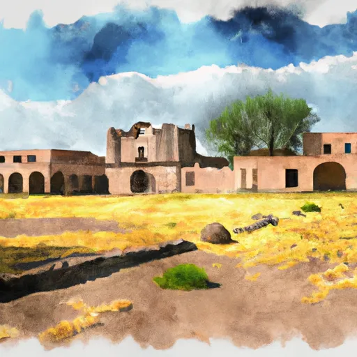
One of the main reasons to visit Tumacacori National Historical Park is to explore its cultural heritage. The park preserves the ruins of three Spanish mission communities that were established in the late 17th century. These missions, San José de Tumacácori, Los Santos Ángeles de Guevavi, and San Cayetano de Calabazas, offer a glimpse into the region's colonial history and the efforts of Spanish missionaries to convert and assimilate the local indigenous populations.
Visitors can explore the mission ruins, which feature preserved walls, courtyards, and religious artifacts. The Tumacácori Museum, located within the park, provides further insights into the history and cultural significance of the missions.
Apart from the missions, Tumacacori National Historical Park boasts beautiful natural surroundings and scenic landscapes. The park is situated along the Santa Cruz River, offering opportunities for hiking and enjoying the peacefulness of the riparian habitat. Visitors can take leisurely walks along the trails, observing the diverse flora and fauna that call the park home.
Interesting facts about the area include the fact that Tumacácori National Historical Park is part of a larger cultural landscape known as the Juan Bautista de Anza National Historic Trail. This trail commemorates the migration route of Spanish colonists and indigenous people from the region to California.
The best time to visit Tumacacori National Historical Park is during the cooler months, from November to April, as the summer months can be extremely hot in this part of Arizona. It is advisable to check the park's website or contact the visitor center for updated information on operating hours and events.
In order to ensure accuracy, it is recommended to verify the information provided by consulting multiple independent sources such as the official website of Tumacacori National Historical Park, publications from the National Park Service, or reputable travel guides.