


MELVERN LK NR MELVERN
Reservoir Levels • Weather • Hydrology
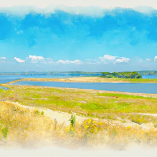
Melvern Lake is a reservoir located in Kansas, near the town of Melvern. The lake was created in 1970 by the U.S. Army Corps of Engineers for the purposes of flood control, water supply, and recreation. The lake covers an area of 6,930 acres and has a maximum depth of 95 feet. The hydrology of the lake is mainly supplied by the Marais des Cygnes River, which drains into the lake. The lake is also fed by snowpack and precipitation from the surrounding area. Agricultural uses around the lake include grazing and crop production, while recreational uses include fishing, boating, camping, and hiking. Melvern Lake is a popular destination for outdoor enthusiasts and provides a variety of activities for visitors.
May 20, 2024
°F
°F
mph
Windspeed
%
Humidity
| Lake Or Reservoir Water Surface Elevation Above Ngvd 1929, Ft 24hr Change | -0.01% |
| Percent of Normal | 100% |
| Minimum |
1,031.63 ft
2013-02-21 |
| Maximum |
1,055.6 ft
2019-06-06 |
| Average | 1,039 ft |
| Hydraulic_Height | 123 |
| Drainage_Area | 349 |
| Year_Completed | 1972 |
| Nid_Storage | 363000 |
| Hazard_Potential | High |
| Structural_Height | 98 |
| Primary_Dam_Type | Earth |
| River_Or_Stream | MARAIS DES CYGNES |
| Foundations | Rock, Soil |
| Surface_Area | 6930 |
| Outlet_Gates | Uncontrolled - 0 |
| Dam_Length | 9750 |
| Nid_Height | 123 |
Explore the Interactive Map
View recreational hotspots like fishing, camping, and parks, alongside climate-related data such as river levels, snowpack, and weather forecasts. Enjoy 3D mapping for an immersive experience, and switch to satellite view for a detailed look at your favorite spots. Simply click, explore, and discover nature like never before!

Points of Interest
You Might Like
Explore Nearby Places
 Pelican Point State Recreation Area
Pelican Point State Recreation Area is a scenic and tranquil park located in the state of Iowa. It is situated on the eastern bank of the Missouri River in Mills County and covers about 160 acres. The park is a popular destination for those looking to escape the hustle and bustle of the city and enjoy the outdoors. One of the main reasons to visit Pelican Point State Recreation Area is for its natural beauty. The park boasts stunning views of the Missouri River and the surrounding hills, making it a great spot for photography or simply relaxing. Visitors can ...