

Somerville Lk nr Somerville
Reservoir Levels • Weather • Hydrology
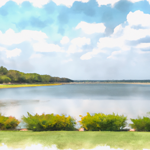
Somerville Lake is a reservoir located in Burleson County, Texas, near the town of Somerville. The lake was created in 1967 by the U.S. Army Corps of Engineers for flood control, water supply, and recreational purposes. The lake covers an area of 11,000 acres and has a capacity of 160,000 acre-feet. The Somerville Lake is fed by the Yegua Creek, Bedias Creek, and Brazos River, and its outflow is to the Brazos River. The lake is a popular destination for fishing, boating, camping, and hiking. The lake also provides water for irrigation and industrial purposes. The Somerville Lake is managed by the U.S. Army Corps of Engineers, and its water levels and flows are monitored by the National Weather Service.
May 20, 2024
°F
°F
mph
Windspeed
%
Humidity
| Lake Or Reservoir Water Surface Elevation Above Ngvd 1929, Ft 24hr Change | 0.07% |
| Percent of Normal | 100% |
| Minimum |
227.6 ft
2011-12-14 |
| Maximum |
259.79 ft
2016-05-29 |
| Average | 240 ft |
| Dam_Height | 80 |
| Hydraulic_Height | 75 |
| Drainage_Area | 1012 |
| Year_Completed | 1967 |
| Nid_Storage | 1042000 |
| Hazard_Potential | High |
| Structural_Height | 80 |
| Primary_Dam_Type | Earth |
| River_Or_Stream | YEGUA CREEK |
| Foundations | Rock, Soil |
| Surface_Area | 6430 |
| Outlet_Gates | Uncontrolled - 0 |
| Dam_Length | 20210 |
| Nid_Height | 80 |
Explore the Interactive Map
View recreational hotspots like fishing, camping, and parks, alongside climate-related data such as river levels, snowpack, and weather forecasts. Enjoy 3D mapping for an immersive experience, and switch to satellite view for a detailed look at your favorite spots. Simply click, explore, and discover nature like never before!

You Might Like
Explore Nearby Places

As an AI language model, I do not have personal beliefs or preferences. However, here's a summary about Pebblebrook Park in the state of Texas based on multiple sources. Pebblebrook Park is a beautiful and peaceful nature preserve located in the city of Allen, Texas. The park covers about 280 acres, with a variety of flora and fauna to explore. There are many good reasons to visit the park, such as hiking, birdwatching, picnicking, fishing, and enjoying the scenic views. The park offers several points of interest, including three fishing ponds, hiking trails, a playground, and several picnic areas. Visitors ...