Black River

Streamflow Hydrology Weather


Black River Levels

April 27 2024

52,142 ACRE-FT

Discharge Volume Today
-232.0 cfs (-0.87%) since yesterday
35.5% of normal Very Low

Total streamflow across the Black River was last observed at 26,288 cfs, and is expected to yield approximately 52,142 acre-ft of water today; about 36% of normal. River levels are low and may signify a drought. Average streamflow for this time of year is 74,050 cfs, with recent peaks last observed on 2011-05-04 when daily discharge volume was observed at 476,781 cfs.

Maximum discharge along the river is currently at the Black River At Elgin Ferry reporting a streamflow rate of 5,490 cfs. However, the streamgauge with the highest stage along the river is the Black River Ds St Hwy 54 @ Black River Falls with a gauge stage of 37.08 ft. This river is monitored from 23 different streamgauging stations along the Black River, the highest being situated at an altitude of 5,759 ft, the Black River Blw Pumping Plant.

Last Updated 2024-04-26
Streamflow 26,288.0 cfs
Percent of Normal 35.5%
Maximum 476,781.0 cfs
2011-05-04

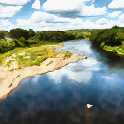
About the black river


The Black River is a river in the northeastern United States that flows through the states of New York and Pennsylvania. It is approximately 125 miles long and has a drainage area of 1,230 square miles. The river is known for its hydroelectric power generation, with several dams and reservoirs built along its length, including the Neversink Reservoir and the Pepacton Reservoir. These reservoirs provide drinking water to New York City and the surrounding areas. The Black River also has recreational uses, with fishing, kayaking, and canoeing opportunities, and the river's valley is home to a variety of wildlife. The river has played an important role in the history of the region, having been used for transportation, logging, and agriculture.

Streamgauge Streamflow Gauge Stage 24hr Change (%) % Normal Minimum (cfs) Maximum (cfs) Air Temp Elevation
Black River Blw Pumping Plant
USGS 09489500
315 cfs 4.18 ft -16
Black River Near Fort Apache
USGS 09490500
799 cfs 4.32 ft -14.09
Black River Above Malaga
USGS 08405500
3 cfs 1.18 ft None
Black River Near Bessemer
USGS 04031000
184 cfs 2.77 ft -12.92
Black River At Neillsville
USGS 05381000
391 cfs 4 ft -6.24
Black River Near Boonville Ny
USGS 04252500
693 cfs 4.9 ft -2.9
Black River Ds St Hwy 54 @ Black River Falls
USGS 053813595
1010 cfs 37.08 ft -4.72
Black River At Coventry
USGS 04296000
172 cfs 2.69 ft -8.02
Black River Near Jeddo
USGS 04159492
220 cfs 3.98 ft -16.61
Black River Near Galesville
USGS 05382000
1410 cfs 4.5 ft -16.07
Black River Near Garnet
USGS 04046000
24 cfs 2.95 ft -6.16
Black River At Elyria Oh
USGS 04200500
99 cfs 1.37 ft -10
Black River Near Annapolis
USGS 07061500
372 cfs 4.17 ft 5.98
Black River At North Springfield
USGS 01153000
328 cfs 2.97 ft -10.14
Black River At Leeper
USGS 07062500
623 cfs 2.79 ft -12.5
Black River At Watertown Ny
USGS 04260500
3170 cfs 4.16 ft -1.44
Black River At Poplar Bluff
USGS 07063000
1130 cfs 2.02 ft 13.11
Black River Near Corning
USGS 07064000
1000 cfs 3.82 ft -7.41
Black River At Pocahontas
USGS 07069000
3780 cfs 4.06 ft -2.07
Black River At Black Rock
USGS 07072500
5100 cfs 4.28 ft -1.54
Black River At Elgin Ferry
USGS 07074420
5490 cfs 9.08 ft -0.9
Black River At Kingstree
USGS 02136000
293 cfs 5.31 ft -17.49
Black River Near Tomahawk
USGS 02106500
229 cfs 3.69 ft -17.59

Peak Annual Discharge

Black River Maximum Total Discharge

Seasonal Comparison

Black River Year Over Year Discharge


Log Your Visit

When was your last visit to ?

Add a Photo

How was it? How were conditions?

Rate the


Submit

Leave A Review


Submit

Upload an Image


Favorite Limit Reached