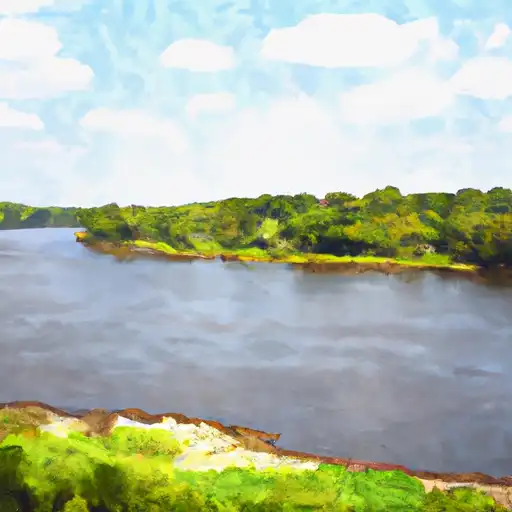
| Last Updated | 2024-11-10 |
| Discharge Volume | 26,092 ACRE-FT |
| Streamflow |
13,154.5 cfs
+23.3 cfs (+0.18%) |
| Percent of Normal | 43.76% |
| Maximum |
713,528.0 cfs
2011-09-09 |
| Seasonal Avg | 30,058 cfs |
READ SUMMARY
STREAMFLOW LEVELS
YEAR OVER YEAR DISCHARGE
Streamflow Conditions
| Streamgauge | Streamflow | Gauge Stage | 24hr Change (%) | % Normal | Minimum (cfs) | Maximum (cfs) | Air Temp | Elevation |
|---|---|---|---|---|---|---|---|---|
|
Delaware River Nr Red Bluff
USGS 08408500 |
0 cfs | 1.88 ft | None | |||||
|
Delaware R Nr Muscotah
USGS 06890100 |
55 cfs | 2.88 ft | 54.83 | |||||
|
Delaware R Bl Perry Dam
USGS 06890900 |
130 cfs | 27.45 ft | 3.17 | |||||
|
Delaware River At Lordville Ny
USGS 01427207 |
1310 cfs | 6.44 ft | -12.08 | |||||
|
Delaware River At Callicoon Ny
USGS 01427510 |
1300 cfs | 3.45 ft | -12.16 | |||||
|
Delaware R Above Lackawaxen R Nr Barryville Ny
USGS 01428500 |
1510 cfs | 3.33 ft | 4.86 | |||||
|
Delaware River At Port Jervis Ny
USGS 01434000 |
1700 cfs | 2.66 ft | 10.39 | |||||
|
Delaware River At Montague Nj
USGS 01438500 |
1980 cfs | 5.06 ft | 8.79 | |||||
|
Delaware River At Belvidere Nj
USGS 01446500 |
1960 cfs | 3.54 ft | -2.97 | |||||
|
Delaware River At Trenton Nj
USGS 01463500 |
3210 cfs | 8.08 ft | 0.94 |
History of the River
The Delaware River is a major river on the Atlantic coast of the United States. It drains an area of 14,119 square miles (36,570 km2) in five U.S. states: Delaware, Maryland, New Jersey, New York, Pennsylvania. Rising in two branches in New York state's Catskill Mountains, the river flows 419 miles (674 km) into Delaware Bay where its waters enter the Atlantic Ocean near Cape May in New Jersey and Cape Henlopen in Delaware. Not including Delaware Bay, the river's length including its two branches is 388 miles (624 km).
The Delaware River is one of nineteen "Great Waters" recognized by the America's Great Waters Coalition.The Delaware River rises in two main branches that descend from the western flank of the Catskill Mountains in New York. The West Branch begins near Mount Jefferson in the Town of Jefferson in Schoharie County. The river's East Branch begins at Grand Gorge near Roxbury in Delaware County. These two branches flow west and merge near Hancock in Delaware County, and the combined waters flow as the Delaware River south. Through its course, the Delaware River forms the boundaries between Pennsylvania and New York, the entire boundary between New Jersey and Pennsylvania, and most of the boundary between Delaware and New Jersey. The river meets tide-water at the junction of Morrisville, Pennsylvania, and Trenton, New Jersey, at the Falls of the Delaware. The river's navigable, tidal section served as a conduit for shipping and transportation that aided the development of the industrial cities of Trenton, Camden, and Philadelphia. The mean freshwater discharge of the Delaware River into the estuary of Delaware Bay is 11,550 cubic feet per second (327 m3/s).
Before the arrival of European settlers, the river was the homeland of the Lenape Native Americans. They called the river Lenapewihittuk, or Lenape River, and Kithanne, meaning the largest river in this part of the country.In 1609, the river was first visited by a Dutch East India Company expedition led by Henry Hudson. Hudson, an English navigator, was hired to find a western route to Cathay (present-day China), but his discoveries set the stage for Dutch colonization of North America in the 17th century. Early Dutch and Swedish settlements were established along the lower section of river and Delaware Bay. Both colonial powers called the river the South River, compared to the Hudson River, which was known as the North River. After the English expelled the Dutch and took control of the New Netherland colony in 1664, the river was renamed Delaware after Sir Thomas West, 3rd Baron De La Warr, an English nobleman and the Virginia colony's first royal governor who defended the colony during the First Anglo-Powhatan War.


