SKI AREAS • ALASKA
ARCTIC VALLEY
May 8, 2024
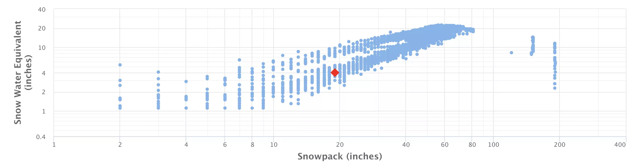
25.0" Snowpack (136% of Normal)
•
Special Weather Statement
Until 2024-05-09T08:00:00-08:00 • National Weather Service
Chances for snow are becoming more likely for higher elevations above about 800 feet and for passes such as Thompson Pass, Turnagain Pass, Summit Lake, Hatcher Pass and the Sutton area. Expect 3 to 6 inches of snow for Thompson Pass and Hatcher Pass and around 2 to 4 inches for the Anchorage and Eagle River Hillsides, Turnagain Pass, Summit Lake, and the Sutton area through Friday morning. Locally higher amounts are possible. Accumulation on roadways will be difficult due to warm temperatures and standing water following the rain, but the higher elevations may accumulate snow on roadways overnight when temperatures are coolest. The first wave of precipitation will move through Southcentral tonight through Thursday morning and will spread rain across Prince William Sound, the Kenai Peninsula, Anchorage, and the MatSu Valley. Cooler air moving into the area tonight will aid in lower snow levels. When the next wave of precipitation arrives, additional moisture and cool air will increase potential for accumulation at higher elevations and perhaps even light snow down to sea level. Forecast confidence is low for snowfall at elevations below 800 feet. Little to no snow accumulation is expected at lower elevations due to the ground being warmer. Protect sensitive outdoor plants and keep winter gear available, especially if you plan to travel or be outdoors.
No new snow to report today, with snowpack levels sitting at 25.0". Snowpack levels for this time of year average around 13 inches, but can be as high as 114 inches.
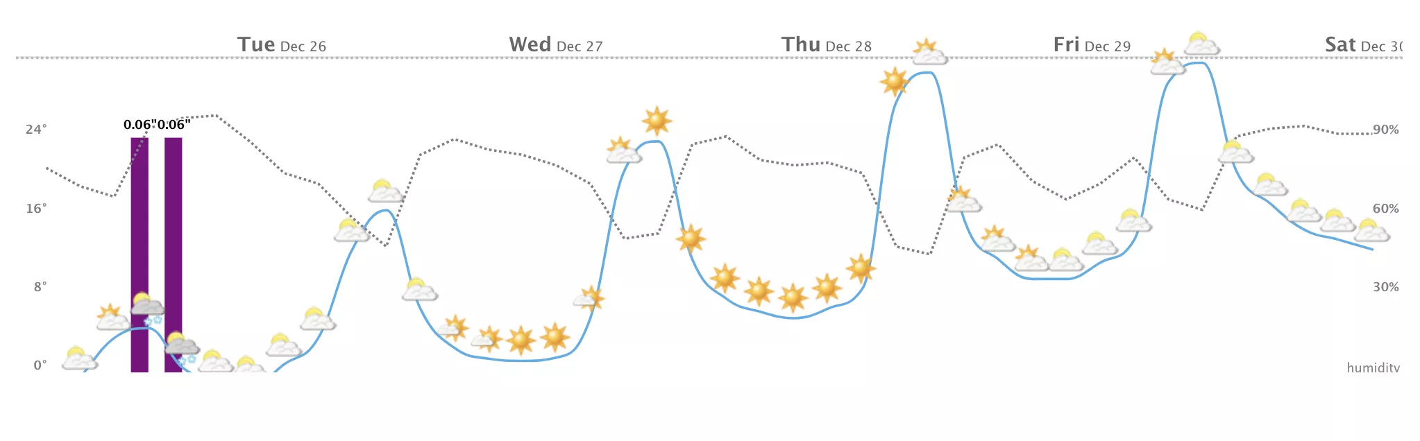
Weather today, isolated showers between 1pm and 4pm, then rain likely after 4pm. mostly cloudy, with a high near 42. calm wind. chance of precipitation is 60%. Up to 4" of more snowfall forecasted over the next 5 days.
None Read More
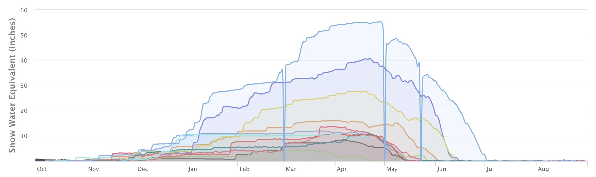
Snowpack Depth (Past 7 Days)
Data sourced from Anchorage Hillside
Recent Air Temperatures