SKI AREAS • MONTANA
BEAR PAW SKI BOWL
May 7, 2024
Until 2024-05-09T12:00:00-06:00 • National Weather Service
* WHAT...Flooding caused by excessive rainfall continues. * WHERE...Portions of central and north central Montana, including the following counties, in central Montana, Fergus. In north central Montana, Blaine, Chouteau and Hill. * WHEN...Until noon MDT Thursday. * IMPACTS...Minor flooding in low-lying and poor drainage areas. * ADDITIONAL DETAILS... - At 936 PM MDT, Doppler radar and automated rain gauges indicated heavy rain. Minor flooding is already occurring in the advisory area. Between 2 and 5 inches of rain have fallen over the last 24 hours. - Additional rainfall amounts of 0.5 to 1 inch are expected over the area. This additional rain will result in minor flooding. - Some locations that will experience flooding include... Havre, Fort Benton, Chinook, Big Sandy, Harlem, Geraldine, Winifred, Parker School, Agency, Azure, St. Pierre, Sangrey, Boneau, Beaver Creek, Box Elder, Fort Belknap, Gildford, Hays, Turner and Hingham. - http://www.weather.gov/safety/flood
Blizzard Warning
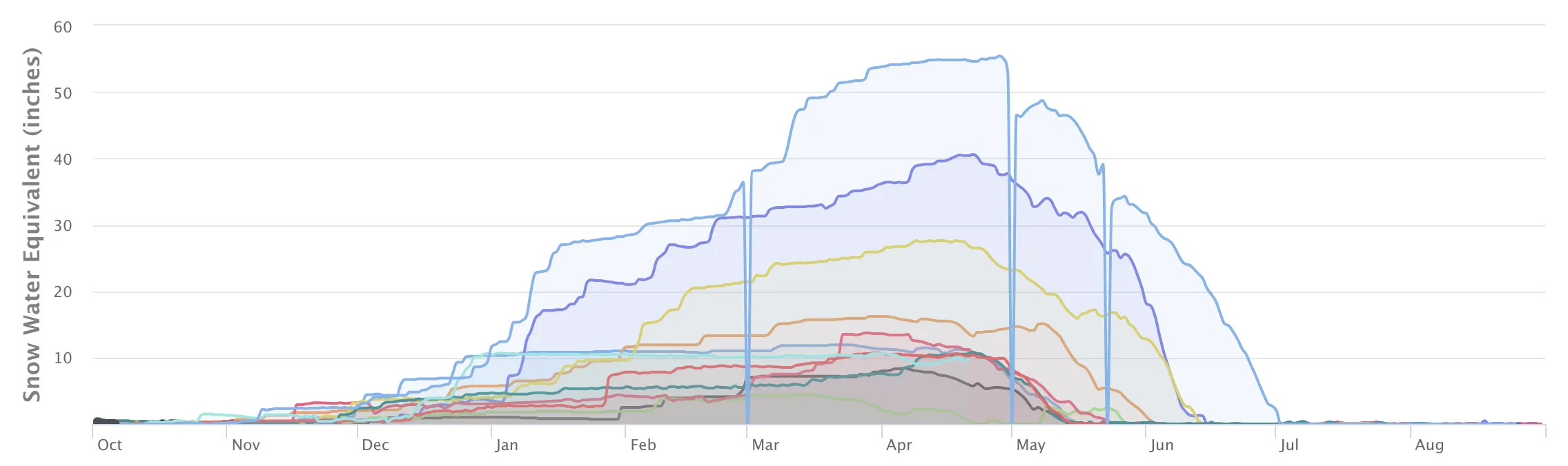
No new snow to report today, with snowpack levels sitting at 0.0".
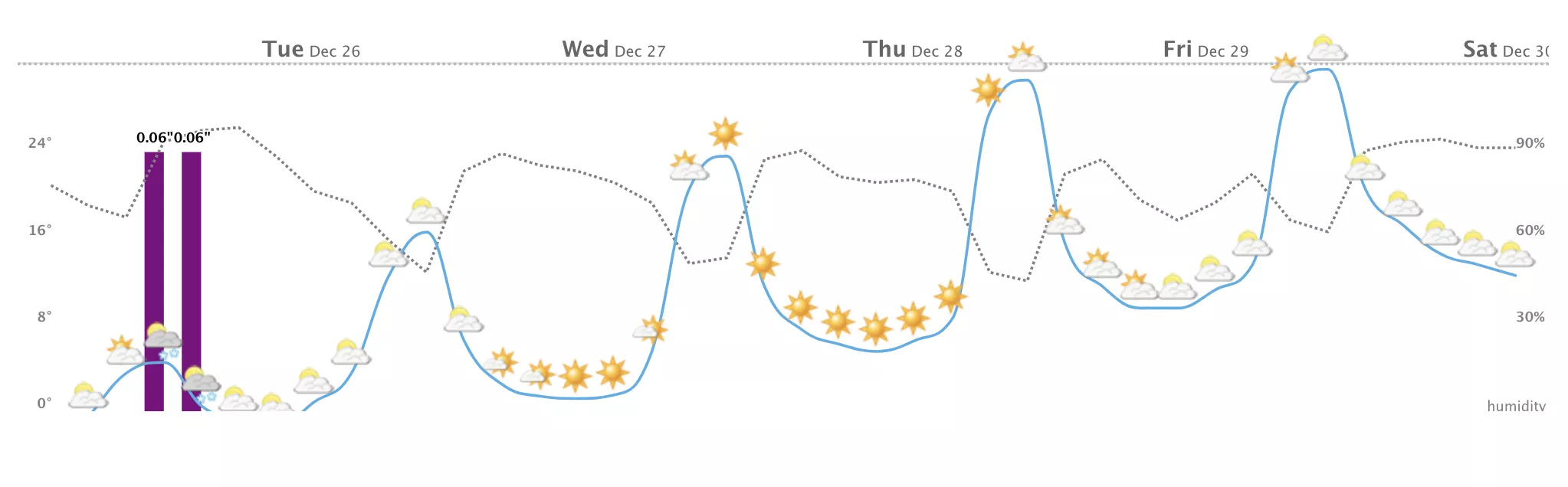
Weather today, snow, possibly mixed with rain before 3pm, then rain between 3pm and 4pm, then snow, possibly mixed with rain after 4pm. the rain and snow could be heavy at times. widespread blowing snow before 10am, then widespread blowing snow after 5pm. high near 41. windy, with a west northwest wind 34 to 40 mph, with gusts as high as 60 mph. chance of precipitation is 100%. new snow accumulation of 5 to 9 inches possible. Up to 41" of more snowfall forecasted over the next 5 days. Heavy snow is on the way, with the mountain expecting up to 32.91" of new snowfall by tomorrow. Get driving directions if you're planning on heading up.
None Read More