SKI AREAS • MONTANA
TETON PASS SKI AREA
May 8, 2024
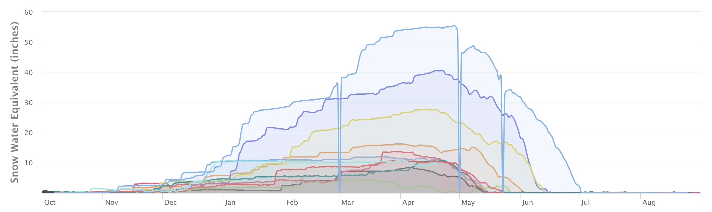
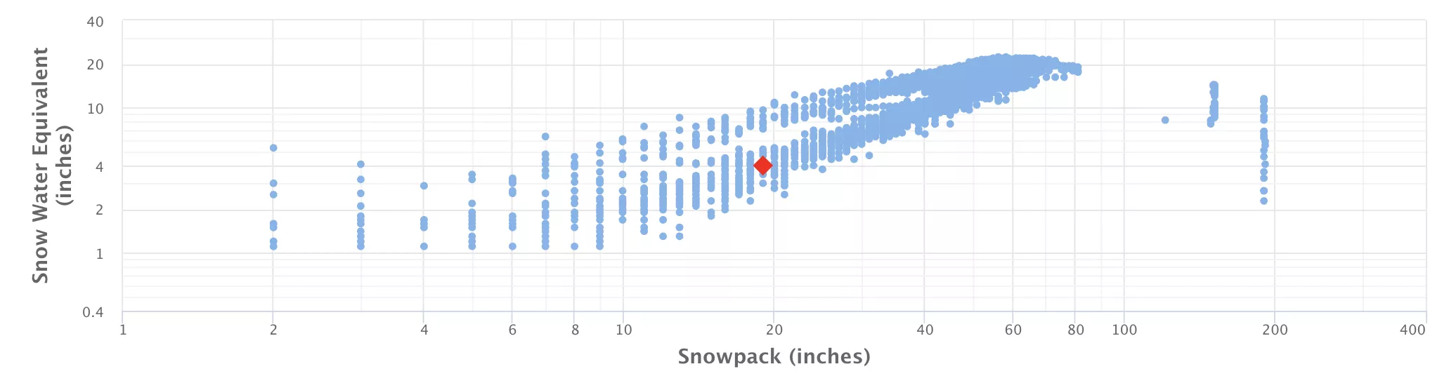
40.0" Snowpack (59% of Normal)
• 34° Heavy Snow and Blowing Snow
Until 2024-05-08T18:00:00-06:00 • National Weather Service
* WHAT...Heavy snow. Additional snow accumulations between 6 and 12 inches above mountain pass level, with another 3 to 6 inches on mountain passes and foothills. Winds gusting as high as 55 mph will cause blowing snow. * WHERE...The Continental Divide along the Rocky Mountain Front. * WHEN...Until midnight MDT tonight. * IMPACTS...Travel could be very difficult, and tire chains may be required for some vehicles. Those in the backcountry should ensure they have appropriate knowledge and gear and may want to consider alternate plans. Widespread blowing snow will significantly reduce visibility. The combination of heavy wet snow and strong winds could cause extensive damage to trees and power lines.
Blizzard Warning
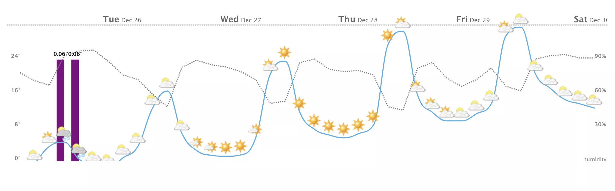
New snowfall today with 15" of fresh powder on the slopes, and snowpack levels reaching 40". Snowpack levels for this time of year average around 43 inches, but can be as high as 99 inches.
Weather today, snow, mainly before 3pm. the snow could be heavy at times. widespread blowing snow, mainly before 1pm. high near 34. windy, with a north wind 38 to 43 mph decreasing to 24 to 29 mph in the afternoon. winds could gust as high as 55 mph. chance of precipitation is 100%. new snow accumulation of 3 to 7 inches possible. Up to 16" of more snowfall forecasted over the next 5 days. Heavy snow is on the way, with the mountain expecting up to 15.85" of new snowfall by tomorrow. Get driving directions if you're planning on heading up.
None Read More