

Montana Whitewater
GALLATIN CANYON, SEC. 19, T4S, R4E TO YELLOWSTONE NATIONAL PARK, SEC. 27, T9S, R5E
STREAMFLOW: 2,470 CFS
• Class II-III River Run
.
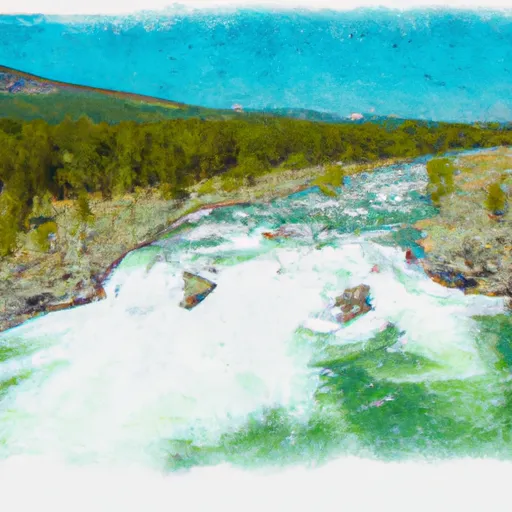
The whitewater river run from Gallatin Canyon to Yellowstone National Park in Montana is an exciting and popular adventure for rafters and kayakers. The ideal streamflow range for this stretch of river is between 2,500 and 5,000 cfs. The river is rated as a class II-III rapids, making it suitable for intermediate-level paddlers.
The segment mileage for this run is approximately 70 miles, and it includes several notable rapids and obstacles. Some of the most challenging rapids include House Rock, Kitchen Sink, and Zigzag. There are also several sections of calm water that allow paddlers to relax and take in the beautiful scenery.
Specific regulations for this area include a required permit for all commercial outfitters operating on the river. Private paddlers are not required to obtain a permit, but they must follow all state and federal regulations, including wearing proper safety equipment and adhering to all speed limits and other boating laws.
Get driving directions.
| Last Updated | 2024-04-25 |
| River Levels | 11100 cfs (6.31 ft) |
| Percent of Normal | 92% |
| Reporting Streamgauge | Yellowstone River at Corwin Springs MT |
| Elevation | 5,094 ft. |
| River | Yellowstone-River |
| Watershed | Gallatin |
Nearby Camping
| Location | Campsites | Reservations | Toilets | Showers | Elevation |
|---|---|---|---|---|---|
| Greek Creek | 15 | 5,634 ft | |||
| Cherry Creek - Dispersed | Numerous | 6,586 ft | |||
| Spire Rock | 22 | 5,608 ft | |||
| Red Cliff | 68 | 6,306 ft | |||
| Tom Miner | 16 | 7,117 ft | |||
| Moose Creek Flat | 15 | 5,716 ft | |||
| Swan Creek | 13 | 5,831 ft | |||
| Bakers Hole | 72 | 6,572 ft | |||
| Lonesomehurst | 26 | 6,547 ft | |||
| Rainbow Point | 55 | 6,548 ft |
Weather Forecast
