Laurel Street 515, Lee boat launch
Community Reviews
Been here? Share the conditions.
Reviews, ratings & photos are added in the free Snoflo iOS app — rate a spot, tag the conditions, and your visit is verified by location. Add or manage your reviews from the app.
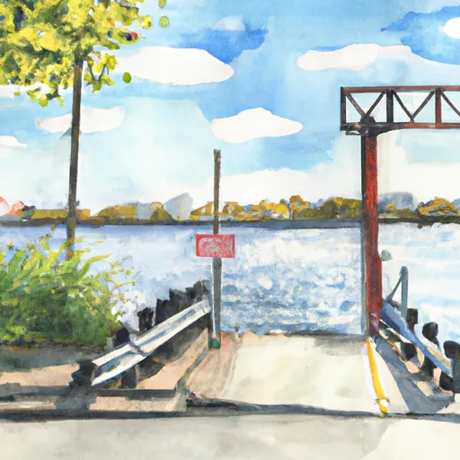
Laurel Street 515, Lee
However, I can provide some general information regarding boat ramps in New York. Boat ramps can vary in size and width depending on their location and intended use. Some ramps may be designed for smaller watercraft such as canoes or kayaks, while others may be able to accommodate larger boats and trailers.
The body of water that a boat ramp services can also vary. New York is home to many bodies of water, including lakes, rivers, and even the ocean. The type of craft permitted on the water can also vary depending on the size and type of the body of water. For example, some lakes may have restrictions on the size of boats or the use of motorized watercraft.
It is important to note that before using any boat ramp, it is essential to verify the ramp's location and any regulations or restrictions in place. This information can often be found on the website of the governing body overseeing the body of water, such as the New York State Office of Parks, Recreation, and Historic Preservation.
Plan your launch down to the hour
Same weather feed Snoflo's iOS app uses -- updated continuously from NOAA / yr.no.
Next 5 days, hour by hour
Temperature line with weather symbols on top, snow + rain accumulation as columns, humidity as a dotted line.
5-day forecast table
Every 3 hours, broken out across temperature, snow, rain, humidity, and wind.
| Time | Condition | Temp (°F) | Snow (in) | Rain (in) | Humidity (%) | Wind (mps) | Wind dir |
|---|---|---|---|---|---|---|---|
| Loading detailed forecast… | |||||||
15-day temperature & precipitation
Daily temperatures, snow, and rain projected over the next two weeks.
Area streamflow levels
USGS streamgauges around Laurel Street 515, Lee -- the same readings that determine whether your launch is safe and your boat is the right craft.
| Streamgauge | Discharge | View |
|---|---|---|
| Housatonic River Near Great Barrington | 170 cfs | → |
| East Branch Housatonic River At Coltsville | 24 cfs | → |
| Green River Near Great Barrington | 14 cfs | → |
| Housatonic River Nr Ashley Falls | 239 cfs | → |
| West Branch Farmington River Near New Boston | 24 cfs | → |
| West Branch Westfield River At Huntington | 24 cfs | → |
Plan a longer trip
The closest paddle runs, fishing spots, and other boat launches so you can extend a day on the water.
River runs
- The Massachusetts-Connecticut Border To Falls Mountain Road In Canaan, Connecticut
- Falls Mountain Road In Canaan, Connecticut To Kent Bridge
- The Massachusetts-Connecticut State Line In Hartland To The Confluence With The Salmon Brook Main Stem
- The Hartland Headwaters To The Confluence With The Salmon Brook Main Stem
- The Confluence Of The East And West Branches To The Confluence With The Farmington River In East Granby
- Stamford Town Line To Confluence With City Stream
Boating safety & etiquette
- Check the conditions before you launch
- Use the streamflow numbers, weather, and wind forecast on this page. High-cfs whitewater requires whitewater-specific craft and skill.
- Wear your life jacket
- Statistically the single biggest survival factor in a boating incident. State law often requires one per passenger.
- File a float plan
- Tell someone on shore your put-in, take-out, and expected return time. Especially for multi-day or remote trips.
- Yield at the ramp
- Prep gear in the parking lot, not on the ramp. Launch and clear quickly so others can use the lane.
- Clean, drain, dry
- Inspect, clean, drain and dry your boat between waters to prevent the spread of aquatic invasive species.
Set push alerts in the Snoflo app
Save Laurel Street 515, Lee as a favorite, set a discharge threshold or a wind/precipitation alert, and the iOS app will push the moment conditions cross.
About Laurel Street 515, Lee
Can I launch a motorboat here?
Most Snoflo-tracked launches support motorboats; check the operator for any horsepower restrictions, paddle-only zones, or seasonal closures.
How fresh is the streamflow data?
USGS streamgauges report continuously (every 15 minutes); the table on this page pulls the latest reading at page load.
Is there a fee?
Many federal and state boat launches charge a day-use fee. Check the operator's site before driving out.
What boat is right for these conditions?
Use the nearby streamflow numbers and river-run panel on this page to gauge current conditions. Wider, slower water is friendly for casual paddling and powerboats; high-cfs whitewater requires whitewater-specific craft and skill.
Can I get alerts when conditions change?
Yes -- alerts are managed in the Snoflo iOS app. Favorite this launch, set a threshold (discharge, wind), and you'll get a push the moment it crosses.
Other launches near here
Snoflo-tracked boat launches within driving distance of Laurel Street 515, Lee.