2025-01-16T10:00:00-08:00
* WHAT...For the Dense Fog Advisory, visibility of less than a quarter of a mile in dense fog. For the Air Stagnation Advisory, poor air quality will continue. This is due to an inversion and stagnant air conditions near the surface that will continue to trap pollutants. * WHERE...Valleys in central Douglas County. This includes Roseburg, Sutherlin, Elkton, Camas Valley, Canyonville, Glendale and surrounding areas. * WHEN...For the Dense Fog Advisory, until 10 AM PST this morning. For the Air Stagnation Advisory, until 10 AM PST Thursday. * IMPACTS...Low visibility could make driving conditions hazardous. Poor air quality may cause issues for people with respiratory problems. * ADDITIONAL DETAILS...Strong valley inversions, very shallow mixing layers of less than 1000 feet, and calm winds are expected throughout the advisory time, especially during the overnight and morning hours. A weak front on Thursday may allow for a brief period of improved mixing and particulate dispersion.
°F
°F
mph
Windspeed
%
Humidity


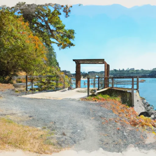
Based on available information, Pickett Park boat ramp is located in Douglas County, Oregon (latitude: 42.93972015, longitude: -123.26541901). It is a public boat ramp that provides access to the South Umpqua River, which flows through southern Oregon.
The boat ramp at Pickett Park is a single-lane ramp with a concrete surface. It is relatively wide and can accommodate larger boats, although there is no official information available on its exact width.
The South Umpqua River is primarily used for recreational activities such as fishing, kayaking, and rafting. The river is known for its steelhead and salmon runs, and also has populations of smallmouth bass and trout. Motorized boats are permitted on the river, but there are no specific restrictions on the types of craft allowed.
In summary, Pickett Park boat ramp is a public boat ramp located in Douglas County, Oregon, that provides access to the South Umpqua River. The ramp is relatively wide and can accommodate larger boats. The river is primarily used for recreational activities such as fishing, kayaking, and rafting, and motorized boats are permitted.
Weather Forecast
Nearby Streamflow Levels
| Discharge | Stage | Elevation | |
|
ROGUE RIVER AT GRANTS PASS
2025-01-14T00:20:00.000-08:00 |
7630cfs | 5.48ft | 891ft |
|
BEAR CREEK AT MEDFORD
2025-01-14T00:15:00.000-08:00 |
113cfs | 3.08ft | 1364ft |
|
APPLEGATE RIVER NEAR COPPER
2025-01-14T00:15:00.000-08:00 |
1250cfs | 4.06ft | 1768ft |
|
ROGUE RIVER AT RAYGOLD NEAR CENTRAL POINT
2025-01-14T00:20:00.000-08:00 |
6720cfs | 4.42ft | 1149ft |
|
APPLEGATE RIVER NEAR APPLEGATE
2025-01-14T00:20:00.000-08:00 |
1350cfs | 3.72ft | 1301ft |
|
APPLEGATE RIVER NEAR WILDERVILLE
2025-01-14T00:20:00.000-08:00 |
1650cfs | 4.22ft | 963ft |
|
SUCKER CR BL LT GRAYBACK CR NR HOLLAND
2025-01-14T00:00:00.000-08:00 |
394cfs | 2.25ft | 1767ft |
Nearby Camping
| Camping Area | Reservations | Toilets | Showers |
|---|---|---|---|
| Tipsu Tyee | |||
| Squaw Lakes | |||
| Mt Ashland | |||
| Jackson Complex | |||
| Hart-Tish Park - Applegate Lake | |||
| Mount Ashland |


