


-
 Snoflo Premium
Get unlimited access to all our content
With no Ad interruptions! - Start Your Free Trial Login with existing account
Weather Outlook
Seasonal Comparison
Historical Data
Regional Streamflow Levels
| Streamgauge | Streamflow | Gage Height |
|---|---|---|
| MEDICINE CREEK NEAR LAREDO | 332 cfs | 3.7 ft |
| MUSSEL FORK NEAR MUSSELFORK | 905 cfs | 13.4 ft |
| CROOKED RIVER NEAR RICHMOND | 140 cfs | 7.9 ft |
| EAST FORK BIG CREEK NEAR BETHANY | 154 cfs | 3.2 ft |
| SHOAL CREEK NEAR BRAYMER MO | 295 cfs | 8.3 ft |
| THOMPSON RIVER AT TRENTON | 1,500 cfs | 13.9 ft |
| WAKENDA CREEK AT CARROLLTON | 270 cfs | 6.2 ft |
Fishing Destinations
Camp Clear Fork Reservoir
Black Crappie • Blue Catfish • Bluegill • Channel Catfish • Kelp Bass • Largemouth Bass
Moss Creek
Black Crappie • Blue Catfish • Kelp Bass • Largemouth Bass
Horsehead Creek
Black Crappie • Blue Catfish • Green Sunfish • Kelp Bass
Paris Reservoir
Black Crappie • Blue Catfish • Bluegill • Kelp Bass • Largemouth Bass
Lake Greeson
Black Crappie • Blue Catfish • Kelp Bass • Largemouth Bass
Peter George Lake
Black Crappie • Bluegill • Kelp Bass • Largemouth Bass
Rocky Shoals Day Use
Bigmouth Buffalo • Blue Catfish • Kelp Bass • Largemouth Bass • Smallmouth Bass • Spotted Bass
Leatherwood Creek
Black Crappie • Blue Catfish • Bluegill • Kelp Bass • Largemouth Bass
Nimrod Lake
Black Crappie • Blue Catfish • Kelp Bass
Lake Ouachita
Black Crappie • Blue Catfish • Kelp Bass
Clearfork
Black Crappie • Blue Catfish • Kelp Bass • Largemouth Bass • Spotted Bass
Lake Ludwig
Black Crappie • Blue Catfish • Kelp Bass
Lake Dardanelle
Black Crappie • Blue Catfish • Kelp Bass • Largemouth Bass
Dragover Day Use
Black Crappie • Blue Catfish • Green Sunfish • Kelp Bass • Largemouth Bass • Smallmouth Bass
Blue Mountain Lake
Black Crappie • Blue Catfish • Kelp Bass • Largemouth Bass
Little Piney Creek
Black Crappie • Blue Catfish • Bluegill • Channel Catfish • Kelp Bass • Largemouth Bass • Smallmouth Bass • Spotted Bass
Area Boat Ramps
|
SWINGING BRIDGE DRIVE COOPER COUNTY
Lamine Watershed, Missouri |
|
LAFAYETTE COUNTY
Blackwater Watershed, Missouri |
|
MO K HENRY COUNTY
South Grand Watershed, Missouri |
|
NORTHWEST 575TH ROAD JOHNSON COUNTY
Blackwater Watershed, Missouri |
|
I 70;US 40 COOPER COUNTY
Lamine Watershed, Missouri |
|
THE LOOP ROAD STONE COUNTY
James Watershed, Missouri |
|
COUNTY ROAD K SALINE COUNTY
Blackwater Watershed, Missouri |
|
LEXINGTON
Lower Missouri-Crooked Watershed, Missouri |
|
LAFAYETTE COUNTY
Blackwater Watershed, Missouri |
|
SOUTHEAST 91 ROAD HENRY COUNTY
South Grand Watershed, Missouri |
Rafting & Kayaking
|
TOWN BLUFF DAM TO HWY 96 BRIDGE
Lower Neches Watershed, Texas |
|
US HIGHWAY 69 TO BA STEINHAGEN RESERVOIR
Lower Neches Watershed, Texas |
|
SEC 30, T3S, R27W TO SEC 19, T4S, R24W
Upper Ouachita Watershed, Arkansas |
|
HWY 96 BRIDGE TO NECHES RIVER SALTWATER BARRIER
Lower Neches Watershed, Texas |
|
NF BOUNDARY AT PINE RIDGE, AR TO HIGHWAY 298 BRIDGE NEAR SIMS, AR
Ouachita Headwaters Watershed, Arkansas |
|
PRESERVE BOUNDARY IN THE BIG SANDY UNIT TO CONFLUENCE WITH BIG SANDY CREEK
Village Watershed, Texas |
|
US HIGHWAY 59 TO US HIGHWAY 69
Middle Neches Watershed, Texas |
|
PRESERVE BOUNDARY IN THE LANCE ROSIER UNIT TO CONFLUENCE WITH PINE ISLAND BAYOU
Pine Island Bayou Watershed, Texas |
|
CONFLUENCE WITH BIG SANDY CREEK TO CONFLUENCE WITH THE NECHES RIVER
Village Watershed, Texas |
|
PRESERVE BOUNDARY IN THE LANCE ROSIER UNIT TO CONFLUENCE WITH THE NECHES RIVER
Pine Island Bayou Watershed, Texas |
Parks & Recreation
|
GUIBOR'S BATTERY
Guibor's Battery is a point of interest in Missouri located within the Wilson's Creek National Battlefield. It is a key location in the story of the Battle of Wilson's Creek, ... |
|
LYON MARKER
The Lyon Marker point of interest is located in southeastern Missouri and is part of the Mark Twain National Forest. This historical site marks the location where Nathaniel Lyon, a ... |
|
PRICE'S HEADQUATERS TOUR STOP
Price's Headquarters Tour Stop is a point of interest located in Wilson's Creek National Battlefield in Republic, Missouri. This site served as the headquarters for Confederate General Sterling Price during ... |
|
BLEDSOE'S BATTERY
Welcome to Bledsoe's Battery, a significant point of interest in Missouri's Wilson's Creek National Battlefield. As a national park tour guide, let me tell you why you should visit this ... |
|
BLOODY HILL TOUR STOP
Bloody Hill Tour Stop, located at Wilson's Creek National Battlefield in southwest Missouri, is a point of interest worth visiting for history and nature enthusiasts alike. The tour stop marks ... |
|
SOKALSKI'S SECTION 2ND POSITION
Sokalski's Section 2nd Position is a popular point of interest within Missouri's national parks. Located in the Mark Twain National Forest, this area is known for its beautiful scenic views, ... |
|
GUIBOR'S BATTERY TOUR STOP
Guibor's Battery is a historic site located within the Wilson's Creek National Battlefield in southwest Missouri. The site was originally a Confederate battery during the Battle of Wilson's Creek in ... |
|
BACKOF'S FINAL BATTERY
Backof's Final Battery is a point of interest in Missouri that is popular among history enthusiasts and nature lovers alike. Located within the Wilson's Creek National Battlefield, the battery site ... |
|
FORT SMITH BATTERY
The Fort Smith Battery point of interest is located in the Ozark National Scenic Riverways in Missouri and is a must-see for history and nature enthusiasts. Fort Smith Battery was ... |
|
SIGEL'S FINAL POSITION TOUR STOP
The Sigel's Final Position Tour Stop is a point of interest in the Wilson's Creek National Battlefield Park in Missouri. This tour stop is a significant location as it marks ... |
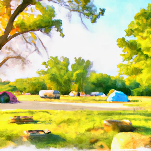
Nearby Campgrounds
| Camping Area | Campsites | Reservations | Toilets | Showers | Elevation |
|---|---|---|---|---|---|
| Shadow Rock Park | Numerous | 676 ft | |||
| Eagle Rock - Table Rock Lake | Numerous | 988 ft | |||
| Indian Point - Table Rock Lake | Numerous | 1,040 ft | |||
| Big Bay - Table Rock Lake | 61 | 1,022 ft | |||
| Aunts Creek - Table Rock Lake | Numerous | 998 ft | |||
| Long Creek - Table Rock Lake | Numerous | 1,001 ft | |||
| Branson City Campground | Numerous | 704 ft | |||
| Buck Creek - Bull Shoals Lake | Numerous | 724 ft | |||
| Cape Fair - Table Rock Lake | Numerous | 966 ft | |||
| River Run | Numerous | 701 ft |