SOUTH BRANCH POND - BAXTER STATE PARK

Amenities Weather Recreation


CAMPING MAINE

South Branch Pond - Baxter State Park


April 27, 2024

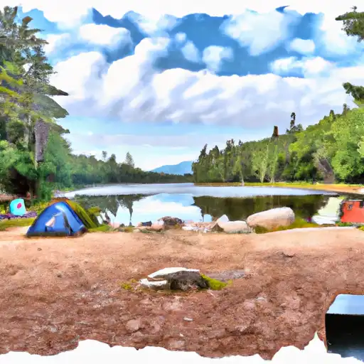
South Branch Pond is a beautiful camping area located within Baxter State Park in the state of Maine. This campground offers a range of amenities to ensure a comfortable stay in the great outdoors. Campers can expect to find picnic tables, fire pits, and pit toilets at the campground. However, it is important to note that there are no showers or electrical hookups available. Additionally, potable water is not provided, so campers should bring their own or be prepared to treat water from the pond.

Reservations are required for camping at South Branch Pond, and they can be made online through the Baxter State Park website. It is advised to book well in advance, especially during peak season, as this campground is popular among outdoor enthusiasts. The best time to visit South Branch Pond is during the summer months, from June to September, when the weather is generally mild and the campground is fully operational.

While exploring the camping area, campers will be captivated by the stunning views of South Branch Pond and the surrounding mountains. Hiking enthusiasts can embark on the challenging but rewarding hike to the summit of Mount Katahdin, the highest peak in Maine. It is important to be cautious of wildlife in the area, such as black bears, and to properly store food to avoid attracting them. Campers must also adhere to the park's strict regulations, including the Leave No Trace principles, to preserve the natural beauty of South Branch Pond and ensure an enjoyable experience for all.


Weather Outlook


16 Day Long Term Forecast

Seasonal Comparison


Historical Data


Rafting & Kayaking

GOLDEN ROAD BRIDGE (APPROX. 2 MILES BELOW LOBSTER STREAM) TO CONFLUENCE WITH PINE STREAM
West Branch Penobscot Watershed, Maine
HEADWATERS TO CONFLUENCE WITH PENOBSCOT RIVER, EAST BRANCH
East Branch Penobscot Watershed, Maine
HAY BROOK TO BRIDGE ABOVE MEDWAY AT STATE ROUTE 157
East Branch Penobscot Watershed, Maine
AMBAJEJUS FALLS TO THE END OF NORTH AND SOUTH TWIN LAKES
West Branch Penobscot Watershed, Maine
HEADWATERS TO CONFLUENCE WITH WEST BRANCH PENOBSCOT RIVER
East Branch Penobscot Watershed, Maine
THE NORTH BRANCH HEADWATER FROM CANAL CUT APPROXIMATELY 1.25 MILES UPSTREAM OF BIG BOG TO PITTSTON FARM
West Branch Penobscot Watershed, Maine
LOBSTER LAKE TO CONFLUENCE WITH WEST BRANCH
West Branch Penobscot Watershed, Maine
BOWLIN CAMPS TO HAY BROOK
East Branch Penobscot Watershed, Maine
GRAND LAKE MATAGAMON TO BOWLIN CAMPS
East Branch Penobscot Watershed, Maine
HEADWATERS TO CONFLUENCE WITH PENOBSCOT RIVER, EAST BRANCH
East Branch Penobscot Watershed, Maine

Log Your Visit

When was your last visit to South Branch Pond - Baxter State Park?

Add a Photo

How was it? How were conditions?

Rate the camping


Submit

Leave A Review

South Branch Pond - Baxter State Park

Submit

Upload an Image

South Branch Pond - Baxter State Park

Favorite Limit Reached