Crossroads Campsite 26 Campground
Community Reviews
Been here? Share the conditions.
Reviews, ratings & photos are added in the free Snoflo iOS app — rate a spot, tag the conditions, and your visit is verified by location. Add or manage your reviews from the app.
Crossroads Campsite 26
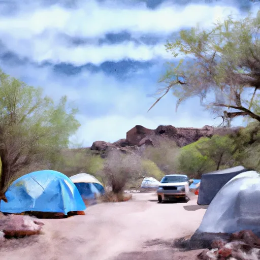
The campsite features numerous amenities, including picnic tables, fire rings, and grills, making it an ideal location for outdoor activities such as hiking, fishing, and boating. Visitors can also explore nearby attractions such as the Imperial Wildlife Area, the Imperial National Wildlife Refuge, and the Martinez Lake.
Interesting facts about the area include the fact that it was once inhabited by indigenous tribes such as the Quechan and the Cocopah, who used the area for hunting and fishing. The area was also once home to the Yuma Territorial Prison, which operated from 1876 to 1909.
The best time of year to visit the Crossroads Campsite 26 is from October to April, with average temperatures ranging from 60-80 degrees Fahrenheit. During this time, visitors can enjoy the mild weather and participate in outdoor activities without the extreme heat of the summer months.
Overall, the Crossroads Campsite 26 is a beautiful and peaceful location that offers visitors the opportunity to connect with nature and explore the rich history of the area.
What's on-site at Crossroads Campsite 26
Key facilities Snoflo tracks for this campground. Confirm with the operator before booking -- amenities can change seasonally.
Plan your trip down to the hour
Same weather feed Snoflo's iOS app uses -- updated continuously from NOAA / yr.no.
Next 5 days, hour by hour
Temperature line with weather symbols on top, snow + rain accumulation as columns, humidity as a dotted line.
5-day forecast table
Every 3 hours, broken out across temperature, snow, rain, humidity, and wind. Each cell is colour-coded relative to the column min/max so trends jump out at a glance.
| Time | Condition | Temp (°F) | Snow (in) | Rain (in) | Humidity (%) | Wind (mps) | Wind dir |
|---|---|---|---|---|---|---|---|
| Loading detailed forecast… | |||||||
15-day temperature & precipitation
Daily temperatures, snow, and rain projected over the next two weeks. Hover any point for the full breakdown.
Other campgrounds in the area
Snoflo-tracked campsites within driving distance of Crossroads Campsite 26, with reservations status.
| Campground | Reservations | Toilets | View |
|---|---|---|---|
| Crossroads Campsite 25 | ✗ | ✗ | → |
| Crossroads Campsite 24 | ✗ | ✗ | → |
| Crossroads Campsite 23 | ✗ | ✗ | → |
| Crossroads Campsite 22 | ✗ | ✗ | → |
| Crossroads Campsite 21 | ✗ | ✗ | → |
Nearby streamflow
USGS streamgauges within reach of Crossroads Campsite 26 -- pulled live from the National Water Information System.
| Streamgauge | Discharge | View |
|---|---|---|
| C.R.I.R. Main Canal Nr Parker | 1,150 cfs | → |
| Colorado River Below Parker Dam | 2,300 cfs | → |
| Bill Williams River Near Parker | · | → |
| Gardner Lateral Spill Near Parker | 9 cfs | → |
| Poston Wasteway Near Poston | 53 cfs | → |
| Bill Williams River Below Alamo Dam | 32 cfs | → |
Plan a longer trip
The closest parks, lakes, boat launches, and paddle runs so a camping night can grow into a full weekend.
Parks
- Buckskin Mountain State Park
- Cattail Cove State Park
- Gibraltar Mountain Wilderness
- Lake Havasu State Park
- Bill Williams River National Wildlife Refuge
- Whipple Mountains Wilderness
Boat launches
- Rio Del Colorado
- Parker Dam Road 52650-52900, Earp
- Rock House Recreation Area Boat Launch
- River Land Resort
- Emerald Cove Resort/Colorado River Adventures
- Echo Lodge Resort
Points of interest
- Parker Dam Road Backcountry Byway Cross Roads
- Parker Dam Road Backcountry Byway Burro Flats
- Parker Dam Road Backcountry Byway Bullfrog
- Parker Dam Road Backcountry Byway Bristoll Springs
- Parker Dam Road Backcountry Byway Quail Hollow
- Monkeyhead Flat Wildlife Viewing Area
Camping essentials & Leave No Trace
- Pack it in, pack it out
- Take all trash, food scraps, and gear back with you to keep campsites clean and protect wildlife.
- Respect wildlife
- Observe animals from a distance, store food securely, and never feed wildlife to maintain natural behavior and safety.
- Know before you go
- Check weather, fire restrictions, trail conditions, and permit requirements to ensure a safe and well-planned trip.
- Minimize campfire impact
- Use established fire rings, keep fires small, fully extinguish them, or opt for a camp stove when fires are restricted.
- Leave what you find
- Preserve natural and cultural features by avoiding removal of plants, rocks, artifacts, or other elements of the environment.
Set push alerts in the Snoflo app
Save Crossroads Campsite 26 as a favorite, set a custom threshold (precipitation, snowpack, freezing temperatures), and the iOS app will push the moment conditions cross.
About Crossroads Campsite 26
Can I make reservations at Crossroads Campsite 26?
This campground does not appear to accept reservations -- it's typically first-come, first-served. Arrive early on summer weekends.
How fresh is the weather data on this page?
The hourly forecast updates throughout the day from the NOAA / yr.no public feeds. Streamflow data is pulled live from USGS streamgauges and snowpack from the NRCS SNOTEL network.
What's the best time of year to visit?
Use the 15-day temperature & precipitation outlook on this page to plan -- pick a window with comfortable temperatures and low precipitation. For longer trips, the 5-day hourly meteogram shows snow + rain accumulation hour-by-hour.
How do I get to Crossroads Campsite 26?
Tap Directions in the hero above to open driving directions in Google Maps, or Open in map to center the Snoflo interactive map on the campground.
Can I get alerts when conditions change?
Yes -- alerts are managed through the Snoflo iOS app. Favorite this campground, set a threshold (temperature, snowpack, precipitation), and you'll get a push the moment it crosses.
Other campgrounds near here
Snoflo-tracked campgrounds within driving distance of Crossroads Campsite 26.