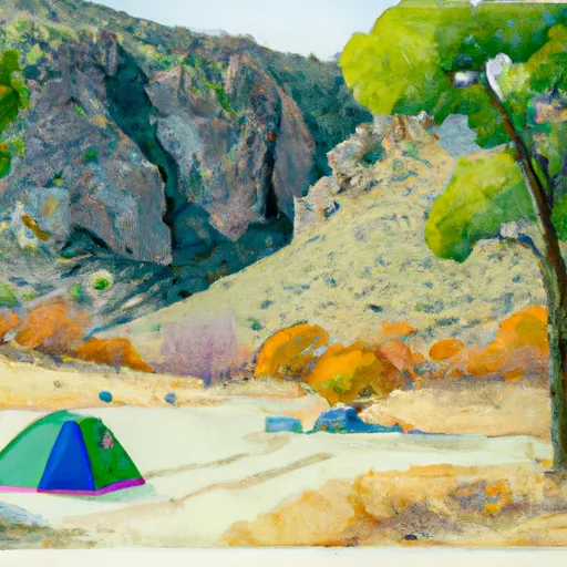
Elam Creek campground
Community Reviews
Been here? Share the conditions.
Reviews, ratings & photos are added in the free Snoflo iOS app — rate a spot, tag the conditions, and your visit is verified by location. Add or manage your reviews from the app.
Elam Creek
The campground amenities at Elam Creek include picnic tables, fire rings, and vault toilets for guests to use. However, there is no drinking water available at this camping area, so visitors should bring their own water supply.
Interesting facts about the area include that it was once home to the Miwok Indian tribe, who used the land for hunting and fishing. Additionally, the area was once a hotspot for gold mining during the California Gold Rush in the mid-1800s.
The best time of year to visit Elam Creek camping area is during the summer months from June to September when temperatures range from 75 to 85 degrees Fahrenheit during the day and can drop to as low as 40 degrees at night. Visitors should also be aware that this camping area is only accessible via a dirt road that can be difficult to navigate, especially during the winter months when there is snow on the ground.
In summary, Elam Creek camping area offers stunning surrounding views, nearby points of interest, basic campground amenities, and interesting historical facts. Visitors should plan their trip during the summer months and bring their own water supply due to the lack of drinking water available.
What's on-site at Elam Creek
Key facilities Snoflo tracks for this campground. Confirm with the operator before booking -- amenities can change seasonally.
Plan your trip down to the hour
Same weather feed Snoflo's iOS app uses -- updated continuously from NOAA / yr.no.
Next 5 days, hour by hour
Temperature line with weather symbols on top, snow + rain accumulation as columns, humidity as a dotted line.
5-day forecast table
Every 3 hours, broken out across temperature, snow, rain, humidity, and wind. Each cell is colour-coded relative to the column min/max so trends jump out at a glance.
| Time | Condition | Temp (°F) | Snow (in) | Rain (in) | Humidity (%) | Wind (mps) | Wind dir |
|---|---|---|---|---|---|---|---|
| Loading detailed forecast… | |||||||
15-day temperature & precipitation
Daily temperatures, snow, and rain projected over the next two weeks. Hover any point for the full breakdown.
Other campgrounds in the area
Snoflo-tracked campsites within driving distance of Elam Creek, with reservations status.
| Campground | Reservations | Toilets | View |
|---|---|---|---|
| Elam Camp | ✗ | ✗ | → |
| 44 Camp | ✗ | ✗ | → |
| Stone Lagoon | ✗ | ✗ | → |
| Stone Lagoon Boat-In Campground | ✗ | ✗ | → |
| Rv Tent Sites | ✗ | ✗ | → |
Nearby streamflow
USGS streamgauges within reach of Elam Creek -- pulled live from the National Water Information System.
| Streamgauge | Discharge | View |
|---|---|---|
| Redwood C A Orick Ca | 53 cfs | → |
| Klamath R Nr Klamath Ca | 2,820 cfs | → |
| Little R Nr Trinidad Ca | 7 cfs | → |
| Trinity R A Hoopa Ca | 758 cfs | → |
| Mad R Nr Arcata Ca | 52 cfs | → |
| Klamath R A Orleans | 1,150 cfs | → |
Plan a longer trip
The closest parks, lakes, boat launches, and paddle runs so a camping night can grow into a full weekend.
Parks
- Prairie Creek Redwoods State Park
- Humboldt Lagoon State Park
- Patrick's Point State Park
- Trinidad State Beach
- Wilderness Siskiyou
- Redwood National And State Parks
Boat launches
- Redwood Highway, Trinidad
- Humboldt Lagoons State Park
- Big Lagoon Boat Ramp Humboldt County
- Trinidad Wharf, Trinidad
- Klamath
- Requa Resort
Fishing spots
Paddle runs
- Sounthern Boundary Of Redwood National And State Parks To Northern Boundary Of Redwood National And State Parks
- Nw 1/4 Sec 23, T14n, R4e To Near Center Of Sec 3, T12n, R3e
- Lacks Creek
- North Fork Dillon Creek Headwaters To Confluence With Dillon Creek
- Headwaters In Siskiyou Wilderness To Unnamed Trib In Sec 32, T14n, R6e
- Unnamed Trib In Sec 32 To Confluence With Klamath River
Camping essentials & Leave No Trace
- Pack it in, pack it out
- Take all trash, food scraps, and gear back with you to keep campsites clean and protect wildlife.
- Respect wildlife
- Observe animals from a distance, store food securely, and never feed wildlife to maintain natural behavior and safety.
- Know before you go
- Check weather, fire restrictions, trail conditions, and permit requirements to ensure a safe and well-planned trip.
- Minimize campfire impact
- Use established fire rings, keep fires small, fully extinguish them, or opt for a camp stove when fires are restricted.
- Leave what you find
- Preserve natural and cultural features by avoiding removal of plants, rocks, artifacts, or other elements of the environment.
Set push alerts in the Snoflo app
Save Elam Creek as a favorite, set a custom threshold (precipitation, snowpack, freezing temperatures), and the iOS app will push the moment conditions cross.
About Elam Creek
Can I make reservations at Elam Creek?
This campground does not appear to accept reservations -- it's typically first-come, first-served. Arrive early on summer weekends.
How fresh is the weather data on this page?
The hourly forecast updates throughout the day from the NOAA / yr.no public feeds. Streamflow data is pulled live from USGS streamgauges and snowpack from the NRCS SNOTEL network.
What's the best time of year to visit?
Use the 15-day temperature & precipitation outlook on this page to plan -- pick a window with comfortable temperatures and low precipitation. For longer trips, the 5-day hourly meteogram shows snow + rain accumulation hour-by-hour.
How do I get to Elam Creek?
Tap Directions in the hero above to open driving directions in Google Maps, or Open in map to center the Snoflo interactive map on the campground.
Can I get alerts when conditions change?
Yes -- alerts are managed through the Snoflo iOS app. Favorite this campground, set a threshold (temperature, snowpack, precipitation), and you'll get a push the moment it crosses.
Other campgrounds near here
Snoflo-tracked campgrounds within driving distance of Elam Creek.