Travis Afb Military campground
Community Reviews
Been here? Share the conditions.
Reviews, ratings & photos are added in the free Snoflo iOS app — rate a spot, tag the conditions, and your visit is verified by location. Add or manage your reviews from the app.
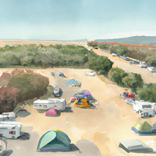
Travis Afb Military
An interesting fact about the area is that it hosts the largest air mobility wing in the Air Force, and it is known for being the gateway to the Pacific from the West Coast. The best time of year to visit Travis AFB Military Camping Area is from late spring through early fall, with average temperatures ranging from the low 60s to the high 80s.
Overall, Travis AFB Military Camping Area is a great destination for military personnel and their families, offering a range of nearby attractions and amenities to enjoy.
What's on-site at Travis Afb Military
Key facilities Snoflo tracks for this campground. Confirm with the operator before booking -- amenities can change seasonally.
Plan your trip down to the hour
Same weather feed Snoflo's iOS app uses -- updated continuously from NOAA / yr.no.
Next 5 days, hour by hour
Temperature line with weather symbols on top, snow + rain accumulation as columns, humidity as a dotted line.
5-day forecast table
Every 3 hours, broken out across temperature, snow, rain, humidity, and wind. Each cell is colour-coded relative to the column min/max so trends jump out at a glance.
| Time | Condition | Temp (°F) | Snow (in) | Rain (in) | Humidity (%) | Wind (mps) | Wind dir |
|---|---|---|---|---|---|---|---|
| Loading detailed forecast… | |||||||
15-day temperature & precipitation
Daily temperatures, snow, and rain projected over the next two weeks. Hover any point for the full breakdown.
Other campgrounds in the area
Snoflo-tracked campsites within driving distance of Travis Afb Military, with reservations status.
| Campground | Reservations | Toilets | View |
|---|---|---|---|
| Skyline Wilderness County Park | ✗ | ✗ | → |
| Lake Solano County Park | ✗ | ✗ | → |
| Skyline Wilderness Park Horse Camp Area | ✗ | ✗ | → |
| Sandy Beach County Park | ✗ | ✗ | → |
| Duck Island | ✗ | ✗ | → |
Nearby streamflow
USGS streamgauges within reach of Travis Afb Military -- pulled live from the National Water Information System.
| Streamgauge | Discharge | View |
|---|---|---|
| Shag Slough A Liberty Island Nr Courtland Ca | 3,500 cfs | → |
| Cache Slough A S Liberty Island Nr Rio Vista Ca | 4,280 cfs | → |
| Sacramento R Deep Water Ship Channel Nr Rio Vista | 9,620 cfs | → |
| Sacramento R A Rio Vista Ca | 33,400 cfs | → |
| Cache Slough Ab Ryer Island Ferry Nr Rio Vista Ca | 6,770 cfs | → |
| Miner Slough A Hwy 84 Bridge | 1,790 cfs | → |
Plan a longer trip
The closest parks, lakes, boat launches, and paddle runs so a camping night can grow into a full weekend.
Parks
Boat launches
- Suisun City Boat
- Belden's Landing Boat Launch
- Mcavoy Yacht Harbor
- Mcavoy Road 1099, Bay Point
- Rio Vista
- Delta Marina Yacht Harbor
Fishing spots
- Cliff House Fishing Access Area
- 9th Street Boat Ramp
- City Of Benicia Fishing Pier
- Contra Loma Reservoir
- Berryessa Lake
- Lake Berryessa
Points of interest
Camping essentials & Leave No Trace
- Pack it in, pack it out
- Take all trash, food scraps, and gear back with you to keep campsites clean and protect wildlife.
- Respect wildlife
- Observe animals from a distance, store food securely, and never feed wildlife to maintain natural behavior and safety.
- Know before you go
- Check weather, fire restrictions, trail conditions, and permit requirements to ensure a safe and well-planned trip.
- Minimize campfire impact
- Use established fire rings, keep fires small, fully extinguish them, or opt for a camp stove when fires are restricted.
- Leave what you find
- Preserve natural and cultural features by avoiding removal of plants, rocks, artifacts, or other elements of the environment.
Set push alerts in the Snoflo app
Save Travis Afb Military as a favorite, set a custom threshold (precipitation, snowpack, freezing temperatures), and the iOS app will push the moment conditions cross.
About Travis Afb Military
Can I make reservations at Travis Afb Military?
Yes -- this campground accepts reservations. Snoflo recommends booking early for peak season; check the operator (Recreation.gov / state park system / private operator) for the booking window and cancellation policy.
How fresh is the weather data on this page?
The hourly forecast updates throughout the day from the NOAA / yr.no public feeds. Streamflow data is pulled live from USGS streamgauges and snowpack from the NRCS SNOTEL network.
What's the best time of year to visit?
Use the 15-day temperature & precipitation outlook on this page to plan -- pick a window with comfortable temperatures and low precipitation. For longer trips, the 5-day hourly meteogram shows snow + rain accumulation hour-by-hour.
How do I get to Travis Afb Military?
Tap Directions in the hero above to open driving directions in Google Maps, or Open in map to center the Snoflo interactive map on the campground.
Can I get alerts when conditions change?
Yes -- alerts are managed through the Snoflo iOS app. Favorite this campground, set a threshold (temperature, snowpack, precipitation), and you'll get a push the moment it crosses.
Other campgrounds near here
Snoflo-tracked campgrounds within driving distance of Travis Afb Military.