Wailaki Campground
Community Reviews
Been here? Share the conditions.
Reviews, ratings & photos are added in the free Snoflo iOS app — rate a spot, tag the conditions, and your visit is verified by location. Add or manage your reviews from the app.
Wailaki
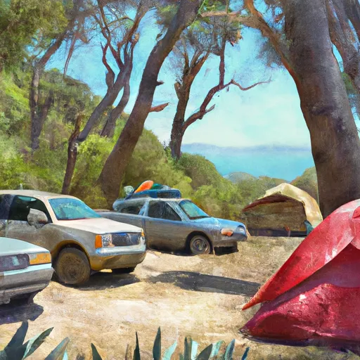
The campsite has amenities such as picnic tables, fire rings, and vault toilets. The area is also known for its abundance of wildlife, including black bears, deer, and various bird species. Visitors are advised to follow proper food storage guidelines to prevent attracting bears to the area.
The nearby points of interest include the famous Lost Coast Trail, King Range National Conservation Area, and Sinkyone Wilderness State Park. These areas offer hiking trails, camping facilities, and stunning ocean views.
The best time of year to visit Wailaki Campsite is from May to October when the weather is mild and dry. The average temperature during this time is around 70 degrees Fahrenheit during the day and around 50 degrees Fahrenheit at night. It is advisable to check the weather and road conditions before planning a trip to this area.
Overall, the Wailaki Campsite is a beautiful and peaceful place to camp, surrounded by stunning views of nature and offering a variety of activities for visitors.
What's on-site at Wailaki
Key facilities Snoflo tracks for this campground. Confirm with the operator before booking -- amenities can change seasonally.
Plan your trip down to the hour
Same weather feed Snoflo's iOS app uses -- updated continuously from NOAA / yr.no.
Next 5 days, hour by hour
Temperature line with weather symbols on top, snow + rain accumulation as columns, humidity as a dotted line.
5-day forecast table
Every 3 hours, broken out across temperature, snow, rain, humidity, and wind. Each cell is colour-coded relative to the column min/max so trends jump out at a glance.
| Time | Condition | Temp (°F) | Snow (in) | Rain (in) | Humidity (%) | Wind (mps) | Wind dir |
|---|---|---|---|---|---|---|---|
| Loading detailed forecast… | |||||||
15-day temperature & precipitation
Daily temperatures, snow, and rain projected over the next two weeks. Hover any point for the full breakdown.
Other campgrounds in the area
Snoflo-tracked campsites within driving distance of Wailaki, with reservations status.
| Campground | Reservations | Toilets | View |
|---|---|---|---|
| Wailaki Campground | ✗ | ✗ | → |
| Nadelos Tenting Area | ✗ | ✗ | → |
| Nadelos | ✗ | ✗ | → |
| Nick's Camp | ✗ | ✗ | → |
| Jones Beach Campground | ✗ | ✗ | → |
Nearby streamflow
USGS streamgauges within reach of Wailaki -- pulled live from the National Water Information System.
| Streamgauge | Discharge | View |
|---|---|---|
| Mattole R Nr Ettersburg Ca | 10 cfs | → |
| Sf Eel R Nr Miranda Ca | 40 cfs | → |
| Sf Eel R A Leggett Ca | 28 cfs | → |
| Bull C Nr Weott Ca | 1 cfs | → |
| Eel R A Fort Seward Ca | 63 cfs | → |
| Mattole R Nr Petrolia Ca | 34 cfs | → |
Plan a longer trip
The closest parks, lakes, boat launches, and paddle runs so a camping night can grow into a full weekend.
Camping essentials & Leave No Trace
- Pack it in, pack it out
- Take all trash, food scraps, and gear back with you to keep campsites clean and protect wildlife.
- Respect wildlife
- Observe animals from a distance, store food securely, and never feed wildlife to maintain natural behavior and safety.
- Know before you go
- Check weather, fire restrictions, trail conditions, and permit requirements to ensure a safe and well-planned trip.
- Minimize campfire impact
- Use established fire rings, keep fires small, fully extinguish them, or opt for a camp stove when fires are restricted.
- Leave what you find
- Preserve natural and cultural features by avoiding removal of plants, rocks, artifacts, or other elements of the environment.
Set push alerts in the Snoflo app
Save Wailaki as a favorite, set a custom threshold (precipitation, snowpack, freezing temperatures), and the iOS app will push the moment conditions cross.
About Wailaki
Can I make reservations at Wailaki?
This campground does not appear to accept reservations -- it's typically first-come, first-served. Arrive early on summer weekends.
How fresh is the weather data on this page?
The hourly forecast updates throughout the day from the NOAA / yr.no public feeds. Streamflow data is pulled live from USGS streamgauges and snowpack from the NRCS SNOTEL network.
What's the best time of year to visit?
Use the 15-day temperature & precipitation outlook on this page to plan -- pick a window with comfortable temperatures and low precipitation. For longer trips, the 5-day hourly meteogram shows snow + rain accumulation hour-by-hour.
How do I get to Wailaki?
Tap Directions in the hero above to open driving directions in Google Maps, or Open in map to center the Snoflo interactive map on the campground.
Can I get alerts when conditions change?
Yes -- alerts are managed through the Snoflo iOS app. Favorite this campground, set a threshold (temperature, snowpack, precipitation), and you'll get a push the moment it crosses.
Other campgrounds near here
Snoflo-tracked campgrounds within driving distance of Wailaki.