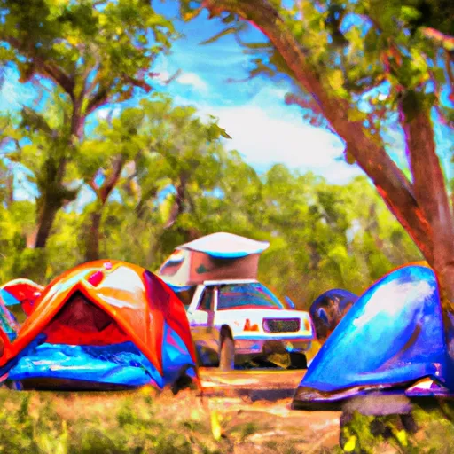
Hugo Docking 2012 campground
Community Reviews
Been here? Share the conditions.
Reviews, ratings & photos are added in the free Snoflo iOS app — rate a spot, tag the conditions, and your visit is verified by location. Add or manage your reviews from the app.
Hugo Docking 2012
Reservations are accepted at Hugo Docking 2012 camping area, providing campers with the convenience of securing a spot in advance. It is advisable to make reservations early, especially during peak seasons, to ensure availability.
The best time to visit Hugo Docking 2012 camping area in Florida would be during the cooler months of the year, such as fall or winter. This helps avoid the hot and humid conditions experienced during the summer months. Visitors should also be aware of the possibility of rain showers, as Florida is known for its unpredictable weather patterns.
While camping at Hugo Docking 2012, campers can explore the nearby natural wonders, such as hiking trails and beautiful scenic spots. It is important to be cautious of wildlife in the area, including alligators and snakes, which are common in Florida. Taking necessary precautions, such as keeping a safe distance and properly storing food, will ensure a safe and enjoyable camping experience.
What's on-site at Hugo Docking 2012
Key facilities Snoflo tracks for this campground. Confirm with the operator before booking -- amenities can change seasonally.
Plan your trip down to the hour
Same weather feed Snoflo's iOS app uses -- updated continuously from NOAA / yr.no.
Next 5 days, hour by hour
Temperature line with weather symbols on top, snow + rain accumulation as columns, humidity as a dotted line.
5-day forecast table
Every 3 hours, broken out across temperature, snow, rain, humidity, and wind. Each cell is colour-coded relative to the column min/max so trends jump out at a glance.
| Time | Condition | Temp (°F) | Snow (in) | Rain (in) | Humidity (%) | Wind (mps) | Wind dir |
|---|---|---|---|---|---|---|---|
| Loading detailed forecast… | |||||||
15-day temperature & precipitation
Daily temperatures, snow, and rain projected over the next two weeks. Hover any point for the full breakdown.
Other campgrounds in the area
Snoflo-tracked campsites within driving distance of Hugo Docking 2012, with reservations status.
| Campground | Reservations | Toilets | View |
|---|---|---|---|
| Butcher Pen Landing | ✗ | ✗ | → |
| Gardner Landing | ✗ | ✗ | → |
| Bloody Bluff Landing | ✗ | ✗ | → |
| High Bluff | ✗ | ✗ | → |
| Primative 1 | ✗ | ✗ | → |
Nearby streamflow
USGS streamgauges within reach of Hugo Docking 2012 -- pulled live from the National Water Information System.
| Streamgauge | Discharge | View |
|---|---|---|
| Apalachicola River Nr Sumatra | 11,600 cfs | → |
| New River Nr Sumatra Fla | 237 cfs | → |
| Apalachicola R.Ab Chipola Conr Wewahitchka | 10,800 cfs | → |
| Ochlockonee River Nr Smith Creek | 831 cfs | → |
| Sopchoppy River Nr Sopchoppy | 8 cfs | → |
| Lost Creek At Arran Fla | 1 cfs | → |
Plan a longer trip
The closest parks, lakes, boat launches, and paddle runs so a camping night can grow into a full weekend.
Parks
- Orman House Historic State Park
- John Gorrie Museum State Park
- Apalachicola River Wildlife And Environmental Area
- Box R Wildlife Management Area
- Tate's Hell State Forest
- Cape St. George State Reserve
Boat launches
- Scipio Creek Marina
- John B. Meyer Harbor House
- Battery Park City Marina
- Seafood Workers Park Public Boat Ramp
- Henry Abercrombie, Jr Boat Landing Road Franklin County
- Indian Creek Public Park
Fishing spots
Points of interest
- Bert Lindsley Studio-Gallery
- Orman House
- Bryant Patton Memorial Bridge
- Cape Saint George Light
- Journeys Of Saint George Island
- Oyster Boat
Paddle runs
- Segment D--Mud Swamp/New River Wilderness (Southern) Wilderness Boundary To Northern Boundary Of Town Of Carrabelle (Rm 4)
- Segment C--Mud Swamp/New River Wilderness Boundary To Mud Swamp/New River Wilderness (Southern) Boundary
- Segment B--Sh 65 To Carr Bridge On Fh 13
- Forest Service Property Bounday To St. Marks Wildlife Refuge Boundary
- Tirce Creek Bridge (Monkey Creek) To Forest Service Property Boundary In Sec 13
- Bradwell Bay Wilderness (Northern Boundary) To Bradwell Bay Wilderness Boundary At Trice Bridge On Fr 329
Camping essentials & Leave No Trace
- Pack it in, pack it out
- Take all trash, food scraps, and gear back with you to keep campsites clean and protect wildlife.
- Respect wildlife
- Observe animals from a distance, store food securely, and never feed wildlife to maintain natural behavior and safety.
- Know before you go
- Check weather, fire restrictions, trail conditions, and permit requirements to ensure a safe and well-planned trip.
- Minimize campfire impact
- Use established fire rings, keep fires small, fully extinguish them, or opt for a camp stove when fires are restricted.
- Leave what you find
- Preserve natural and cultural features by avoiding removal of plants, rocks, artifacts, or other elements of the environment.
Set push alerts in the Snoflo app
Save Hugo Docking 2012 as a favorite, set a custom threshold (precipitation, snowpack, freezing temperatures), and the iOS app will push the moment conditions cross.
About Hugo Docking 2012
Can I make reservations at Hugo Docking 2012?
This campground does not appear to accept reservations -- it's typically first-come, first-served. Arrive early on summer weekends.
How fresh is the weather data on this page?
The hourly forecast updates throughout the day from the NOAA / yr.no public feeds. Streamflow data is pulled live from USGS streamgauges and snowpack from the NRCS SNOTEL network.
What's the best time of year to visit?
Use the 15-day temperature & precipitation outlook on this page to plan -- pick a window with comfortable temperatures and low precipitation. For longer trips, the 5-day hourly meteogram shows snow + rain accumulation hour-by-hour.
How do I get to Hugo Docking 2012?
Tap Directions in the hero above to open driving directions in Google Maps, or Open in map to center the Snoflo interactive map on the campground.
Can I get alerts when conditions change?
Yes -- alerts are managed through the Snoflo iOS app. Favorite this campground, set a threshold (temperature, snowpack, precipitation), and you'll get a push the moment it crosses.
Other campgrounds near here
Snoflo-tracked campgrounds within driving distance of Hugo Docking 2012.