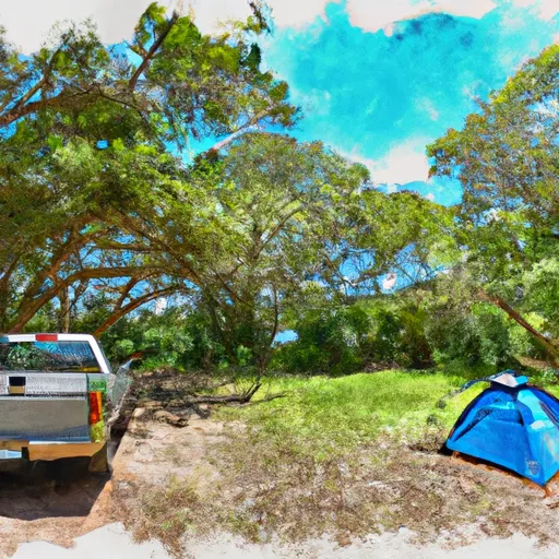
Little Manatee River State Park Campground
Community Reviews
Been here? Share the conditions.
Reviews, ratings & photos are added in the free Snoflo iOS app — rate a spot, tag the conditions, and your visit is verified by location. Add or manage your reviews from the app.
Little Manatee River State Park
What's on-site at Little Manatee River State Park
Key facilities Snoflo tracks for this campground. Confirm with the operator before booking -- amenities can change seasonally.
Plan your trip down to the hour
Same weather feed Snoflo's iOS app uses -- updated continuously from NOAA / yr.no.
Next 5 days, hour by hour
Temperature line with weather symbols on top, snow + rain accumulation as columns, humidity as a dotted line.
5-day forecast table
Every 3 hours, broken out across temperature, snow, rain, humidity, and wind. Each cell is colour-coded relative to the column min/max so trends jump out at a glance.
| Time | Condition | Temp (°F) | Snow (in) | Rain (in) | Humidity (%) | Wind (mps) | Wind dir |
|---|---|---|---|---|---|---|---|
| Loading detailed forecast… | |||||||
15-day temperature & precipitation
Daily temperatures, snow, and rain projected over the next two weeks. Hover any point for the full breakdown.
Other campgrounds in the area
Snoflo-tracked campsites within driving distance of Little Manatee River State Park, with reservations status.
| Campground | Reservations | Toilets | View |
|---|---|---|---|
| Youth Camping | ✗ | ✗ | → |
| Equestrian Camp Sites 31 - 34 | ✗ | ✗ | → |
| Family Camp Sites 1 - 30 | ✗ | ✗ | → |
| Primative Camp Site | ✗ | ✗ | → |
| E G Simmons County Park | ✗ | ✗ | → |
Nearby streamflow
USGS streamgauges within reach of Little Manatee River State Park -- pulled live from the National Water Information System.
| Streamgauge | Discharge | View |
|---|---|---|
| Little Manatee River Near Wimauma Fl | 190 cfs | → |
| South Fork Little Manatee River Near Wimauma Fl | 59 cfs | → |
| Gamble Creek At County Road 675 Near Parrish Fl | 3 cfs | → |
| Gamble Creek Near Parrish Fl | 26 cfs | → |
| Bullfrog Creek Near Wimauma Fl | 296 cfs | → |
| Frog Creek At Buffalo Road Near Rubonia Fl | 11 cfs | → |
Plan a longer trip
The closest parks, lakes, boat launches, and paddle runs so a camping night can grow into a full weekend.
Parks
- Little Manatee River State Park
- Sumner Acres Park
- Masonic Park And Youth Camp
- Ruskin Center Park
- Beaudette County Park
- Hillsborough County Park
Boat launches
- Wildcat Creek
- Domino Park Boat Ramp
- Commongood Park
- Shell Point Marina
- E G Simmonspark
- Cockroach Bay
Fishing spots
- Carlton Lake
- Lake Manatee
- Ward Lake (Bill Evers Reservoir)
- Industrial Lake
- Edward Medard Reservoir
- Upper Myakka Lake
Points of interest
- Camp Bayou Outdoor Learning Center
- Florida Gulf Coast Railroad Museum
- Manatee Viewing Center
- Lincoln Park
- Manatee County Fair
- Hernando Desoto Bridge
Paddle runs
- County Road 780 Bridge To State Road 72 Bridge
- Begins Downstream Of The State Road 72 Bridge To The Southern Boundary Of Myakka River State Park
- The Southern Boundary Of The Myakka River State Park To Ends Approximately At River Mile 23 Where Riverfront Residential Development Begins
- Approximately At River Mile 23 Where Riverfront Residential Development Begins To The Vicinity Of Snook Haven Fish Camp At Approximately River Mile 18
- Approximately River Mile 18 To A Point Just Upriver Of The Us 41 Highway Crossing
- A Point Just Upriver Of The Us 41 Highway Crossing To The Sarasota/Charlotte County Line
Camping essentials & Leave No Trace
- Pack it in, pack it out
- Take all trash, food scraps, and gear back with you to keep campsites clean and protect wildlife.
- Respect wildlife
- Observe animals from a distance, store food securely, and never feed wildlife to maintain natural behavior and safety.
- Know before you go
- Check weather, fire restrictions, trail conditions, and permit requirements to ensure a safe and well-planned trip.
- Minimize campfire impact
- Use established fire rings, keep fires small, fully extinguish them, or opt for a camp stove when fires are restricted.
- Leave what you find
- Preserve natural and cultural features by avoiding removal of plants, rocks, artifacts, or other elements of the environment.
Set push alerts in the Snoflo app
Save Little Manatee River State Park as a favorite, set a custom threshold (precipitation, snowpack, freezing temperatures), and the iOS app will push the moment conditions cross.
About Little Manatee River State Park
Can I make reservations at Little Manatee River State Park?
Yes -- this campground accepts reservations. Snoflo recommends booking early for peak season; check the operator (Recreation.gov / state park system / private operator) for the booking window and cancellation policy.
How fresh is the weather data on this page?
The hourly forecast updates throughout the day from the NOAA / yr.no public feeds. Streamflow data is pulled live from USGS streamgauges and snowpack from the NRCS SNOTEL network.
What's the best time of year to visit?
Use the 15-day temperature & precipitation outlook on this page to plan -- pick a window with comfortable temperatures and low precipitation. For longer trips, the 5-day hourly meteogram shows snow + rain accumulation hour-by-hour.
How do I get to Little Manatee River State Park?
Tap Directions in the hero above to open driving directions in Google Maps, or Open in map to center the Snoflo interactive map on the campground.
Can I get alerts when conditions change?
Yes -- alerts are managed through the Snoflo iOS app. Favorite this campground, set a threshold (temperature, snowpack, precipitation), and you'll get a push the moment it crosses.
Other campgrounds near here
Snoflo-tracked campgrounds within driving distance of Little Manatee River State Park.