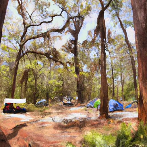
Torreya State Park campground
Community Reviews
Been here? Share the conditions.
Reviews, ratings & photos are added in the free Snoflo iOS app — rate a spot, tag the conditions, and your visit is verified by location. Add or manage your reviews from the app.
Torreya State Park
Nearby points of interest include the historic Gregory House, which was built in the 1840s and is listed on the National Register of Historic Places. Visitors can also explore the park's unique geological formations, including the Torreya formation, which is a rare type of sandstone found only in this region of Florida.
The campground at Torreya State Park offers several amenities, including electric and water hookups, picnic tables, and fire pits. The park offers both reservation and first-come-first-serve campsites, and there are a total of 30 campsites available.
An interesting fact about the area is that Torreya State Park is home to the endangered Florida Torreya tree. This rare species is found only in a small area of Florida and Georgia, and the park is actively involved in efforts to conserve and protect the tree.
The best time of year to visit Torreya State Park is in the fall or winter when temperatures are milder. The average temperature in the fall is around 75 degrees Fahrenheit, and in the winter, the average temperature is around 60 degrees Fahrenheit. Overall, Torreya State Park is a beautiful and unique camping destination that offers stunning views, interesting geological features, and a chance to explore one of Florida's rarest trees.
What's on-site at Torreya State Park
Key facilities Snoflo tracks for this campground. Confirm with the operator before booking -- amenities can change seasonally.
Plan your trip down to the hour
Same weather feed Snoflo's iOS app uses -- updated continuously from NOAA / yr.no.
Next 5 days, hour by hour
Temperature line with weather symbols on top, snow + rain accumulation as columns, humidity as a dotted line.
5-day forecast table
Every 3 hours, broken out across temperature, snow, rain, humidity, and wind. Each cell is colour-coded relative to the column min/max so trends jump out at a glance.
| Time | Condition | Temp (°F) | Snow (in) | Rain (in) | Humidity (%) | Wind (mps) | Wind dir |
|---|---|---|---|---|---|---|---|
| Loading detailed forecast… | |||||||
15-day temperature & precipitation
Daily temperatures, snow, and rain projected over the next two weeks. Hover any point for the full breakdown.
Other campgrounds in the area
Snoflo-tracked campsites within driving distance of Torreya State Park, with reservations status.
| Campground | Reservations | Toilets | View |
|---|---|---|---|
| Rock Bluff Primitive Camp | ✗ | ✗ | → |
| Rock Creek Primitive Camp | ✗ | ✗ | → |
| Torreya Challenge Primitive Camp | ✗ | ✗ | → |
| Triple C'S Campground And Rv Park | ✗ | ✗ | → |
| Chattahoochee City Park | ✗ | ✗ | → |
Nearby streamflow
USGS streamgauges within reach of Torreya State Park -- pulled live from the National Water Information System.
| Streamgauge | Discharge | View |
|---|---|---|
| Telogia Creek Nr Bristol | 85 cfs | → |
| Apalachicola River At Chattahoochee Fla | 10,500 cfs | → |
| Apalachicola River Nr Blountstown | 11,600 cfs | → |
| Chipola River Nr Altha | 1,070 cfs | → |
| Chipola River At Marianna Fl | 637 cfs | → |
| Ochlockonee River Nr Bloxham | 790 cfs | → |
Nearby snow depths
NRCS SNOTEL stations within reach of Torreya State Park -- relevant when planning a shoulder-season or alpine trip.
| SNOTEL station | Snowpack | 24h Snowfall | View |
|---|---|---|---|
| Marianna 7 Ne | 6.0 in | 4.0 in | → |
| Marianna 0.8 Nne | 0.0 in | 0.0 in | → |
| Fountain 3.4 Sse | 0.0 in | 0.0 in | → |
| Havana 4.2 Sw | 0.0 in | 0.0 in | → |
| Havana 5.5 Ne | 0.0 in | 0.0 in | → |
| Pansey 1.6 Nne | 0.0 in | 0.0 in | → |
Plan a longer trip
The closest parks, lakes, boat launches, and paddle runs so a camping night can grow into a full weekend.
Parks
- Torreya State Park
- Beaverdam Creek Wildlife Management Area
- Apalachicola Bluffs And Ravines Preserve
- Sam Atkins Park
- Three Rivers State Park
- Apalachee Wildlife Management Area
Boat launches
- Land Store Road, Grand Ridge
- John Redd East Road Calhoun County
- Beaverdam Creek Tract - Harry Donar Landing
- Ocheesee Pond Public Boat Ramp
- Gulf Power Boat Ramp
- Bristol Public Boat Ramp
Fishing spots
Points of interest
Paddle runs
- 2 Miles Below Dam On Lake Talquin To Ochlockonee Bay
- Segment B--Sh 65 To Carr Bridge On Fh 13
- Headwaters To Concrete Bridge (Burnt Bridge) On Fh 13 (Where River Enters Bradwell Ray Wilderness)
- Segment C--Mud Swamp/New River Wilderness Boundary To Mud Swamp/New River Wilderness (Southern) Boundary
- Bradwell Bay Wilderness (Northern Boundary) To Bradwell Bay Wilderness Boundary At Trice Bridge On Fr 329
- Tirce Creek Bridge (Monkey Creek) To Forest Service Property Boundary In Sec 13
Camping essentials & Leave No Trace
- Pack it in, pack it out
- Take all trash, food scraps, and gear back with you to keep campsites clean and protect wildlife.
- Respect wildlife
- Observe animals from a distance, store food securely, and never feed wildlife to maintain natural behavior and safety.
- Know before you go
- Check weather, fire restrictions, trail conditions, and permit requirements to ensure a safe and well-planned trip.
- Minimize campfire impact
- Use established fire rings, keep fires small, fully extinguish them, or opt for a camp stove when fires are restricted.
- Leave what you find
- Preserve natural and cultural features by avoiding removal of plants, rocks, artifacts, or other elements of the environment.
Set push alerts in the Snoflo app
Save Torreya State Park as a favorite, set a custom threshold (precipitation, snowpack, freezing temperatures), and the iOS app will push the moment conditions cross.
About Torreya State Park
Can I make reservations at Torreya State Park?
Yes -- this campground accepts reservations. Snoflo recommends booking early for peak season; check the operator (Recreation.gov / state park system / private operator) for the booking window and cancellation policy.
How fresh is the weather data on this page?
The hourly forecast updates throughout the day from the NOAA / yr.no public feeds. Streamflow data is pulled live from USGS streamgauges and snowpack from the NRCS SNOTEL network.
What's the best time of year to visit?
Use the 15-day temperature & precipitation outlook on this page to plan -- pick a window with comfortable temperatures and low precipitation. For longer trips, the 5-day hourly meteogram shows snow + rain accumulation hour-by-hour.
How do I get to Torreya State Park?
Tap Directions in the hero above to open driving directions in Google Maps, or Open in map to center the Snoflo interactive map on the campground.
Can I get alerts when conditions change?
Yes -- alerts are managed through the Snoflo iOS app. Favorite this campground, set a threshold (temperature, snowpack, precipitation), and you'll get a push the moment it crosses.
Other campgrounds near here
Snoflo-tracked campgrounds within driving distance of Torreya State Park.