Summary
This campground provides a range of amenities to ensure campers have a comfortable stay. It features well-maintained restroom facilities, picnic tables, and fire pits for cooking and relaxation. Additionally, the campground provides access to a pristine pond, offering opportunities for swimming, fishing, and boating.
Reservations are accepted at Harrison’s Pierce Pond Camp, allowing campers to secure their desired dates in advance. It is recommended to make a reservation, especially during peak seasons, to guarantee availability. The best time of year to visit this camping area is during the summer months, typically from June to August. This period offers pleasant weather and an abundance of outdoor activities to enjoy.
While camping at Harrison’s Pierce Pond Camp, visitors should be aware of potential wildlife encounters, as the area is home to diverse flora and fauna. It is important to properly store food to avoid attracting animals. Additionally, campers should be cautious when swimming or boating in the pond, ensuring they adhere to safety guidelines and wear appropriate flotation devices. By following these precautions and respecting the natural surroundings, campers can have a memorable and enjoyable experience at Harrison’s Pierce Pond Camp.
°F
°F
mph
Wind
%
Humidity
15-Day Weather Outlook
5-Day Hourly Forecast Detail
Nearby Streamflow Levels
 Dead River Near Dead River
|
825cfs |
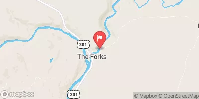
 Kennebec River At The Forks
|
1240cfs |
 Spencer Stream At Mouth
|
104cfs |
 Austin Stream At Bingham
|
55cfs |
 Kennebec River At Bingham
|
2150cfs |
 Piscataquis River At Blanchard
|
67cfs |
Camping Essential Practices
Take all trash, food scraps, and gear back with you to keep campsites clean and protect wildlife.
Respect Wildlife
Observe animals from a distance, store food securely, and never feed wildlife to maintain natural behavior and safety.
Know Before You Go
Check weather, fire restrictions, trail conditions, and permit requirements to ensure a safe and well-planned trip.
Minimize Campfire Impact
Use established fire rings, keep fires small, fully extinguish them, or opt for a camp stove when fires are restricted.
Leave What You Find
Preserve natural and cultural features by avoiding removal of plants, rocks, artifacts, or other elements of the environment.
Related Links
Nearby Snowpack Depths
|
KINGFIELD
|
0" |
|
SOLON 3.9 ESE
|
0" |
|
JACKMAN
|
1" |
|
MOOSEHEAD LAKE
|
1" |
|
BRASSUA DAM
|
1" |
|
HARMONY
|
6" |
