Town Creek Campsite Campground
Community Reviews
Been here? Share the conditions.
Reviews, ratings & photos are added in the free Snoflo iOS app — rate a spot, tag the conditions, and your visit is verified by location. Add or manage your reviews from the app.
Town Creek Campsite
One major point of interest is the Greenbelt Museum, which is located just a short distance from the campground. This museum is dedicated to showcasing the history and culture of the area, including the role it played in the civil rights movement. Other nearby attractions include the NASA Goddard Space Flight Center and the Smithsonian National Air and Space Museum.
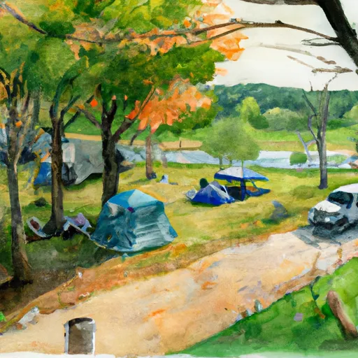
The campground itself is equipped with many amenities to make visitors' stay comfortable. There are both tent and RV camping sites available, as well as picnic tables, fire pits, and grills. The campground also has clean restrooms and showers, as well as a dump station for RVs. Visitors should note that there is no electricity or water hookup at the campsites.
One interesting fact about the area is that it was once home to a large Native American community, and the nearby Patuxent River was a major trading route for these communities. Visitors can explore these historical sites through hiking trails in the park.
The best time of year to visit the Town Creek Campsite is during the spring and fall, as the temperatures are mild and pleasant. During the spring, temperatures average around 60 degrees Fahrenheit, while in the fall, temperatures average around 50 degrees Fahrenheit. Visitors should be prepared for potentially hot and humid weather during the summer months, with temperatures averaging around 80 degrees Fahrenheit.
Sources:
https://www.nps.gov/gree/planyourvisit/camping.htm
https://www.greenbeltmuseum.org/
https://www.nps.gov/gree/learn/historyculture/index.htm
https://www.nps.gov/gree/planyourvisit/weather.htm
What's on-site at Town Creek Campsite
Key facilities Snoflo tracks for this campground. Confirm with the operator before booking -- amenities can change seasonally.
Plan your trip down to the hour
Same weather feed Snoflo's iOS app uses -- updated continuously from NOAA / yr.no.
Next 5 days, hour by hour
Temperature line with weather symbols on top, snow + rain accumulation as columns, humidity as a dotted line.
5-day forecast table
Every 3 hours, broken out across temperature, snow, rain, humidity, and wind. Each cell is colour-coded relative to the column min/max so trends jump out at a glance.
| Time | Condition | Temp (°F) | Snow (in) | Rain (in) | Humidity (%) | Wind (mps) | Wind dir |
|---|---|---|---|---|---|---|---|
| Loading detailed forecast… | |||||||
15-day temperature & precipitation
Daily temperatures, snow, and rain projected over the next two weeks. Hover any point for the full breakdown.
Other campgrounds in the area
Snoflo-tracked campsites within driving distance of Town Creek Campsite, with reservations status.
| Campground | Reservations | Toilets | View |
|---|---|---|---|
| Town Creek Hijer Biker Camp Site | ✗ | ✗ | → |
| Potomac Forks Hiker Biker Campsite | ✗ | ✗ | → |
| Potomac Forks Campsite | ✗ | ✗ | → |
| Purslane Run Hiker Biker Campsite | ✗ | ✗ | → |
| Purslane Run Campsite | ✗ | ✗ | → |
Nearby streamflow
USGS streamgauges within reach of Town Creek Campsite -- pulled live from the National Water Information System.
| Streamgauge | Discharge | View |
|---|---|---|
| Town Creek Near Oldtown | 12 cfs | → |
| Potomac River At Paw Paw | 612 cfs | → |
| South Branch Potomac River Near Springfield | 169 cfs | → |
| Cacapon River Near Great Cacapon | 58 cfs | → |
| Sideling Hill Creek Near Bellegrove | 1 cfs | → |
| North Branch Potomac River Near Cumberland | 376 cfs | → |
Nearby snow depths
NRCS SNOTEL stations within reach of Town Creek Campsite -- relevant when planning a shoulder-season or alpine trip.
| SNOTEL station | Snowpack | 24h Snowfall | View |
|---|---|---|---|
| Cacapon St Park | 0.0 in | 0.0 in | → |
| Cumberland 2 Coop | 0.0 in | 0.0 in | → |
| Frostburg 2 Coop | 0.0 in | 0.0 in | → |
| Frostburg 1 Nnw | 0.0 in | 0.0 in | → |
| Keyser 2 Ssw Coop | 0.0 in | 0.0 in | → |
| Glencoe | 0.0 in | 0.0 in | → |
Plan a longer trip
The closest parks, lakes, boat launches, and paddle runs so a camping night can grow into a full weekend.
Parks
- Green Ridge State Forest
- Cacapon Resort State Park
- Rocky Gap State Park
- C Eugene Mason Sports Complex
- Wills Mountain State Park
- Buchanan State Forest
Boat launches
- Paw Paw Cr 1/1
- Blue Ford North
- Paw Paw
- Bonds Landing Road Allegany County
- Cacapon Crossing
- Springfield Pike Hampshire County
Fishing spots
Points of interest
- Springfield Brick House
- Swing
- Evitts Creek Aqueduct
- Washington Bottom Farm
- Allegany Museum
- Cumberland Visitor Center
Paddle runs
- Begins South Of Largent To The Confluence With The Potomac At Great Cacapon
- Capon Bridge To Ends Just South Of Largent
- Begins Where The Lost River Becomes The Cacapon River To Wardensville
- Wardensville To The Town Of Capon Bridge
- The West Virginia 259 Bridge South Of Wardensville To Ends Where The Lost River Becomes The Cacapon River
- Headwaters Adjacent To Fdt 573 To State Route 622 Bridge
Camping essentials & Leave No Trace
- Pack it in, pack it out
- Take all trash, food scraps, and gear back with you to keep campsites clean and protect wildlife.
- Respect wildlife
- Observe animals from a distance, store food securely, and never feed wildlife to maintain natural behavior and safety.
- Know before you go
- Check weather, fire restrictions, trail conditions, and permit requirements to ensure a safe and well-planned trip.
- Minimize campfire impact
- Use established fire rings, keep fires small, fully extinguish them, or opt for a camp stove when fires are restricted.
- Leave what you find
- Preserve natural and cultural features by avoiding removal of plants, rocks, artifacts, or other elements of the environment.
Set push alerts in the Snoflo app
Save Town Creek Campsite as a favorite, set a custom threshold (precipitation, snowpack, freezing temperatures), and the iOS app will push the moment conditions cross.
About Town Creek Campsite
Can I make reservations at Town Creek Campsite?
This campground does not appear to accept reservations -- it's typically first-come, first-served. Arrive early on summer weekends.
How fresh is the weather data on this page?
The hourly forecast updates throughout the day from the NOAA / yr.no public feeds. Streamflow data is pulled live from USGS streamgauges and snowpack from the NRCS SNOTEL network.
What's the best time of year to visit?
Use the 15-day temperature & precipitation outlook on this page to plan -- pick a window with comfortable temperatures and low precipitation. For longer trips, the 5-day hourly meteogram shows snow + rain accumulation hour-by-hour.
How do I get to Town Creek Campsite?
Tap Directions in the hero above to open driving directions in Google Maps, or Open in map to center the Snoflo interactive map on the campground.
Can I get alerts when conditions change?
Yes -- alerts are managed through the Snoflo iOS app. Favorite this campground, set a threshold (temperature, snowpack, precipitation), and you'll get a push the moment it crosses.
Other campgrounds near here
Snoflo-tracked campgrounds within driving distance of Town Creek Campsite.