Lake Claude Bennett Campground
Community Reviews
Been here? Share the conditions.
Reviews, ratings & photos are added in the free Snoflo iOS app — rate a spot, tag the conditions, and your visit is verified by location. Add or manage your reviews from the app.
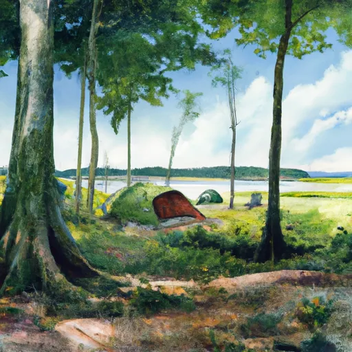
Lake Claude Bennett
Reservations are accepted at Lake Claude Bennett camping area, allowing visitors to secure their preferred campsite in advance. This is particularly beneficial during peak seasons or weekends when the campground might get busy. It is advisable to make reservations to ensure availability and avoid any last-minute disappointments.
The best time to visit Lake Claude Bennett camping area is during the warmer months, typically from spring to fall. This allows campers to take advantage of the beautiful lake for activities such as fishing, boating, and swimming. The serene surroundings and the abundance of nature make it a perfect place for hiking and bird-watching enthusiasts.
While camping at Lake Claude Bennett, visitors should be cautious of potential wildlife encounters. It is important to store food securely to prevent attracting animals, such as raccoons or bears. Additionally, campers should be mindful of fire safety and follow any guidelines provided by the campground. Overall, Lake Claude Bennett camping area offers a wonderful retreat for nature lovers looking to relax and enjoy the scenic beauty of Mississippi.
What's on-site at Lake Claude Bennett
Key facilities Snoflo tracks for this campground. Confirm with the operator before booking -- amenities can change seasonally.
Plan your trip down to the hour
Same weather feed Snoflo's iOS app uses -- updated continuously from NOAA / yr.no.
Next 5 days, hour by hour
Temperature line with weather symbols on top, snow + rain accumulation as columns, humidity as a dotted line.
5-day forecast table
Every 3 hours, broken out across temperature, snow, rain, humidity, and wind. Each cell is colour-coded relative to the column min/max so trends jump out at a glance.
| Time | Condition | Temp (°F) | Snow (in) | Rain (in) | Humidity (%) | Wind (mps) | Wind dir |
|---|---|---|---|---|---|---|---|
| Loading detailed forecast… | |||||||
15-day temperature & precipitation
Daily temperatures, snow, and rain projected over the next two weeks. Hover any point for the full breakdown.
Other campgrounds in the area
Snoflo-tracked campsites within driving distance of Lake Claude Bennett, with reservations status.
| Campground | Reservations | Toilets | View |
|---|---|---|---|
| Dunns Falls Water Park | ✗ | ✗ | → |
| Dunn's Falls Water Park | ✗ | ✗ | → |
| Clarkco State Park | ✓ | ✗ | → |
| Archusa Creek Waterpark | ✗ | ✗ | → |
| Marathon Lake | ✗ | ✗ | → |
Nearby streamflow
USGS streamgauges within reach of Lake Claude Bennett -- pulled live from the National Water Information System.
| Streamgauge | Discharge | View |
|---|---|---|
| Tallahala Creek At Waldrup | 117 cfs | → |
| Chickasawhay River At Enterprise | 414 cfs | → |
| Chunky River Nr Chunky | 156 cfs | → |
| Okatibbee Creek At Arundel | 223 cfs | → |
| Sowashee Creek At Meridian | 21 cfs | → |
| Tallahala Creek At Laurel | 17 cfs | → |
Plan a longer trip
The closest parks, lakes, boat launches, and paddle runs so a camping night can grow into a full weekend.
Parks
- Clarkco State Park
- Oka State Conservation Area
- Cotton Mill Park
- Bienville National Forest
- National Conservation Area Cane
Camping essentials & Leave No Trace
- Pack it in, pack it out
- Take all trash, food scraps, and gear back with you to keep campsites clean and protect wildlife.
- Respect wildlife
- Observe animals from a distance, store food securely, and never feed wildlife to maintain natural behavior and safety.
- Know before you go
- Check weather, fire restrictions, trail conditions, and permit requirements to ensure a safe and well-planned trip.
- Minimize campfire impact
- Use established fire rings, keep fires small, fully extinguish them, or opt for a camp stove when fires are restricted.
- Leave what you find
- Preserve natural and cultural features by avoiding removal of plants, rocks, artifacts, or other elements of the environment.
Set push alerts in the Snoflo app
Save Lake Claude Bennett as a favorite, set a custom threshold (precipitation, snowpack, freezing temperatures), and the iOS app will push the moment conditions cross.
About Lake Claude Bennett
Can I make reservations at Lake Claude Bennett?
This campground does not appear to accept reservations -- it's typically first-come, first-served. Arrive early on summer weekends.
How fresh is the weather data on this page?
The hourly forecast updates throughout the day from the NOAA / yr.no public feeds. Streamflow data is pulled live from USGS streamgauges and snowpack from the NRCS SNOTEL network.
What's the best time of year to visit?
Use the 15-day temperature & precipitation outlook on this page to plan -- pick a window with comfortable temperatures and low precipitation. For longer trips, the 5-day hourly meteogram shows snow + rain accumulation hour-by-hour.
How do I get to Lake Claude Bennett?
Tap Directions in the hero above to open driving directions in Google Maps, or Open in map to center the Snoflo interactive map on the campground.
Can I get alerts when conditions change?
Yes -- alerts are managed through the Snoflo iOS app. Favorite this campground, set a threshold (temperature, snowpack, precipitation), and you'll get a push the moment it crosses.
Other campgrounds near here
Snoflo-tracked campgrounds within driving distance of Lake Claude Bennett.