Coppermine Shelter Campground
Community Reviews
Been here? Share the conditions.
Reviews, ratings & photos are added in the free Snoflo iOS app — rate a spot, tag the conditions, and your visit is verified by location. Add or manage your reviews from the app.
Coppermine Shelter
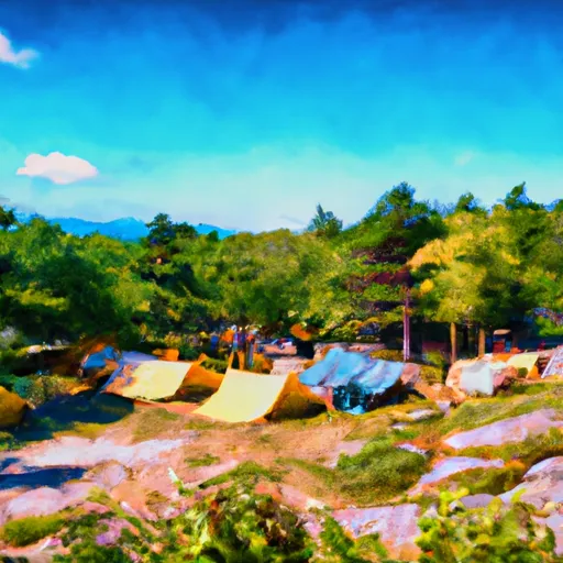
The best time to visit Coppermine Shelter camping area is during the summer months, from June to September, when the weather is mild and the park is less crowded. The camping area is nestled in the White Mountains region, offering breathtaking views of the surrounding peaks and valleys. Hiking enthusiasts will find the nearby Coppermine Trail rewarding, leading to stunning waterfalls and picturesque landscapes.
While camping at Coppermine Shelter, it is important to be mindful of the wildlife in the area. Black bears are known to frequent the campground, so proper food storage is crucial to prevent any unwanted encounters. Additionally, campers should be cautious of potential weather changes and pack accordingly, as the region can experience sudden temperature drops and heavy rainfall. By following the rules and regulations of the campground and being aware of the surroundings, campers can enjoy a memorable experience at Coppermine Shelter in New Hampshire.
What's on-site at Coppermine Shelter
Key facilities Snoflo tracks for this campground. Confirm with the operator before booking -- amenities can change seasonally.
Plan your trip down to the hour
Same weather feed Snoflo's iOS app uses -- updated continuously from NOAA / yr.no.
Next 5 days, hour by hour
Temperature line with weather symbols on top, snow + rain accumulation as columns, humidity as a dotted line.
5-day forecast table
Every 3 hours, broken out across temperature, snow, rain, humidity, and wind. Each cell is colour-coded relative to the column min/max so trends jump out at a glance.
| Time | Condition | Temp (°F) | Snow (in) | Rain (in) | Humidity (%) | Wind (mps) | Wind dir |
|---|---|---|---|---|---|---|---|
| Loading detailed forecast… | |||||||
15-day temperature & precipitation
Daily temperatures, snow, and rain projected over the next two weeks. Hover any point for the full breakdown.
Other campgrounds in the area
Snoflo-tracked campsites within driving distance of Coppermine Shelter, with reservations status.
| Campground | Reservations | Toilets | View |
|---|---|---|---|
| Kinsman Pond Shelter | ✓ | ✗ | → |
| Kinsman Pond Tentsite | ✗ | ✗ | → |
| Cannon Mountain Rv Park | ✓ | ✗ | → |
| Lafayette - Franconia Notch State Park | ✓ | ✗ | → |
| Fransted Campground | ✗ | ✗ | → |
Nearby streamflow
USGS streamgauges within reach of Coppermine Shelter -- pulled live from the National Water Information System.
| Streamgauge | Discharge | View |
|---|---|---|
| East Branch Pemigewasset River At Lincoln | 95 cfs | → |
| Ammonoosuc River At Bethlehem Junction | 78 cfs | → |
| Pemigewasset River At Woodstock | 141 cfs | → |
| Connecticut River At Wells River | 1,470 cfs | → |
| Wells River At Wells River | 44 cfs | → |
| Connecticut River Near Dalton | 1,100 cfs | → |
Nearby snow depths
NRCS SNOTEL stations within reach of Coppermine Shelter -- relevant when planning a shoulder-season or alpine trip.
| SNOTEL station | Snowpack | 24h Snowfall | View |
|---|---|---|---|
| Littleton 7.3 W | 0.0 in | 0.0 in | → |
| Nohrsc Hubbard Brook | 0.0 in | 0.0 in | → |
| Crawford Notch | 0.0 in | 0.0 in | → |
| Nohrsc Carroll 4.6 Ne | 0.0 in | 0.0 in | → |
| Ryegate 1.5 N | 0.0 in | 0.0 in | → |
| Jefferson | 0.0 in | 0.0 in | → |
Plan a longer trip
The closest parks, lakes, boat launches, and paddle runs so a camping night can grow into a full weekend.
Parks
- Franconia Notch State Park
- Dell's Park
- Wilderness Pemigewasset
- Forest Lake State Park
- Crawford Notch State Park
- Pondicherry Wildlife Refuge
Boat launches
- Echo Lake Boat Launch
- Streeter Pond
- White Mountain National Forest
- Lyman Road Lyman
- Pine Island
- Pattenville Picnic Area
Camping essentials & Leave No Trace
- Pack it in, pack it out
- Take all trash, food scraps, and gear back with you to keep campsites clean and protect wildlife.
- Respect wildlife
- Observe animals from a distance, store food securely, and never feed wildlife to maintain natural behavior and safety.
- Know before you go
- Check weather, fire restrictions, trail conditions, and permit requirements to ensure a safe and well-planned trip.
- Minimize campfire impact
- Use established fire rings, keep fires small, fully extinguish them, or opt for a camp stove when fires are restricted.
- Leave what you find
- Preserve natural and cultural features by avoiding removal of plants, rocks, artifacts, or other elements of the environment.
Set push alerts in the Snoflo app
Save Coppermine Shelter as a favorite, set a custom threshold (precipitation, snowpack, freezing temperatures), and the iOS app will push the moment conditions cross.
About Coppermine Shelter
Can I make reservations at Coppermine Shelter?
This campground does not appear to accept reservations -- it's typically first-come, first-served. Arrive early on summer weekends.
How fresh is the weather data on this page?
The hourly forecast updates throughout the day from the NOAA / yr.no public feeds. Streamflow data is pulled live from USGS streamgauges and snowpack from the NRCS SNOTEL network.
What's the best time of year to visit?
Use the 15-day temperature & precipitation outlook on this page to plan -- pick a window with comfortable temperatures and low precipitation. For longer trips, the 5-day hourly meteogram shows snow + rain accumulation hour-by-hour.
How do I get to Coppermine Shelter?
Tap Directions in the hero above to open driving directions in Google Maps, or Open in map to center the Snoflo interactive map on the campground.
Can I get alerts when conditions change?
Yes -- alerts are managed through the Snoflo iOS app. Favorite this campground, set a threshold (temperature, snowpack, precipitation), and you'll get a push the moment it crosses.
Other campgrounds near here
Snoflo-tracked campgrounds within driving distance of Coppermine Shelter.