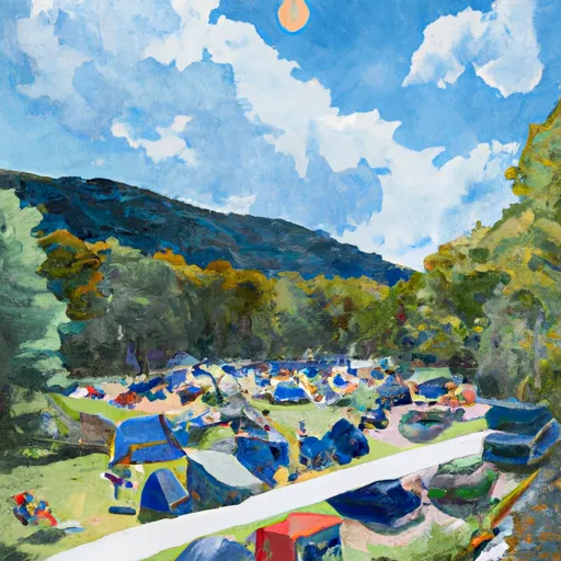
Moon #2 Campground
Community Reviews
Been here? Share the conditions.
Reviews, ratings & photos are added in the free Snoflo iOS app — rate a spot, tag the conditions, and your visit is verified by location. Add or manage your reviews from the app.
Moon #2
Reservations are accepted at Moon #2 camping area, allowing campers to secure their spot in advance. This is especially recommended during peak seasons when the campground tends to be more crowded. Speaking of which, the best time to visit this camping area is during the summer and early fall months, when the weather is pleasant and conducive to outdoor activities.
Visitors to Moon #2 camping area can enjoy various points of interest nearby. The campground is situated amidst the stunning natural beauty of New Hampshire, offering opportunities for hiking, fishing, and wildlife observation. It is important to be cautious of wildlife encounters and to follow proper bear safety protocols, as the area is known for its bear population. Overall, Moon #2 camping area provides a serene and well-equipped camping experience, making it an ideal destination for nature enthusiasts looking to immerse themselves in the beauty of New Hampshire.
What's on-site at Moon #2
Key facilities Snoflo tracks for this campground. Confirm with the operator before booking -- amenities can change seasonally.
Plan your trip down to the hour
Same weather feed Snoflo's iOS app uses -- updated continuously from NOAA / yr.no.
Next 5 days, hour by hour
Temperature line with weather symbols on top, snow + rain accumulation as columns, humidity as a dotted line.
5-day forecast table
Every 3 hours, broken out across temperature, snow, rain, humidity, and wind. Each cell is colour-coded relative to the column min/max so trends jump out at a glance.
| Time | Condition | Temp (°F) | Snow (in) | Rain (in) | Humidity (%) | Wind (mps) | Wind dir |
|---|---|---|---|---|---|---|---|
| Loading detailed forecast… | |||||||
15-day temperature & precipitation
Daily temperatures, snow, and rain projected over the next two weeks. Hover any point for the full breakdown.
Nearby streamflow
USGS streamgauges within reach of Moon #2 -- pulled live from the National Water Information System.
| Streamgauge | Discharge | View |
|---|---|---|
| Pemigewasset River At Plymouth | 234 cfs | → |
| Bearcamp River At South Tamworth | 12 cfs | → |
| Baker River Near Rumney | 26 cfs | → |
| Smith River Near Bristol | 32 cfs | → |
| Pemigewasset River At Woodstock | 121 cfs | → |
| Winnipesaukee River At Tilton | 311 cfs | → |
Nearby snow depths
NRCS SNOTEL stations within reach of Moon #2 -- relevant when planning a shoulder-season or alpine trip.
| SNOTEL station | Snowpack | 24h Snowfall | View |
|---|---|---|---|
| Meredith 3.3 Nne | 0.0 in | 0.0 in | → |
| Holderness 4.6 Nw | 0.0 in | 0.0 in | → |
| Meredith 2.9 Ssw | 0.0 in | 0.0 in | → |
| East Sandwich | 0.0 in | 0.0 in | → |
| Nohrsc Center Sandwich 4.9 E | 0.0 in | 0.0 in | → |
| Lakeport 2 | 0.0 in | 0.0 in | → |
Plan a longer trip
The closest parks, lakes, boat launches, and paddle runs so a camping night can grow into a full weekend.
Parks
- Unsworth Preserve
- Wilderness Sandwich Range
- White Mountain National Forest
- Ahern State Park
- Wellington State Park
- Ellacoya State Park
Boat launches
- Squam Lakes Association
- Center Harbor Town Beach
- Squam Lake Public Boat Launch
- Center Harbor
- Kanasatka Lake Boat Launch
- Winona Lake Boat Launch
Points of interest
- Webster Estate
- Squam Lakes Natural Science Center
- True Farm
- Whipple House
- Red Hill/Bears Nest Ski Area
- The Old Country Store
Paddle runs
- Thornton Railroad Bridge To Bridgewater/Bristol Town Line
- Woodstock/Thornton Town Line To Thornton Railroad Bridge
- Begins In Franklin To Sewall's Island
- Headwaters At Profile Lake To Southern Boundary Of Franconia Notch State Park
- Sewall's Island To Manchester Street Bridge
Camping essentials & Leave No Trace
- Pack it in, pack it out
- Take all trash, food scraps, and gear back with you to keep campsites clean and protect wildlife.
- Respect wildlife
- Observe animals from a distance, store food securely, and never feed wildlife to maintain natural behavior and safety.
- Know before you go
- Check weather, fire restrictions, trail conditions, and permit requirements to ensure a safe and well-planned trip.
- Minimize campfire impact
- Use established fire rings, keep fires small, fully extinguish them, or opt for a camp stove when fires are restricted.
- Leave what you find
- Preserve natural and cultural features by avoiding removal of plants, rocks, artifacts, or other elements of the environment.
Set push alerts in the Snoflo app
Save Moon #2 as a favorite, set a custom threshold (precipitation, snowpack, freezing temperatures), and the iOS app will push the moment conditions cross.
About Moon #2
Can I make reservations at Moon #2?
This campground does not appear to accept reservations -- it's typically first-come, first-served. Arrive early on summer weekends.
How fresh is the weather data on this page?
The hourly forecast updates throughout the day from the NOAA / yr.no public feeds. Streamflow data is pulled live from USGS streamgauges and snowpack from the NRCS SNOTEL network.
What's the best time of year to visit?
Use the 15-day temperature & precipitation outlook on this page to plan -- pick a window with comfortable temperatures and low precipitation. For longer trips, the 5-day hourly meteogram shows snow + rain accumulation hour-by-hour.
How do I get to Moon #2?
Tap Directions in the hero above to open driving directions in Google Maps, or Open in map to center the Snoflo interactive map on the campground.
Can I get alerts when conditions change?
Yes -- alerts are managed through the Snoflo iOS app. Favorite this campground, set a threshold (temperature, snowpack, precipitation), and you'll get a push the moment it crosses.