Three Rivers Campground
Community Reviews
Been here? Share the conditions.
Reviews, ratings & photos are added in the free Snoflo iOS app — rate a spot, tag the conditions, and your visit is verified by location. Add or manage your reviews from the app.
Three Rivers
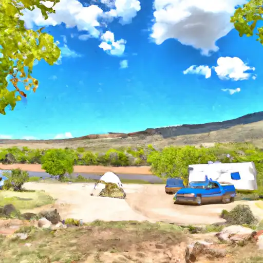
The campground features several amenities, including restrooms, picnic tables, fire rings, and potable water. The campground also offers tent and RV sites, with reservations available online or on a first-come, first-served basis. The campground has a total of 18 sites, all of which are equipped with picnic tables and fire pits.
An interesting and quirky fact about the area is that it is located in the Mimbres Valley, which was once home to the Mimbres people, a Native American culture that thrived in the area between 1000-1140 AD. The Mimbres people were known for their intricate pottery and colorful designs, many of which can be seen in museums throughout the Southwest.
The best time of year to visit the Three Rivers Camping Area is in the spring or fall, when the temperatures are mild and the surrounding foliage is vibrant. In the spring, average temperatures range from the mid-60s during the day to the low 40s at night. In the fall, temperatures range from the mid-60s during the day to the mid-30s at night. Overall, the Three Rivers Camping Area is a beautiful and tranquil spot to camp and explore the rich history and natural beauty of New Mexico.
What's on-site at Three Rivers
Key facilities Snoflo tracks for this campground. Confirm with the operator before booking -- amenities can change seasonally.
Plan your trip down to the hour
Same weather feed Snoflo's iOS app uses -- updated continuously from NOAA / yr.no.
Next 5 days, hour by hour
Temperature line with weather symbols on top, snow + rain accumulation as columns, humidity as a dotted line.
5-day forecast table
Every 3 hours, broken out across temperature, snow, rain, humidity, and wind. Each cell is colour-coded relative to the column min/max so trends jump out at a glance.
| Time | Condition | Temp (°F) | Snow (in) | Rain (in) | Humidity (%) | Wind (mps) | Wind dir |
|---|---|---|---|---|---|---|---|
| Loading detailed forecast… | |||||||
15-day temperature & precipitation
Daily temperatures, snow, and rain projected over the next two weeks. Hover any point for the full breakdown.
Other campgrounds in the area
Snoflo-tracked campsites within driving distance of Three Rivers, with reservations status.
| Campground | Reservations | Toilets | View |
|---|---|---|---|
| Three Rivers Campground | ✓ | ✗ | → |
| Eagle Creek Lakes | ✗ | ✓ | → |
| Oak Grove | ✗ | ✓ | → |
| South Fork | ✗ | ✓ | → |
| Three Rivers Petroglyph National Rec Site | ✗ | ✓ | → |
Nearby streamflow
USGS streamgauges within reach of Three Rivers -- pulled live from the National Water Information System.
| Streamgauge | Discharge | View |
|---|---|---|
| Eagle Creek Below South Fork Near Alto | 0 cfs | → |
| Rio Ruidoso At Ruidoso | 34 cfs | → |
| Rio Ruidoso At Hollywood | 18 cfs | → |
| Tularosa Creek Near Bent | 9 cfs | → |
| Salt Creek Near Tularosa | 0 cfs | → |
| Rio Penasco Near Dunken | · | → |
Nearby snow depths
NRCS SNOTEL stations within reach of Three Rivers -- relevant when planning a shoulder-season or alpine trip.
| SNOTEL station | Snowpack | 24h Snowfall | View |
|---|---|---|---|
| Sierra Blanca | 0.0 in | 0.0 in | → |
Plan a longer trip
The closest parks, lakes, boat launches, and paddle runs so a camping night can grow into a full weekend.
Parks
- Wilderness White Mountain
- Valley Of Fires Recreation Area
- Links At Sierra Blanca
- Fort Stanton-Snowy River Cave National Conservation Area
Points of interest
- Windy Point
- Ruidoso River Museum
- Ruidoso Lookout Tower
- Riley, Lynch & Holmes
- Maue, Clark & Hayne
- Paden's Drug Store
Paddle runs
- Headwaters Of Three Rivers, Including 5 Segments Branching South And East To Western Nf Boundary At Three Rivers Campground
- Confluence Of 2 Headwaters For South Fork (Sec 28, T10s, R11e) To Southern Boundary Of South Fork Campground
- Headwaters Nf Rio Ruidoso To Nf Boundary
- Rio Bonito
Camping essentials & Leave No Trace
- Pack it in, pack it out
- Take all trash, food scraps, and gear back with you to keep campsites clean and protect wildlife.
- Respect wildlife
- Observe animals from a distance, store food securely, and never feed wildlife to maintain natural behavior and safety.
- Know before you go
- Check weather, fire restrictions, trail conditions, and permit requirements to ensure a safe and well-planned trip.
- Minimize campfire impact
- Use established fire rings, keep fires small, fully extinguish them, or opt for a camp stove when fires are restricted.
- Leave what you find
- Preserve natural and cultural features by avoiding removal of plants, rocks, artifacts, or other elements of the environment.
Set push alerts in the Snoflo app
Save Three Rivers as a favorite, set a custom threshold (precipitation, snowpack, freezing temperatures), and the iOS app will push the moment conditions cross.
About Three Rivers
Can I make reservations at Three Rivers?
This campground does not appear to accept reservations -- it's typically first-come, first-served. Arrive early on summer weekends.
How fresh is the weather data on this page?
The hourly forecast updates throughout the day from the NOAA / yr.no public feeds. Streamflow data is pulled live from USGS streamgauges and snowpack from the NRCS SNOTEL network.
What's the best time of year to visit?
Use the 15-day temperature & precipitation outlook on this page to plan -- pick a window with comfortable temperatures and low precipitation. For longer trips, the 5-day hourly meteogram shows snow + rain accumulation hour-by-hour.
How do I get to Three Rivers?
Tap Directions in the hero above to open driving directions in Google Maps, or Open in map to center the Snoflo interactive map on the campground.
Can I get alerts when conditions change?
Yes -- alerts are managed through the Snoflo iOS app. Favorite this campground, set a threshold (temperature, snowpack, precipitation), and you'll get a push the moment it crosses.
Other campgrounds near here
Snoflo-tracked campgrounds within driving distance of Three Rivers.