Bearcamp Creek Campsite Campground
Community Reviews
Been here? Share the conditions.
Reviews, ratings & photos are added in the free Snoflo iOS app — rate a spot, tag the conditions, and your visit is verified by location. Add or manage your reviews from the app.
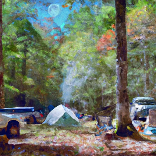
Bearcamp Creek Campsite
Reservations are accepted at Bearcamp Creek Campsite, allowing campers to secure their preferred camping spot in advance. It is recommended to make a reservation, especially during peak season, to guarantee availability.
The best time to visit this camping area is during the spring and fall seasons when the weather is mild and ideal for outdoor activities. Visitors can enjoy the beautiful natural surroundings, including the dense forest and peaceful creek that runs through the campground. However, it is important to note that during heavy rainfall or storms, the campsite may become muddy and less pleasant for camping. Visitors are advised to check the weather forecast before planning their trip.
In terms of specific items of interest, Bearcamp Creek Campsite is located near several hiking trails that offer breathtaking views of the surrounding landscape. Furthermore, the campsite is situated in close proximity to the Pisgah National Forest, providing campers with opportunities for additional outdoor adventures, such as fishing and wildlife spotting. While the campground offers a serene and enjoyable camping experience, campers should be cautious of the presence of bears in the area and take appropriate precautions, such as storing food securely and following proper bear safety guidelines.
What's on-site at Bearcamp Creek Campsite
Key facilities Snoflo tracks for this campground. Confirm with the operator before booking -- amenities can change seasonally.
Plan your trip down to the hour
Same weather feed Snoflo's iOS app uses -- updated continuously from NOAA / yr.no.
Next 5 days, hour by hour
Temperature line with weather symbols on top, snow + rain accumulation as columns, humidity as a dotted line.
5-day forecast table
Every 3 hours, broken out across temperature, snow, rain, humidity, and wind. Each cell is colour-coded relative to the column min/max so trends jump out at a glance.
| Time | Condition | Temp (°F) | Snow (in) | Rain (in) | Humidity (%) | Wind (mps) | Wind dir |
|---|---|---|---|---|---|---|---|
| Loading detailed forecast… | |||||||
15-day temperature & precipitation
Daily temperatures, snow, and rain projected over the next two weeks. Hover any point for the full breakdown.
Other campgrounds in the area
Snoflo-tracked campsites within driving distance of Bearcamp Creek Campsite, with reservations status.
| Campground | Reservations | Toilets | View |
|---|---|---|---|
| Glenn Hilliard Campsite | ✗ | ✗ | → |
| Buck Fields | ✗ | ✗ | → |
| Bear Creek Campsite | ✗ | ✗ | → |
| Whitewater Campsite | ✗ | ✗ | → |
| Indian Camp Campsite | ✗ | ✗ | → |
Nearby streamflow
USGS streamgauges within reach of Bearcamp Creek Campsite -- pulled live from the National Water Information System.
| Streamgauge | Discharge | View |
|---|---|---|
| French Broad River At Rosman | 89 cfs | → |
| South Saluda River Near Cleveland | 5 cfs | → |
| Tuckasegee River At Sr 1172 Nr Cullowhee | 97 cfs | → |
| Twelvemile Creek Near Liberty | 51 cfs | → |
| Davidson River Near Brevard | 49 cfs | → |
| Middle Saluda River Near Cleveland | 20 cfs | → |
Nearby snow depths
NRCS SNOTEL stations within reach of Bearcamp Creek Campsite -- relevant when planning a shoulder-season or alpine trip.
| SNOTEL station | Snowpack | 24h Snowfall | View |
|---|---|---|---|
| Brevard | 0.0 in | 0.0 in | → |
| Dillard 0.7 Nnw | 0.0 in | 0.0 in | → |
| Cleveland 3 S | 0.0 in | 0.0 in | → |
| Germany Valley | 0.0 in | 0.0 in | → |
| Anderson | 0.0 in | 0.0 in | → |
| Bryson City 4 | 0.0 in | 0.0 in | → |
Plan a longer trip
The closest parks, lakes, boat launches, and paddle runs so a camping night can grow into a full weekend.
Parks
- Gorges State Park
- Toxaway Game Land
- Devils Fork State Park
- Pisgah National Forest
- Keowee-Toxaway State Park
- Wilderness Ellicott Rock
Boat launches
- Devils Fork Road Oconee County
- White Oak Hill Road Oconee County
- Jocassee 2
- Jocassee 1
- Cabin Road 398, Pickens County
- Landing Road Oconee County
Fishing spots
Points of interest
- Silver Run Falls
- Twin Falls
- Spoonauger Falls
- Pisgah Astronomical Research Institute
- Bear Lake Reserve
- Yellow Mountain Trailhead
Paddle runs
- Headwaters To Sloan's Bridge Crossing, Crossing Of Sc 107
- Sloan's Bridge Crossing To 1/4 Mile Above The Walhalla Fish Hatchery
- 1/4 Mile Above The Walhalla Fish Hatchery To 1/4 Mile Below The Walhalla Fish Hatchery
- 1/4 Mile Below Walhalla Fish Hatchery To Boundary Of Chattooga Wsr
- Burrels Ford To Lick Log Branch (Section 1)
- Beginning Just Upstream Of Townes Creek,Wash Branch And Crane Creek To Confluence With Kings Creek
Camping essentials & Leave No Trace
- Pack it in, pack it out
- Take all trash, food scraps, and gear back with you to keep campsites clean and protect wildlife.
- Respect wildlife
- Observe animals from a distance, store food securely, and never feed wildlife to maintain natural behavior and safety.
- Know before you go
- Check weather, fire restrictions, trail conditions, and permit requirements to ensure a safe and well-planned trip.
- Minimize campfire impact
- Use established fire rings, keep fires small, fully extinguish them, or opt for a camp stove when fires are restricted.
- Leave what you find
- Preserve natural and cultural features by avoiding removal of plants, rocks, artifacts, or other elements of the environment.
Set push alerts in the Snoflo app
Save Bearcamp Creek Campsite as a favorite, set a custom threshold (precipitation, snowpack, freezing temperatures), and the iOS app will push the moment conditions cross.
About Bearcamp Creek Campsite
Can I make reservations at Bearcamp Creek Campsite?
This campground does not appear to accept reservations -- it's typically first-come, first-served. Arrive early on summer weekends.
How fresh is the weather data on this page?
The hourly forecast updates throughout the day from the NOAA / yr.no public feeds. Streamflow data is pulled live from USGS streamgauges and snowpack from the NRCS SNOTEL network.
What's the best time of year to visit?
Use the 15-day temperature & precipitation outlook on this page to plan -- pick a window with comfortable temperatures and low precipitation. For longer trips, the 5-day hourly meteogram shows snow + rain accumulation hour-by-hour.
How do I get to Bearcamp Creek Campsite?
Tap Directions in the hero above to open driving directions in Google Maps, or Open in map to center the Snoflo interactive map on the campground.
Can I get alerts when conditions change?
Yes -- alerts are managed through the Snoflo iOS app. Favorite this campground, set a threshold (temperature, snowpack, precipitation), and you'll get a push the moment it crosses.
Other campgrounds near here
Snoflo-tracked campgrounds within driving distance of Bearcamp Creek Campsite.