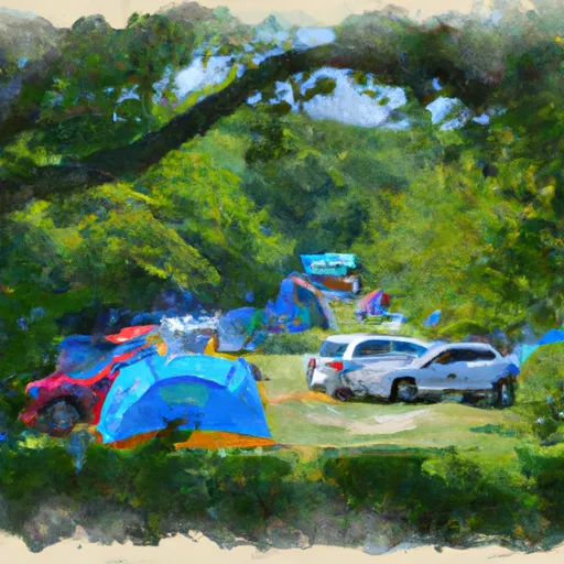
Buck Hill Campground campground
Community Reviews
Been here? Share the conditions.
Reviews, ratings & photos are added in the free Snoflo iOS app — rate a spot, tag the conditions, and your visit is verified by location. Add or manage your reviews from the app.
Buck Hill Campground
What's on-site at Buck Hill Campground
Key facilities Snoflo tracks for this campground. Confirm with the operator before booking -- amenities can change seasonally.
Plan your trip down to the hour
Same weather feed Snoflo's iOS app uses -- updated continuously from NOAA / yr.no.
Next 5 days, hour by hour
Temperature line with weather symbols on top, snow + rain accumulation as columns, humidity as a dotted line.
5-day forecast table
Every 3 hours, broken out across temperature, snow, rain, humidity, and wind. Each cell is colour-coded relative to the column min/max so trends jump out at a glance.
| Time | Condition | Temp (°F) | Snow (in) | Rain (in) | Humidity (%) | Wind (mps) | Wind dir |
|---|---|---|---|---|---|---|---|
| Loading detailed forecast… | |||||||
15-day temperature & precipitation
Daily temperatures, snow, and rain projected over the next two weeks. Hover any point for the full breakdown.
Other campgrounds in the area
Snoflo-tracked campsites within driving distance of Buck Hill Campground, with reservations status.
| Campground | Reservations | Toilets | View |
|---|---|---|---|
| Mountain River Family Campground | ✗ | ✗ | → |
| Plumtree Campground And Retreat | ✗ | ✗ | → |
| Linville River Campground | ✗ | ✗ | → |
| Linville Falls - Blue Ridge Parkway | ✓ | ✗ | → |
| Linville Falls Campground | ✗ | ✗ | → |
Nearby streamflow
USGS streamgauges within reach of Buck Hill Campground -- pulled live from the National Water Information System.
| Streamgauge | Discharge | View |
|---|---|---|
| South Toe River Near Celo | 536 cfs | → |
| Linville River Near Nebo | 443 cfs | → |
| Watauga River Near Sugar Grove | 150 cfs | → |
| Johns River At Arneys Store | 545 cfs | → |
| Catawba R Nr Pleasant Gardens | 369 cfs | → |
| Doe River At Elizabethton | 293 cfs | → |
Nearby snow depths
NRCS SNOTEL stations within reach of Buck Hill Campground -- relevant when planning a shoulder-season or alpine trip.
| SNOTEL station | Snowpack | 24h Snowfall | View |
|---|---|---|---|
| Banner Elk | 0.0 in | 0.0 in | → |
| Beech Mountain | 0.0 in | 0.0 in | → |
| Flat Springs 1.2 E | 0.0 in | 0.0 in | → |
| Flat Springs 1e | 0.0 in | 0.0 in | → |
| Erwin | 0.0 in | 0.0 in | → |
| Vilas 6.3 Nnw | 0.0 in | 0.0 in | → |
Plan a longer trip
The closest parks, lakes, boat launches, and paddle runs so a camping night can grow into a full weekend.
Parks
- Yellow Mountain State Natural Area
- Roan Mountain State Park
- Grandfather Mountain State Park
- Julian Price Memorial Park
- Bear Paw State Natural Area
- Beech Creek Bog State Natural Area
Boat launches
- Linville Boat Ramp
- Price Lake Trail Watauga County
- Black Bear
- Mitchell County
- Canal Bridge Boat Ramp Burke County
- Houseboat Lane 299, Mcdowell County
Fishing spots
- Watauga River
- Nolichucky River
- Asheville Recreation Park Lake
- Bailey Branch
- Dillard Place
- Blood Creek
Points of interest
- Anvil Arts Studio
- North Toe River Valley Overlook
- Linville Falls River Bridge Overlook
- Dianne Borde-Sutherland-Cane Creek Pottery
- Camp Creek Overlook
- Midway Overlook
Paddle runs
- Headwaters Above Linville Gap To Blue Ridge Parkway Boundary
- Blue Ridge Parkway Boundary To Linville Gorge Boundary
- Watauga Reservoir To Tn/Nc State Line
- Linville Gorge Wilderness Boundary To Southern End Of Wilderness
- Boundary Between Mitchell And Yancy Counties To Nc/Tn Stateline
- Linville Wilderness Boundary To Lake James
Camping essentials & Leave No Trace
- Pack it in, pack it out
- Take all trash, food scraps, and gear back with you to keep campsites clean and protect wildlife.
- Respect wildlife
- Observe animals from a distance, store food securely, and never feed wildlife to maintain natural behavior and safety.
- Know before you go
- Check weather, fire restrictions, trail conditions, and permit requirements to ensure a safe and well-planned trip.
- Minimize campfire impact
- Use established fire rings, keep fires small, fully extinguish them, or opt for a camp stove when fires are restricted.
- Leave what you find
- Preserve natural and cultural features by avoiding removal of plants, rocks, artifacts, or other elements of the environment.
Set push alerts in the Snoflo app
Save Buck Hill Campground as a favorite, set a custom threshold (precipitation, snowpack, freezing temperatures), and the iOS app will push the moment conditions cross.
About Buck Hill Campground
Can I make reservations at Buck Hill Campground?
This campground does not appear to accept reservations -- it's typically first-come, first-served. Arrive early on summer weekends.
How fresh is the weather data on this page?
The hourly forecast updates throughout the day from the NOAA / yr.no public feeds. Streamflow data is pulled live from USGS streamgauges and snowpack from the NRCS SNOTEL network.
What's the best time of year to visit?
Use the 15-day temperature & precipitation outlook on this page to plan -- pick a window with comfortable temperatures and low precipitation. For longer trips, the 5-day hourly meteogram shows snow + rain accumulation hour-by-hour.
How do I get to Buck Hill Campground?
Tap Directions in the hero above to open driving directions in Google Maps, or Open in map to center the Snoflo interactive map on the campground.
Can I get alerts when conditions change?
Yes -- alerts are managed through the Snoflo iOS app. Favorite this campground, set a threshold (temperature, snowpack, precipitation), and you'll get a push the moment it crosses.
Other campgrounds near here
Snoflo-tracked campgrounds within driving distance of Buck Hill Campground.