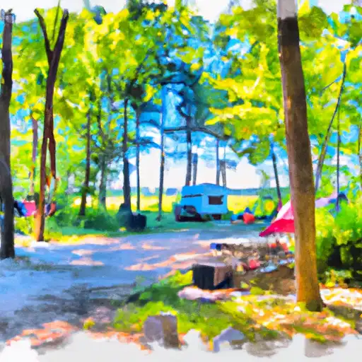
Rondeau Provincial Park campground
Community Reviews
Been here? Share the conditions.
Reviews, ratings & photos are added in the free Snoflo iOS app — rate a spot, tag the conditions, and your visit is verified by location. Add or manage your reviews from the app.
Rondeau Provincial Park
Reservations are accepted at Rondeau Provincial Park, allowing campers to secure their preferred dates in advance. It is advisable to make reservations early, especially during peak seasons, as the campground can get quite busy. The park offers a mix of reservable and first-come, first-served campsites, giving flexibility to campers who may not have made prior reservations.
The best time of year to visit Rondeau Provincial Park is during the summer months when the weather is warm and the park is bustling with activities. The park offers a variety of recreational opportunities, including swimming, boating, fishing, and hiking. It is home to a diverse range of flora and fauna, making it a popular spot for bird-watching and nature enthusiasts.
While enjoying the beauty of Rondeau Provincial Park, campers should be cautious of ticks, as the park is known to have a higher prevalence of Lyme disease-carrying ticks. It is recommended to wear long sleeves, pants, and apply insect repellent to minimize the risk. Additionally, campers should be mindful of wildlife and follow proper food storage practices to avoid attracting animals to their campsites. Overall, Rondeau Provincial Park offers a wonderful camping experience with its amenities, stunning natural surroundings, and abundant recreational opportunities.
What's on-site at Rondeau Provincial Park
Key facilities Snoflo tracks for this campground. Confirm with the operator before booking -- amenities can change seasonally.
Plan your trip down to the hour
Same weather feed Snoflo's iOS app uses -- updated continuously from NOAA / yr.no.
Next 5 days, hour by hour
Temperature line with weather symbols on top, snow + rain accumulation as columns, humidity as a dotted line.
5-day forecast table
Every 3 hours, broken out across temperature, snow, rain, humidity, and wind. Each cell is colour-coded relative to the column min/max so trends jump out at a glance.
| Time | Condition | Temp (°F) | Snow (in) | Rain (in) | Humidity (%) | Wind (mps) | Wind dir |
|---|---|---|---|---|---|---|---|
| Loading detailed forecast… | |||||||
15-day temperature & precipitation
Daily temperatures, snow, and rain projected over the next two weeks. Hover any point for the full breakdown.
Other campgrounds in the area
Snoflo-tracked campsites within driving distance of Rondeau Provincial Park, with reservations status.
| Campground | Reservations | Toilets | View |
|---|---|---|---|
| C. M. Wilson Conservation Area | ✗ | ✓ | → |
| Big Bend Conservation Area | ✗ | ✓ | → |
| Boosey Creek - Wheatley Provincial Park | ✓ | ✓ | → |
| Middle Creek - Wheatley Provincial Park | ✓ | ✓ | → |
| Woodlot Campground | ✗ | ✗ | → |
Nearby streamflow
USGS streamgauges within reach of Rondeau Provincial Park -- pulled live from the National Water Information System.
| Streamgauge | Discharge | View |
|---|---|---|
| Grand River Near Painesville Oh | 90 cfs | → |
| Chagrin River At Willoughby Oh | 23 cfs | → |
| Euclid Creek At Cleveland Oh | 8 cfs | → |
| East Branch Euclid Creek At Richmond Heights Oh | 5 cfs | → |
| Doan Brook At Mlk Jr Dr At Cleveland Oh | 2 cfs | → |
| North Branch Clinton River Near Mt. Clemens | 21 cfs | → |
Nearby snow depths
NRCS SNOTEL stations within reach of Rondeau Provincial Park -- relevant when planning a shoulder-season or alpine trip.
| SNOTEL station | Snowpack | 24h Snowfall | View |
|---|---|---|---|
| Mentor-On-The-Lake Trained Spotter (X4170814) | 0.0 in | 0.0 in | → |
Plan a longer trip
The closest parks, lakes, boat launches, and paddle runs so a camping night can grow into a full weekend.
Boat launches
Camping essentials & Leave No Trace
- Pack it in, pack it out
- Take all trash, food scraps, and gear back with you to keep campsites clean and protect wildlife.
- Respect wildlife
- Observe animals from a distance, store food securely, and never feed wildlife to maintain natural behavior and safety.
- Know before you go
- Check weather, fire restrictions, trail conditions, and permit requirements to ensure a safe and well-planned trip.
- Minimize campfire impact
- Use established fire rings, keep fires small, fully extinguish them, or opt for a camp stove when fires are restricted.
- Leave what you find
- Preserve natural and cultural features by avoiding removal of plants, rocks, artifacts, or other elements of the environment.
Set push alerts in the Snoflo app
Save Rondeau Provincial Park as a favorite, set a custom threshold (precipitation, snowpack, freezing temperatures), and the iOS app will push the moment conditions cross.
About Rondeau Provincial Park
Can I make reservations at Rondeau Provincial Park?
Yes -- this campground accepts reservations. Snoflo recommends booking early for peak season; check the operator (Recreation.gov / state park system / private operator) for the booking window and cancellation policy.
How fresh is the weather data on this page?
The hourly forecast updates throughout the day from the NOAA / yr.no public feeds. Streamflow data is pulled live from USGS streamgauges and snowpack from the NRCS SNOTEL network.
What's the best time of year to visit?
Use the 15-day temperature & precipitation outlook on this page to plan -- pick a window with comfortable temperatures and low precipitation. For longer trips, the 5-day hourly meteogram shows snow + rain accumulation hour-by-hour.
How do I get to Rondeau Provincial Park?
Tap Directions in the hero above to open driving directions in Google Maps, or Open in map to center the Snoflo interactive map on the campground.
Can I get alerts when conditions change?
Yes -- alerts are managed through the Snoflo iOS app. Favorite this campground, set a threshold (temperature, snowpack, precipitation), and you'll get a push the moment it crosses.
Other campgrounds near here
Snoflo-tracked campgrounds within driving distance of Rondeau Provincial Park.