The Point Campground Campground
Community Reviews
Been here? Share the conditions.
Reviews, ratings & photos are added in the free Snoflo iOS app — rate a spot, tag the conditions, and your visit is verified by location. Add or manage your reviews from the app.
The Point Campground
Nearby points of interest include the Talimena Scenic Drive, which offers breathtaking views of the Ouachita Mountains, as well as the nearby Cedar Lake Recreation Area, which provides opportunities for fishing, boating, swimming, and hiking. The Ouachita National Forest also offers a variety of hiking trails and scenic drives for visitors to enjoy.
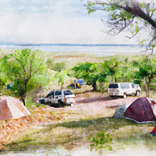
The campground amenities include tent and RV sites, picnic tables, fire rings, and access to potable water. There are also vault toilets located throughout the campground for visitors to use. The Point Campground is a pet-friendly facility, but pets must be kept on a leash at all times.
Interesting facts about the area include that the Ouachita Mountains are one of the oldest mountain ranges in the world, and that the Ouachita National Forest is home to a diverse array of wildlife, including black bears, coyotes, and white-tailed deer.
The best time of year to visit The Point Campground is during the spring and fall months, when temperatures are mild and the foliage is at its most colorful. Average temperatures during these times range from the mid-60s to low 80s during the day and the mid-30s to low 50s at night. Visitors should be aware that temperatures can drop significantly in the winter months, and that summer temperatures can be quite hot and humid.
What's on-site at The Point Campground
Key facilities Snoflo tracks for this campground. Confirm with the operator before booking -- amenities can change seasonally.
Plan your trip down to the hour
Same weather feed Snoflo's iOS app uses -- updated continuously from NOAA / yr.no.
Next 5 days, hour by hour
Temperature line with weather symbols on top, snow + rain accumulation as columns, humidity as a dotted line.
5-day forecast table
Every 3 hours, broken out across temperature, snow, rain, humidity, and wind. Each cell is colour-coded relative to the column min/max so trends jump out at a glance.
| Time | Condition | Temp (°F) | Snow (in) | Rain (in) | Humidity (%) | Wind (mps) | Wind dir |
|---|---|---|---|---|---|---|---|
| Loading detailed forecast… | |||||||
15-day temperature & precipitation
Daily temperatures, snow, and rain projected over the next two weeks. Hover any point for the full breakdown.
Other campgrounds in the area
Snoflo-tracked campsites within driving distance of The Point Campground, with reservations status.
| Campground | Reservations | Toilets | View |
|---|---|---|---|
| The Point - Chickasaw National Rec Area | ✓ | ✗ | → |
| Guy Sandy Campground | ✗ | ✗ | → |
| Guy Sandy - Chickasaw National Rec Area | ✗ | ✓ | → |
| Buckhorn Campground Loop D | ✗ | ✗ | → |
| Buckhorn Campground Loop C | ✗ | ✗ | → |
Nearby streamflow
USGS streamgauges within reach of The Point Campground -- pulled live from the National Water Information System.
| Streamgauge | Discharge | View |
|---|---|---|
| Rock Creek At Sulphur | 10 cfs | → |
| Washita River Near Dickson | 211 cfs | → |
| Pennington Creek Near Reagan | 20 cfs | → |
| Washita River Near Pauls Valley | 188 cfs | → |
| Blue River Near Connerville | 77 cfs | → |
| Walnut Creek At Purcell | 1 cfs | → |
Plan a longer trip
The closest parks, lakes, boat launches, and paddle runs so a camping night can grow into a full weekend.
Camping essentials & Leave No Trace
- Pack it in, pack it out
- Take all trash, food scraps, and gear back with you to keep campsites clean and protect wildlife.
- Respect wildlife
- Observe animals from a distance, store food securely, and never feed wildlife to maintain natural behavior and safety.
- Know before you go
- Check weather, fire restrictions, trail conditions, and permit requirements to ensure a safe and well-planned trip.
- Minimize campfire impact
- Use established fire rings, keep fires small, fully extinguish them, or opt for a camp stove when fires are restricted.
- Leave what you find
- Preserve natural and cultural features by avoiding removal of plants, rocks, artifacts, or other elements of the environment.
Set push alerts in the Snoflo app
Save The Point Campground as a favorite, set a custom threshold (precipitation, snowpack, freezing temperatures), and the iOS app will push the moment conditions cross.
About The Point Campground
Can I make reservations at The Point Campground?
This campground does not appear to accept reservations -- it's typically first-come, first-served. Arrive early on summer weekends.
How fresh is the weather data on this page?
The hourly forecast updates throughout the day from the NOAA / yr.no public feeds. Streamflow data is pulled live from USGS streamgauges and snowpack from the NRCS SNOTEL network.
What's the best time of year to visit?
Use the 15-day temperature & precipitation outlook on this page to plan -- pick a window with comfortable temperatures and low precipitation. For longer trips, the 5-day hourly meteogram shows snow + rain accumulation hour-by-hour.
How do I get to The Point Campground?
Tap Directions in the hero above to open driving directions in Google Maps, or Open in map to center the Snoflo interactive map on the campground.
Can I get alerts when conditions change?
Yes -- alerts are managed through the Snoflo iOS app. Favorite this campground, set a threshold (temperature, snowpack, precipitation), and you'll get a push the moment it crosses.
Other campgrounds near here
Snoflo-tracked campgrounds within driving distance of The Point Campground.