Camp Sherman Campground
Community Reviews
Been here? Share the conditions.
Reviews, ratings & photos are added in the free Snoflo iOS app — rate a spot, tag the conditions, and your visit is verified by location. Add or manage your reviews from the app.
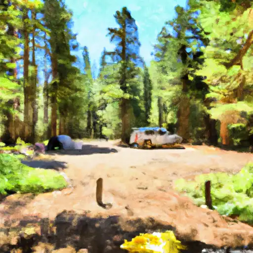
Camp Sherman
What's on-site at Camp Sherman
Key facilities Snoflo tracks for this campground. Confirm with the operator before booking -- amenities can change seasonally.
Plan your trip down to the hour
Same weather feed Snoflo's iOS app uses -- updated continuously from NOAA / yr.no.
Next 5 days, hour by hour
Temperature line with weather symbols on top, snow + rain accumulation as columns, humidity as a dotted line.
5-day forecast table
Every 3 hours, broken out across temperature, snow, rain, humidity, and wind. Each cell is colour-coded relative to the column min/max so trends jump out at a glance.
| Time | Condition | Temp (°F) | Snow (in) | Rain (in) | Humidity (%) | Wind (mps) | Wind dir |
|---|---|---|---|---|---|---|---|
| Loading detailed forecast… | |||||||
15-day temperature & precipitation
Daily temperatures, snow, and rain projected over the next two weeks. Hover any point for the full breakdown.
Other campgrounds in the area
Snoflo-tracked campsites within driving distance of Camp Sherman, with reservations status.
| Campground | Reservations | Toilets | View |
|---|---|---|---|
| Camp Sherman Campground | ✗ | ✗ | → |
| Allingham | ✗ | ✓ | → |
| Allingham Campground | ✗ | ✗ | → |
| Smiling River | ✓ | ✓ | → |
| Smiling River Campground | ✗ | ✗ | → |
Nearby streamflow
USGS streamgauges within reach of Camp Sherman -- pulled live from the National Water Information System.
| Streamgauge | Discharge | View |
|---|---|---|
| Metolius River Near Grandview | 1,250 cfs | → |
| Deschutes River Near Culver | 518 cfs | → |
| Crooked River Below Opal Springs | 1,150 cfs | → |
| Mckenzie River At Outlet Of Clear Lake | 174 cfs | → |
| Shitike Cr | 32 cfs | → |
| Crooked River Blw Osborne Canyon | 118 cfs | → |
Nearby snow depths
NRCS SNOTEL stations within reach of Camp Sherman -- relevant when planning a shoulder-season or alpine trip.
| SNOTEL station | Snowpack | 24h Snowfall | View |
|---|---|---|---|
| Hogg Pass | 0.0 in | 0.0 in | → |
| Nohrsc Hogg Pass | 0.0 in | 0.0 in | → |
| Hoodoo Butte - Snow | 0.0 in | 0.0 in | → |
| Santiam Jct. | 1.0 in | 0.0 in | → |
| Marion Forks | 0.0 in | 0.0 in | → |
| Nohrsc Marion Forks | 0.0 in | 0.0 in | → |
Plan a longer trip
The closest parks, lakes, boat launches, and paddle runs so a camping night can grow into a full weekend.
Parks
- Elliott Corbett Memorial State Recreation Site
- Wilderness Mount Jefferson
- Preserve Indian Ford Meadow
- Preserve Camp Polk Meadow
- Sisters State Park
- Mount Hood National Forest
Boat launches
Points of interest
- Camp Sherman Fish Viewing Platform
- Cold Springs Resort
- Metolius River
- Head Of The Metolius Observation Site
- Kiwanis Club
- Clearwater Gallery
Paddle runs
- Source To Confluence With Metolius River
- Crooked River National Grassland Boundary To Confluence With Deschutes River
- Headwaters To Mt Jefferson Wilderness Boundary
- Mt. Jefferson Wilderness Boundary To Highway 22
- Canyon Run (Lower Bridge To Billy Chinook Res.)
- Russel Lake To Mt. Jefferson Wilderness Boundary
Camping essentials & Leave No Trace
- Pack it in, pack it out
- Take all trash, food scraps, and gear back with you to keep campsites clean and protect wildlife.
- Respect wildlife
- Observe animals from a distance, store food securely, and never feed wildlife to maintain natural behavior and safety.
- Know before you go
- Check weather, fire restrictions, trail conditions, and permit requirements to ensure a safe and well-planned trip.
- Minimize campfire impact
- Use established fire rings, keep fires small, fully extinguish them, or opt for a camp stove when fires are restricted.
- Leave what you find
- Preserve natural and cultural features by avoiding removal of plants, rocks, artifacts, or other elements of the environment.
Set push alerts in the Snoflo app
Save Camp Sherman as a favorite, set a custom threshold (precipitation, snowpack, freezing temperatures), and the iOS app will push the moment conditions cross.
About Camp Sherman
Can I make reservations at Camp Sherman?
Yes -- this campground accepts reservations. Snoflo recommends booking early for peak season; check the operator (Recreation.gov / state park system / private operator) for the booking window and cancellation policy.
How fresh is the weather data on this page?
The hourly forecast updates throughout the day from the NOAA / yr.no public feeds. Streamflow data is pulled live from USGS streamgauges and snowpack from the NRCS SNOTEL network.
What's the best time of year to visit?
Use the 15-day temperature & precipitation outlook on this page to plan -- pick a window with comfortable temperatures and low precipitation. For longer trips, the 5-day hourly meteogram shows snow + rain accumulation hour-by-hour.
How do I get to Camp Sherman?
Tap Directions in the hero above to open driving directions in Google Maps, or Open in map to center the Snoflo interactive map on the campground.
Can I get alerts when conditions change?
Yes -- alerts are managed through the Snoflo iOS app. Favorite this campground, set a threshold (temperature, snowpack, precipitation), and you'll get a push the moment it crosses.
Other campgrounds near here
Snoflo-tracked campgrounds within driving distance of Camp Sherman.