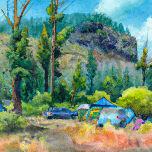
Indian Well Campground
Community Reviews
Been here? Share the conditions.
Reviews, ratings & photos are added in the free Snoflo iOS app — rate a spot, tag the conditions, and your visit is verified by location. Add or manage your reviews from the app.
Indian Well
Reservations are not accepted at Indian Well camping area, and campsites are available on a first-come, first-served basis. It is advisable to arrive early, especially during peak seasons, to secure a spot. The best time to visit this camping area is during the summer months when the weather is pleasant, and outdoor activities such as hiking, fishing, and wildlife viewing are at their prime.
While exploring the Indian Well camping area, campers should be cautious of wildlife encounters, including snakes and bears. It is recommended to store food securely to avoid attracting any unwanted visitors. Furthermore, it is important to follow all campground rules and regulations, including fire safety guidelines, to ensure a safe and enjoyable stay. With its natural beauty and well-maintained facilities, Indian Well camping area in Oregon is a great destination for nature enthusiasts seeking a peaceful camping experience.
What's on-site at Indian Well
Key facilities Snoflo tracks for this campground. Confirm with the operator before booking -- amenities can change seasonally.
Plan your trip down to the hour
Same weather feed Snoflo's iOS app uses -- updated continuously from NOAA / yr.no.
Next 5 days, hour by hour
Temperature line with weather symbols on top, snow + rain accumulation as columns, humidity as a dotted line.
5-day forecast table
Every 3 hours, broken out across temperature, snow, rain, humidity, and wind. Each cell is colour-coded relative to the column min/max so trends jump out at a glance.
| Time | Condition | Temp (°F) | Snow (in) | Rain (in) | Humidity (%) | Wind (mps) | Wind dir |
|---|---|---|---|---|---|---|---|
| Loading detailed forecast… | |||||||
15-day temperature & precipitation
Daily temperatures, snow, and rain projected over the next two weeks. Hover any point for the full breakdown.
Other campgrounds in the area
Snoflo-tracked campsites within driving distance of Indian Well, with reservations status.
| Campground | Reservations | Toilets | View |
|---|---|---|---|
| Indian Well Campground | ✗ | ✗ | → |
| Indian Wells - Lava Bed National Monument | ✗ | ✓ | → |
| Medicine Lake Recreation Area | ✓ | ✗ | → |
| Hemlock | ✗ | ✓ | → |
| Medicine | ✗ | ✓ | → |
Nearby streamflow
USGS streamgauges within reach of Indian Well -- pulled live from the National Water Information System.
| Streamgauge | Discharge | View |
|---|---|---|
| Klamath Straits Drain Near Worden | 1 cfs | → |
| Ady Canal At Highway 97 | 50 cfs | → |
| North Canal At Highway 97 | 118 cfs | → |
| Pit R Nr Canby Ca | 3 cfs | → |
| Klamath River At Keno | 689 cfs | → |
| Link River At Klamath Falls | 1,330 cfs | → |
Nearby snow depths
NRCS SNOTEL stations within reach of Indian Well -- relevant when planning a shoulder-season or alpine trip.
| SNOTEL station | Snowpack | 24h Snowfall | View |
|---|---|---|---|
| Nohrsc Altamont 0.4 Wnw | 0.0 in | 0.0 in | → |
| Keno | 14.0 in | 0.0 in | → |
| Klamath Falls | 0.0 in | 0.0 in | → |
| Gerber Reservoir | 0.0 in | 0.0 in | → |
| Nohrsc Crowder Flat | 1.0 in | 0.0 in | → |
| Crowder Flat | 0.0 in | 0.0 in | → |
Plan a longer trip
The closest parks, lakes, boat launches, and paddle runs so a camping night can grow into a full weekend.
Parks
- Lava Beds National Monument
- Wilderness Lava Beds
- Tule Lake National Wildlife Refuge
- Lower Klamath National Wildlife Refuge
- Clear Lake National Wildlife Refuge
- Bear Valley National Wildlife Refuge
Fishing spots
Camping essentials & Leave No Trace
- Pack it in, pack it out
- Take all trash, food scraps, and gear back with you to keep campsites clean and protect wildlife.
- Respect wildlife
- Observe animals from a distance, store food securely, and never feed wildlife to maintain natural behavior and safety.
- Know before you go
- Check weather, fire restrictions, trail conditions, and permit requirements to ensure a safe and well-planned trip.
- Minimize campfire impact
- Use established fire rings, keep fires small, fully extinguish them, or opt for a camp stove when fires are restricted.
- Leave what you find
- Preserve natural and cultural features by avoiding removal of plants, rocks, artifacts, or other elements of the environment.
Set push alerts in the Snoflo app
Save Indian Well as a favorite, set a custom threshold (precipitation, snowpack, freezing temperatures), and the iOS app will push the moment conditions cross.
About Indian Well
Can I make reservations at Indian Well?
This campground does not appear to accept reservations -- it's typically first-come, first-served. Arrive early on summer weekends.
How fresh is the weather data on this page?
The hourly forecast updates throughout the day from the NOAA / yr.no public feeds. Streamflow data is pulled live from USGS streamgauges and snowpack from the NRCS SNOTEL network.
What's the best time of year to visit?
Use the 15-day temperature & precipitation outlook on this page to plan -- pick a window with comfortable temperatures and low precipitation. For longer trips, the 5-day hourly meteogram shows snow + rain accumulation hour-by-hour.
How do I get to Indian Well?
Tap Directions in the hero above to open driving directions in Google Maps, or Open in map to center the Snoflo interactive map on the campground.
Can I get alerts when conditions change?
Yes -- alerts are managed through the Snoflo iOS app. Favorite this campground, set a threshold (temperature, snowpack, precipitation), and you'll get a push the moment it crosses.
Other campgrounds near here
Snoflo-tracked campgrounds within driving distance of Indian Well.