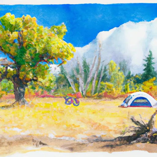
Willow Flats Sump Campground
Community Reviews
Been here? Share the conditions.
Reviews, ratings & photos are added in the free Snoflo iOS app — rate a spot, tag the conditions, and your visit is verified by location. Add or manage your reviews from the app.
Willow Flats Sump
The campground has ten first-come-first-served campsites available and offers several amenities, including fire rings, picnic tables, and vault toilets. There is no drinking water available on-site, so visitors are advised to bring their own.
An interesting fact about the area is that the Malheur National Wildlife Refuge is one of the largest wetland ecosystems in the state of Oregon, covering over 187,000 acres. It is also a popular spot for birdwatching, with over 300 species of birds recorded in the area.
The best time of year to visit Willow Flats Sump Camping Area is during the summer months when temperatures average around 80°F during the day and drop to around 40°F at night. However, visitors should be aware that the area can be prone to thunderstorms during the summer months.
What's on-site at Willow Flats Sump
Key facilities Snoflo tracks for this campground. Confirm with the operator before booking -- amenities can change seasonally.
Plan your trip down to the hour
Same weather feed Snoflo's iOS app uses -- updated continuously from NOAA / yr.no.
Next 5 days, hour by hour
Temperature line with weather symbols on top, snow + rain accumulation as columns, humidity as a dotted line.
5-day forecast table
Every 3 hours, broken out across temperature, snow, rain, humidity, and wind. Each cell is colour-coded relative to the column min/max so trends jump out at a glance.
| Time | Condition | Temp (°F) | Snow (in) | Rain (in) | Humidity (%) | Wind (mps) | Wind dir |
|---|---|---|---|---|---|---|---|
| Loading detailed forecast… | |||||||
15-day temperature & precipitation
Daily temperatures, snow, and rain projected over the next two weeks. Hover any point for the full breakdown.
Other campgrounds in the area
Snoflo-tracked campsites within driving distance of Willow Flats Sump, with reservations status.
| Campground | Reservations | Toilets | View |
|---|---|---|---|
| Emile Shelter | ✗ | ✗ | → |
| Cougar Shelter Forest Camp | ✗ | ✗ | → |
| Fairy Shelter Forest Camp | ✗ | ✗ | → |
| White Creek Campground | ✗ | ✗ | → |
| White Creek | ✗ | ✓ | → |
Nearby streamflow
USGS streamgauges within reach of Willow Flats Sump -- pulled live from the National Water Information System.
| Streamgauge | Discharge | View |
|---|---|---|
| Steamboat Creek Near Glide | 37 cfs | → |
| Little River At Peel | 2,120 cfs | → |
| N Umpqua River Abv Copeland Ck Nr Toketee Falls | 688 cfs | → |
| Boulder Creek Near Toketee Falls | 6 cfs | → |
| N.Umpqua R Blw Soda Spgs Resv | 299 cfs | → |
| N.Umpqua R Blw Slide Ck Dam Nr Toketee Falls | 265 cfs | → |
Nearby snow depths
NRCS SNOTEL stations within reach of Willow Flats Sump -- relevant when planning a shoulder-season or alpine trip.
| SNOTEL station | Snowpack | 24h Snowfall | View |
|---|---|---|---|
| Toketee Airstrip | 0.0 in | 0.0 in | → |
| Nohrsc Toketee Airstrip | 0.0 in | 0.0 in | → |
| Lemolo Lake 3 Nnw | 0.0 in | 0.0 in | → |
| Nohrsc Holland Meadows | 0.0 in | 0.0 in | → |
| Holland Meadows | 0.0 in | 0.0 in | → |
| Canyonville 2s | 0.0 in | 0.0 in | → |
Plan a longer trip
The closest parks, lakes, boat launches, and paddle runs so a camping night can grow into a full weekend.
Parks
- Wilderness Boulder Creek
- Andrew Wiley Park
- North Myrtle Park
- Willamette National Forest
- Wilderness Rogue-Umpqua Divide
- Riverside Park
Boat launches
- Bogus Raft Launch Boating Site
- Bogus Creek
- Susan Creek
- Hemlock Lake
- Apple Creek Campground
- Gravel Bin Take Out
Points of interest
- Susan Creek Campground
- Baker Wayside Recreation Site
- Cavitt Creek Bridge
- Swiftwater Trailhead
- Swiftwater Day-Use Area
- Toketee Lake Boating Site
Paddle runs
- Little Falls To Confluence With North Umpqua River
- Confluence Of Siwash Creek To Little Falls
- Headwaters Of East Fork Steamboat Creek To Confluence With Siwash Creek
- Headwaters To Boulder Creek Wilderness Boundary
- South Umpqua
- Headwaters To Rogue-Umpqua Wilderness Boundary
Camping essentials & Leave No Trace
- Pack it in, pack it out
- Take all trash, food scraps, and gear back with you to keep campsites clean and protect wildlife.
- Respect wildlife
- Observe animals from a distance, store food securely, and never feed wildlife to maintain natural behavior and safety.
- Know before you go
- Check weather, fire restrictions, trail conditions, and permit requirements to ensure a safe and well-planned trip.
- Minimize campfire impact
- Use established fire rings, keep fires small, fully extinguish them, or opt for a camp stove when fires are restricted.
- Leave what you find
- Preserve natural and cultural features by avoiding removal of plants, rocks, artifacts, or other elements of the environment.
Set push alerts in the Snoflo app
Save Willow Flats Sump as a favorite, set a custom threshold (precipitation, snowpack, freezing temperatures), and the iOS app will push the moment conditions cross.
About Willow Flats Sump
Can I make reservations at Willow Flats Sump?
This campground does not appear to accept reservations -- it's typically first-come, first-served. Arrive early on summer weekends.
How fresh is the weather data on this page?
The hourly forecast updates throughout the day from the NOAA / yr.no public feeds. Streamflow data is pulled live from USGS streamgauges and snowpack from the NRCS SNOTEL network.
What's the best time of year to visit?
Use the 15-day temperature & precipitation outlook on this page to plan -- pick a window with comfortable temperatures and low precipitation. For longer trips, the 5-day hourly meteogram shows snow + rain accumulation hour-by-hour.
How do I get to Willow Flats Sump?
Tap Directions in the hero above to open driving directions in Google Maps, or Open in map to center the Snoflo interactive map on the campground.
Can I get alerts when conditions change?
Yes -- alerts are managed through the Snoflo iOS app. Favorite this campground, set a threshold (temperature, snowpack, precipitation), and you'll get a push the moment it crosses.
Other campgrounds near here
Snoflo-tracked campgrounds within driving distance of Willow Flats Sump.