Voorhees State Park Campground
Community Reviews
Been here? Share the conditions.
Reviews, ratings & photos are added in the free Snoflo iOS app — rate a spot, tag the conditions, and your visit is verified by location. Add or manage your reviews from the app.
Voorhees State Park
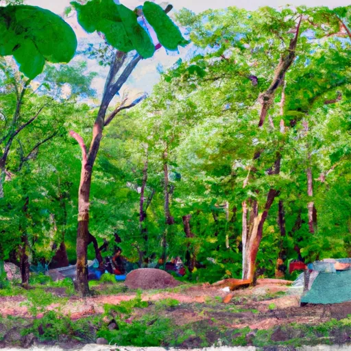
The campground amenities include 47 campsites, each accommodating up to six people. Each site comes equipped with a fire ring and picnic table for added convenience. The campground is open year-round and operates on a first-come, first-serve basis.
In addition to the beautiful views of the surrounding area, the park is also home to several nearby points of interest, including the historic town of Clinton, New Jersey. Visitors can enjoy browsing the quaint shops, restaurants and museums in this charming town.
An interesting fact about the area is that the park was originally part of the Voorhees estate, which was donated to the state in 1929. The park is named after Foster M. Voorhees, a former governor of New Jersey.
The best time of year to visit Voorhees State Park Camping Area is during the fall months from September through November when the average temperature ranges from 60 to 70 degrees Fahrenheit. This time of year offers the perfect weather for outdoor activities like hiking, biking, and fishing.
What's on-site at Voorhees State Park
Key facilities Snoflo tracks for this campground. Confirm with the operator before booking -- amenities can change seasonally.
Plan your trip down to the hour
Same weather feed Snoflo's iOS app uses -- updated continuously from NOAA / yr.no.
Next 5 days, hour by hour
Temperature line with weather symbols on top, snow + rain accumulation as columns, humidity as a dotted line.
5-day forecast table
Every 3 hours, broken out across temperature, snow, rain, humidity, and wind. Each cell is colour-coded relative to the column min/max so trends jump out at a glance.
| Time | Condition | Temp (°F) | Snow (in) | Rain (in) | Humidity (%) | Wind (mps) | Wind dir |
|---|---|---|---|---|---|---|---|
| Loading detailed forecast… | |||||||
15-day temperature & precipitation
Daily temperatures, snow, and rain projected over the next two weeks. Hover any point for the full breakdown.
Other campgrounds in the area
Snoflo-tracked campsites within driving distance of Voorhees State Park, with reservations status.
| Campground | Reservations | Toilets | View |
|---|---|---|---|
| Spruce Run Recreation Area | ✓ | ✗ | → |
| Dogwood Haven Family Campground | ✗ | ✗ | → |
| Driftstone On The Delaware | ✗ | ✗ | → |
| Tinicum County Park | ✗ | ✗ | → |
| Colonial Woods Family Camping Resort | ✗ | ✗ | → |
Nearby streamflow
USGS streamgauges within reach of Voorhees State Park -- pulled live from the National Water Information System.
| Streamgauge | Discharge | View |
|---|---|---|
| South Branch Raritan River Near High Bridge Nj | 49 cfs | → |
| Spruce Run At Clinton Nj | 38 cfs | → |
| Mulhockaway Creek At Van Syckel Nj | 3 cfs | → |
| Sb Rockaway Creek At Whitehouse Station Nj | 37 cfs | → |
| Lamington (Black) River Near Pottersville Nj | 21 cfs | → |
| South Branch Raritan River At Stanton Nj | 142 cfs | → |
Nearby snow depths
NRCS SNOTEL stations within reach of Voorhees State Park -- relevant when planning a shoulder-season or alpine trip.
| SNOTEL station | Snowpack | 24h Snowfall | View |
|---|---|---|---|
| Clinton Twp 3.9 N | 0.0 in | 0.0 in | → |
| Califon 0.6 Nw | 0.0 in | 0.0 in | → |
| Flemington 5 Nnw | 0.0 in | 0.0 in | → |
| Hackettstown 0.8 W | 0.0 in | 0.0 in | → |
| Belvidere Bridge | 0.0 in | 0.0 in | → |
| Mendham 1.5 W | 0.0 in | 0.0 in | → |
Plan a longer trip
The closest parks, lakes, boat launches, and paddle runs so a camping night can grow into a full weekend.
Parks
- Ken Lockwood Gorge Wildlife Management Area
- Voorhees State Park
- Hampton Boro
- Spruce Run State Park
- Clinton Twp. Planning Incen
- Pequest State Conservation Area
Camping essentials & Leave No Trace
- Pack it in, pack it out
- Take all trash, food scraps, and gear back with you to keep campsites clean and protect wildlife.
- Respect wildlife
- Observe animals from a distance, store food securely, and never feed wildlife to maintain natural behavior and safety.
- Know before you go
- Check weather, fire restrictions, trail conditions, and permit requirements to ensure a safe and well-planned trip.
- Minimize campfire impact
- Use established fire rings, keep fires small, fully extinguish them, or opt for a camp stove when fires are restricted.
- Leave what you find
- Preserve natural and cultural features by avoiding removal of plants, rocks, artifacts, or other elements of the environment.
Set push alerts in the Snoflo app
Save Voorhees State Park as a favorite, set a custom threshold (precipitation, snowpack, freezing temperatures), and the iOS app will push the moment conditions cross.
About Voorhees State Park
Can I make reservations at Voorhees State Park?
Yes -- this campground accepts reservations. Snoflo recommends booking early for peak season; check the operator (Recreation.gov / state park system / private operator) for the booking window and cancellation policy.
How fresh is the weather data on this page?
The hourly forecast updates throughout the day from the NOAA / yr.no public feeds. Streamflow data is pulled live from USGS streamgauges and snowpack from the NRCS SNOTEL network.
What's the best time of year to visit?
Use the 15-day temperature & precipitation outlook on this page to plan -- pick a window with comfortable temperatures and low precipitation. For longer trips, the 5-day hourly meteogram shows snow + rain accumulation hour-by-hour.
How do I get to Voorhees State Park?
Tap Directions in the hero above to open driving directions in Google Maps, or Open in map to center the Snoflo interactive map on the campground.
Can I get alerts when conditions change?
Yes -- alerts are managed through the Snoflo iOS app. Favorite this campground, set a threshold (temperature, snowpack, precipitation), and you'll get a push the moment it crosses.
Other campgrounds near here
Snoflo-tracked campgrounds within driving distance of Voorhees State Park.