#01 Cooper Road Campground
Community Reviews
Been here? Share the conditions.
Reviews, ratings & photos are added in the free Snoflo iOS app — rate a spot, tag the conditions, and your visit is verified by location. Add or manage your reviews from the app.
#01 Cooper Road
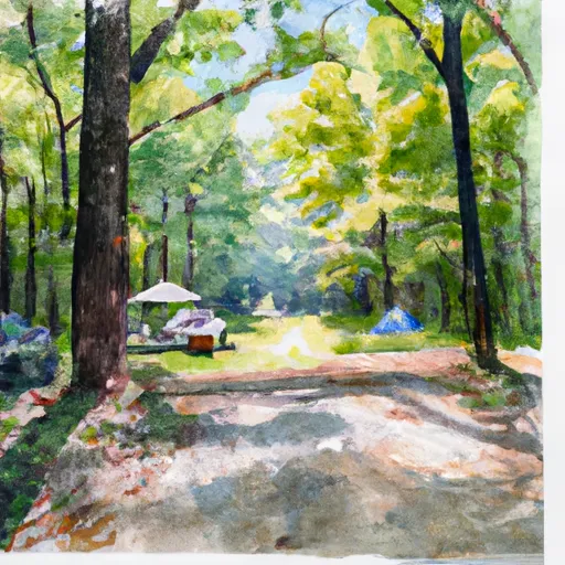
Surrounding Views:
The camping area is nestled in a forested area and offers beautiful views of the surrounding trees and mountains. Visitors can take a short walk to the nearby Abrams Creek and enjoy the scenic views of the creek.
Specific Nearby Points of Interest:
The camping area is located near the Abrams Falls Trail. This trail is a popular hiking spot that leads to a stunning waterfall. The trail is moderately difficult and is around 5 miles round trip.
Campground Amenities:
The #01 Cooper Road camping area is a primitive camping area with no amenities. There are no restrooms, water, or electricity available. Visitors must bring their own supplies, including water and a portable toilet.
Interesting Facts about the Area:
The Great Smoky Mountains National Park is home to over 1,500 black bears. Visitors should take precautions to properly store food and garbage to avoid attracting bears.
Best Time of Year to Visit:
The best time to visit the #01 Cooper Road camping area is during the spring and fall months. The average temperature during the spring (April-June) is around 50-80°F, and during the fall (September-November) it is around 40-70°F. It is important to note that the campground is closed during the winter months.
Overall, the #01 Cooper Road camping area is a great place to stay for those looking to explore the natural beauty of the Great Smoky Mountains National Park. Visitors should come prepared with their own supplies and take necessary precautions to properly store food and garbage.
What's on-site at #01 Cooper Road
Key facilities Snoflo tracks for this campground. Confirm with the operator before booking -- amenities can change seasonally.
Plan your trip down to the hour
Same weather feed Snoflo's iOS app uses -- updated continuously from NOAA / yr.no.
Next 5 days, hour by hour
Temperature line with weather symbols on top, snow + rain accumulation as columns, humidity as a dotted line.
5-day forecast table
Every 3 hours, broken out across temperature, snow, rain, humidity, and wind. Each cell is colour-coded relative to the column min/max so trends jump out at a glance.
| Time | Condition | Temp (°F) | Snow (in) | Rain (in) | Humidity (%) | Wind (mps) | Wind dir |
|---|---|---|---|---|---|---|---|
| Loading detailed forecast… | |||||||
15-day temperature & precipitation
Daily temperatures, snow, and rain projected over the next two weeks. Hover any point for the full breakdown.
Other campgrounds in the area
Snoflo-tracked campsites within driving distance of #01 Cooper Road, with reservations status.
| Campground | Reservations | Toilets | View |
|---|---|---|---|
| 1 Cooper Road | ✗ | ✗ | → |
| Abrams Creek - Great Smoky Mountains National Park | ✗ | ✗ | → |
| Abrams Creek Campground | ✗ | ✗ | → |
| 17 Little Bottoms | ✗ | ✗ | → |
| Look Rock Campground | ✗ | ✗ | → |
Nearby streamflow
USGS streamgauges within reach of #01 Cooper Road -- pulled live from the National Water Information System.
| Streamgauge | Discharge | View |
|---|---|---|
| Little River Near Maryville | 257 cfs | → |
| Little River Above Townsend | 188 cfs | → |
| Cheoah River Nr Bearpen Gap Nr Tapoco | 115 cfs | → |
| Little River Near Alcoa | 290 cfs | → |
| Little Pigeon River At Sevierville | 413 cfs | → |
| Tellico River At Tellico Plains | 160 cfs | → |
Nearby snow depths
NRCS SNOTEL stations within reach of #01 Cooper Road -- relevant when planning a shoulder-season or alpine trip.
| SNOTEL station | Snowpack | 24h Snowfall | View |
|---|---|---|---|
| Gatlinburg | 0.0 in | 0.0 in | → |
| New Found Gap | 12.8 in | 0.0 in | → |
| Bryson City 4 | 0.0 in | 0.0 in | → |
| Kingston | 0.0 in | 0.0 in | → |
Plan a longer trip
The closest parks, lakes, boat launches, and paddle runs so a camping night can grow into a full weekend.
Parks
- Sandy Springs Park
- Pole Climbers Park
- John Sevier Park
- Rock Gardens Park
- Howe Street Park
- Charles M Park
Boat launches
- Calderwood Highway 6676, Blount County
- Tabcat Creek
- Calderwood Highway Blount County
- Tallassee
- Peery's Mill Park
- Harrison Branch
Fishing spots
Points of interest
- Murray Gap Overlook
- Look Rock Overlook
- Happy Valley Overlook
- Abrams Ridge Overlook
- Dunlap Branch Overlook
- Happy Valley Gap Overlook
Paddle runs
- Polecat Branch To Snowbird Picnic Area
- Owlcamp Branch To Polecat Branch
- Headwaters Near Mitchell Lick To Owlcamp Branch
- Headwaters Near Graham County Line To Nc/Tn State Line
- Tn/Nc State Line (Rm 48.0) To Tn360 Bridge (Rm 30.0)
- Natahala Powerhouse To Lake Fontana (River Mile 4)
Camping essentials & Leave No Trace
- Pack it in, pack it out
- Take all trash, food scraps, and gear back with you to keep campsites clean and protect wildlife.
- Respect wildlife
- Observe animals from a distance, store food securely, and never feed wildlife to maintain natural behavior and safety.
- Know before you go
- Check weather, fire restrictions, trail conditions, and permit requirements to ensure a safe and well-planned trip.
- Minimize campfire impact
- Use established fire rings, keep fires small, fully extinguish them, or opt for a camp stove when fires are restricted.
- Leave what you find
- Preserve natural and cultural features by avoiding removal of plants, rocks, artifacts, or other elements of the environment.
Set push alerts in the Snoflo app
Save #01 Cooper Road as a favorite, set a custom threshold (precipitation, snowpack, freezing temperatures), and the iOS app will push the moment conditions cross.
About #01 Cooper Road
Can I make reservations at #01 Cooper Road?
This campground does not appear to accept reservations -- it's typically first-come, first-served. Arrive early on summer weekends.
How fresh is the weather data on this page?
The hourly forecast updates throughout the day from the NOAA / yr.no public feeds. Streamflow data is pulled live from USGS streamgauges and snowpack from the NRCS SNOTEL network.
What's the best time of year to visit?
Use the 15-day temperature & precipitation outlook on this page to plan -- pick a window with comfortable temperatures and low precipitation. For longer trips, the 5-day hourly meteogram shows snow + rain accumulation hour-by-hour.
How do I get to #01 Cooper Road?
Tap Directions in the hero above to open driving directions in Google Maps, or Open in map to center the Snoflo interactive map on the campground.
Can I get alerts when conditions change?
Yes -- alerts are managed through the Snoflo iOS app. Favorite this campground, set a threshold (temperature, snowpack, precipitation), and you'll get a push the moment it crosses.
Other campgrounds near here
Snoflo-tracked campgrounds within driving distance of #01 Cooper Road.